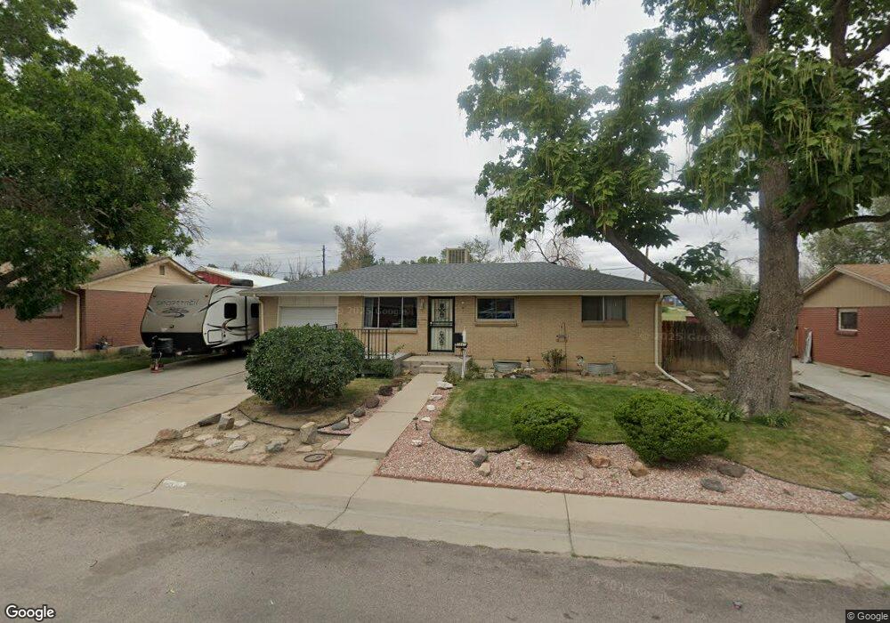
2041 Mcdougal St Denver, CO 80229
Welby NeighborhoodEstimated Value: $392,415 - $458,000
3
Beds
2
Baths
999
Sq Ft
$415/Sq Ft
Est. Value
About This Home
This home is located at 2041 Mcdougal St, Denver, CO 80229 and is currently estimated at $414,854, approximately $415 per square foot. 2041 Mcdougal St is a home located in Adams County with nearby schools including Trailside Academy and The New America School.
Ownership History
Date
Name
Owned For
Owner Type
Purchase Details
Closed on
Jul 19, 1995
Sold by
Hood Hensley David Gene and Hood Hensley Skyla
Bought by
Johnson Gary C and Johnson Loretta L
Current Estimated Value
Home Financials for this Owner
Home Financials are based on the most recent Mortgage that was taken out on this home.
Original Mortgage
$90,337
Interest Rate
7.54%
Mortgage Type
FHA
Purchase Details
Closed on
Apr 9, 1993
Create a Home Valuation Report for This Property
The Home Valuation Report is an in-depth analysis detailing your home's value as well as a comparison with similar homes in the area
Home Values in the Area
Average Home Value in this Area
Purchase History
| Date | Buyer | Sale Price | Title Company |
|---|---|---|---|
| Johnson Gary C | $90,900 | Land Title | |
| -- | $73,500 | -- |
Source: Public Records
Mortgage History
| Date | Status | Borrower | Loan Amount |
|---|---|---|---|
| Closed | Johnson Gary C | $90,337 |
Source: Public Records
Tax History Compared to Growth
Tax History
| Year | Tax Paid | Tax Assessment Tax Assessment Total Assessment is a certain percentage of the fair market value that is determined by local assessors to be the total taxable value of land and additions on the property. | Land | Improvement |
|---|---|---|---|---|
| 2024 | $1,865 | $25,370 | $5,310 | $20,060 |
| 2023 | $1,852 | $28,820 | $5,280 | $23,540 |
| 2022 | $1,849 | $24,100 | $5,420 | $18,680 |
| 2021 | $1,740 | $24,100 | $5,420 | $18,680 |
| 2020 | $1,621 | $23,310 | $5,580 | $17,730 |
| 2019 | $1,628 | $23,310 | $5,580 | $17,730 |
| 2018 | $1,180 | $18,260 | $5,040 | $13,220 |
| 2017 | $1,159 | $18,260 | $5,040 | $13,220 |
| 2016 | $779 | $14,560 | $2,710 | $11,850 |
| 2015 | $740 | $7,280 | $1,350 | $5,930 |
| 2014 | -- | $5,840 | $1,000 | $4,840 |
Source: Public Records
Map
Nearby Homes
- 2081 E 88th Ave
- 2141 E 88th Ave
- 8681 Hopkins Dr
- 2241 Oak Place
- 8770 Rainbow Ave Unit A
- 8861 Poze Blvd
- 2447 Rainbow Dr Unit 22
- 2447 Rainbow Dr Unit D-25
- 2427 Rainbow Dr Unit 29
- 8960 Vine St
- 2469 Devonshire Ct Unit 32
- 2487 Rainbow Dr Unit C51
- 2529 Devonshire Ct Unit 64
- 2626 Devonshire Ct
- 2569 Devonshire Ct Unit 69
- 1490 Oak Place
- 2221 E 84th Ave
- 1290 Ash Ct
- 8511 Franklin Dr
- 8551 Faraday St
- 2061 Mcdougal St
- 2021 Mcdougal St
- 2081 Mcdougal St
- 1981 Mcdougal St
- 2020 Mcdougal St
- 2040 Mcdougal St
- 80029 E 88th Ave
- 2060 Mcdougal St
- 1980 Mcdougal St
- 1961 Mcdougal St
- 2121 Mcdougal St
- 2080 Mcdougal St
- 1960 Mcdougal St
- 2021 Larry Ct
- 2141 Mcdougal St
- 1981 Larry Ct
- 1940 Mcdougal St
- 1931 Mcdougal St
- 8770 Hopkins Dr
- 2041 Larry Ct