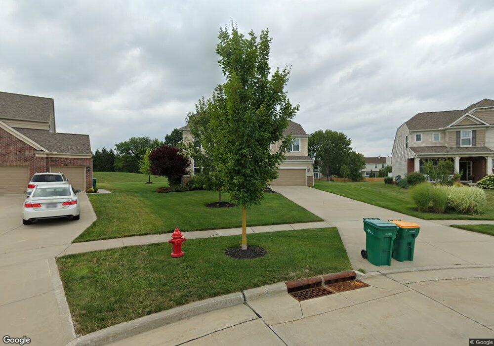
2041 Meadowood Blvd Twinsburg, OH 44087
Estimated Value: $599,385 - $815,000
4
Beds
3
Baths
3,068
Sq Ft
$217/Sq Ft
Est. Value
About This Home
This home is located at 2041 Meadowood Blvd, Twinsburg, OH 44087 and is currently estimated at $664,346, approximately $216 per square foot. 2041 Meadowood Blvd is a home with nearby schools including Wilcox Primary School, Samuel Bissell Elementary School, and Dodge Intermediate School.
Ownership History
Date
Name
Owned For
Owner Type
Purchase Details
Closed on
Nov 13, 2014
Sold by
Pulte Homes Of Ohio Llc
Bought by
Ford Evan R and Ford Karina M
Current Estimated Value
Home Financials for this Owner
Home Financials are based on the most recent Mortgage that was taken out on this home.
Original Mortgage
$321,085
Outstanding Balance
$245,690
Interest Rate
3.97%
Mortgage Type
New Conventional
Estimated Equity
$418,656
Create a Home Valuation Report for This Property
The Home Valuation Report is an in-depth analysis detailing your home's value as well as a comparison with similar homes in the area
Home Values in the Area
Average Home Value in this Area
Purchase History
| Date | Buyer | Sale Price | Title Company |
|---|---|---|---|
| Ford Evan R | $367,873 | None Available |
Source: Public Records
Mortgage History
| Date | Status | Borrower | Loan Amount |
|---|---|---|---|
| Open | Ford Evan R | $321,085 |
Source: Public Records
Tax History Compared to Growth
Tax History
| Year | Tax Paid | Tax Assessment Tax Assessment Total Assessment is a certain percentage of the fair market value that is determined by local assessors to be the total taxable value of land and additions on the property. | Land | Improvement |
|---|---|---|---|---|
| 2025 | $7,898 | $164,119 | $43,936 | $120,183 |
| 2024 | $7,898 | $164,119 | $43,936 | $120,183 |
| 2023 | $7,898 | $164,119 | $43,936 | $120,183 |
| 2022 | $6,971 | $129,227 | $34,594 | $94,633 |
| 2021 | $7,004 | $129,227 | $34,594 | $94,633 |
| 2020 | $6,793 | $129,220 | $34,590 | $94,630 |
| 2019 | $6,875 | $122,220 | $34,590 | $87,630 |
| 2018 | $6,737 | $122,220 | $34,590 | $87,630 |
| 2017 | $6,356 | $122,220 | $34,590 | $87,630 |
| 2016 | $6,317 | $122,220 | $34,590 | $87,630 |
| 2015 | $6,356 | $122,220 | $34,590 | $87,630 |
| 2014 | $98 | $1,830 | $1,830 | $0 |
Source: Public Records
Map
Nearby Homes
- 10132 Scenic View Dr
- 9933 Cynthia Dr
- 10219 Wagner Ct
- 10240 Orchard Hill Ln Unit I23
- 12162 Waywood Dr
- 10085 Glen Eagle Ln Unit 35AG
- 10393 N Pond Ln
- 34105 Blue Heron Dr
- 10502 White Ash Trail
- 32700 Pettibone Rd
- 2627 Post Rd
- 2590 Post Rd
- 7471 Som Center Rd
- 10424 Oviatt Ln
- 1902 Westwood Dr
- 10169 Timothy Ln
- 9618 E Idlewood Dr
- 1816 Westwood Dr
- 11285 Heritage Dr
- 1883 Edgewood Dr
- 2039 Meadowood Blvd
- 2043 Meadowood Blvd
- 2037 Meadowood Blvd
- 2045 Meadowood Blvd
- 2274 Demi Dr
- 2280 Demi Dr
- 2035 Meadowood Blvd
- 2266 Demi Dr
- 2049 Meadowood Blvd
- 2288 Demi Dr
- 2258 Demi Dr
- 10189 Scenic View Dr
- 2031 Meadowood Blvd
- 2250 Demi Dr
- 2296 Demi Dr
- 2053 Meadowood Blvd
- 10187 Scenic View Dr
- 2043 Fieldcrest Ln
- 10185 Scenic View Dr
- 2242 Demi Dr