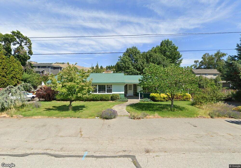
2041 N Ashland Ave East Wenatchee, WA 98802
Estimated Value: $519,862 - $640,000
3
Beds
2
Baths
2,045
Sq Ft
$275/Sq Ft
Est. Value
About This Home
This home is located at 2041 N Ashland Ave, East Wenatchee, WA 98802 and is currently estimated at $563,216, approximately $275 per square foot. 2041 N Ashland Ave is a home located in Douglas County with nearby schools including Cascade Elementary School, Sterling Intermediate School, and Eastmont Junior High School.
Ownership History
Date
Name
Owned For
Owner Type
Purchase Details
Closed on
Mar 24, 2010
Sold by
Howe Kenneth D and Howe Vivian A
Bought by
Dent Donald R and Anne Dent B
Current Estimated Value
Purchase Details
Closed on
Aug 2, 2007
Sold by
Patz Curtis
Bought by
Howe Kenneth D and Howe Vivian A
Home Financials for this Owner
Home Financials are based on the most recent Mortgage that was taken out on this home.
Original Mortgage
$52,000
Interest Rate
6.65%
Mortgage Type
Credit Line Revolving
Create a Home Valuation Report for This Property
The Home Valuation Report is an in-depth analysis detailing your home's value as well as a comparison with similar homes in the area
Home Values in the Area
Average Home Value in this Area
Purchase History
| Date | Buyer | Sale Price | Title Company |
|---|---|---|---|
| Dent Donald R | $257,000 | First American Title Ins Co | |
| Howe Kenneth D | $260,000 | None Available |
Source: Public Records
Mortgage History
| Date | Status | Borrower | Loan Amount |
|---|---|---|---|
| Previous Owner | Howe Kenneth D | $52,000 |
Source: Public Records
Tax History Compared to Growth
Tax History
| Year | Tax Paid | Tax Assessment Tax Assessment Total Assessment is a certain percentage of the fair market value that is determined by local assessors to be the total taxable value of land and additions on the property. | Land | Improvement |
|---|---|---|---|---|
| 2025 | $135 | $414,500 | $100,000 | $314,500 |
| 2024 | $3,700 | $419,100 | $100,000 | $319,100 |
| 2023 | $3,986 | $388,300 | $100,000 | $288,300 |
| 2022 | $3,661 | $330,300 | $80,000 | $250,300 |
| 2021 | $3,849 | $330,300 | $80,000 | $250,300 |
| 2020 | $3,990 | $319,900 | $80,000 | $239,900 |
| 2018 | $3,520 | $289,100 | $60,000 | $229,100 |
| 2017 | $3,017 | $289,100 | $60,000 | $229,100 |
| 2016 | $2,757 | $266,100 | $60,000 | $206,100 |
| 2015 | $2,632 | $242,500 | $60,000 | $182,500 |
| 2014 | -- | $222,000 | $60,000 | $162,000 |
| 2013 | -- | $217,300 | $60,000 | $157,300 |
Source: Public Records
Map
Nearby Homes
- 3230 NW Chadwick (Lot 26) Loop
- 225 19th St NE Unit 31
- 225 19th St NE Unit 23
- 3229 NW Chadwick (Lot 33) Loop
- 351 19th St NE Unit 26
- 351 19th St NE Unit 21
- 1840 Country Club Dr
- 214 Solomon Loop NW
- 208 Solomon Loop NW
- 211 21st St NW
- 326 23rd St NE
- 2407 N Aurora Ave
- 0 xxxx NW Cascade Ave
- 232 Solomon Loop NW
- 2301 NW Cascade Ave
- 0 Mountain View Dr
- 1992 Stoneridge Dr
- 2434 NW Alan Ave
- 3234 NW Chadwick (Lot 25) Loop
- 2335 Columbia Ave NW
- 2054 Autumn Dr
- 2025 N Ashland Ave
- 2043 N Ashland Ave
- 2058 Autumn Dr
- 2050 Autumn Dr
- 2042 N Ashland Ave
- 2040 N Ashland Ave
- 2021 N Ashland Ave
- 2044 N Ashland Ave
- 2030 N Ashland Ave
- 2055 Autumn Dr
- 2051 Autumn Dr
- 2059 Autumn Dr
- 2046 Autumn Dr
- 2110 N Ashland Ave
- 2041 Autumn Dr
- 2026 Autumn Place
- 2111 N Ashland Ave
- 2024 N Ashland Ave
- 2022 Autumn Place