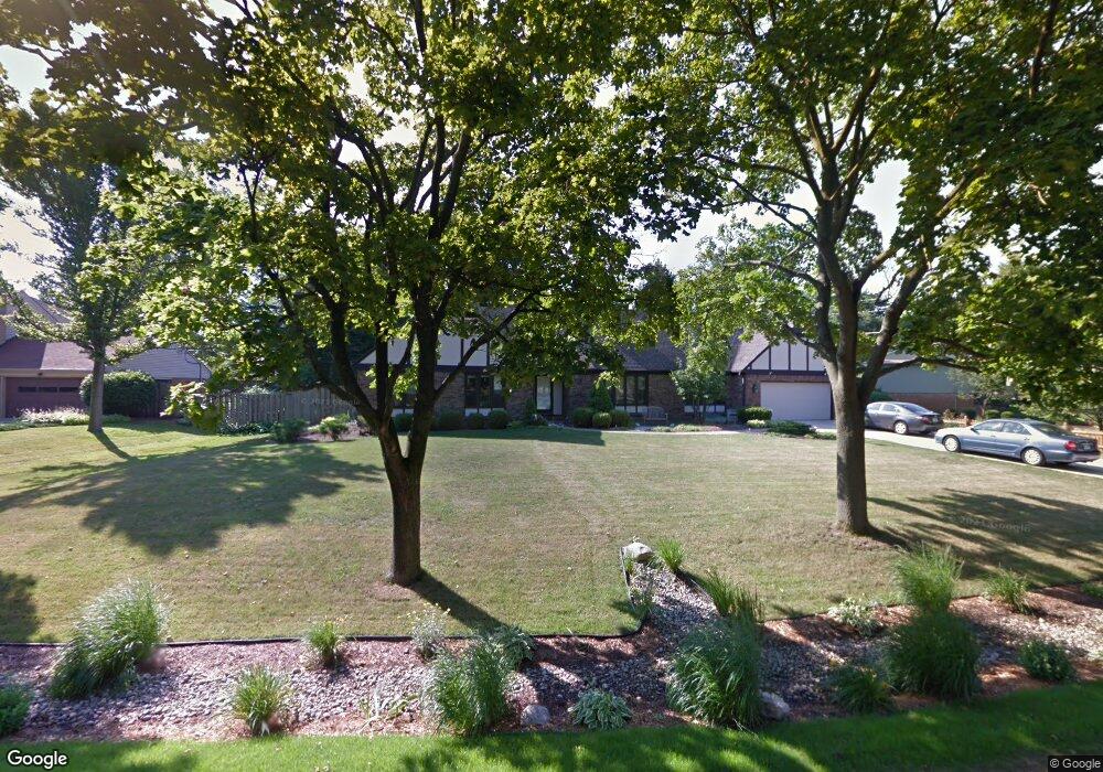
2041 Tomahawk Cir Okemos, MI 48864
Estimated Value: $365,288 - $412,000
Studio
1
Bath
1,992
Sq Ft
$193/Sq Ft
Est. Value
About This Home
This home is located at 2041 Tomahawk Cir, Okemos, MI 48864 and is currently estimated at $384,072, approximately $192 per square foot. 2041 Tomahawk Cir is a home located in Ingham County with nearby schools including Bennett Woods Elementary School, Kinawa School, and Chippewa Middle School.
Ownership History
Date
Name
Owned For
Owner Type
Purchase Details
Closed on
Jan 24, 2007
Sold by
Gould Daniel R and Gould Deborah L
Bought by
Gould Daniel R and Gould Deborah L
Current Estimated Value
Purchase Details
Closed on
Jun 3, 2004
Sold by
Brown Karen K and Brown Ronald L
Bought by
Gould Daniel R and Gould Deb Lee
Home Financials for this Owner
Home Financials are based on the most recent Mortgage that was taken out on this home.
Original Mortgage
$208,000
Outstanding Balance
$104,192
Interest Rate
6.37%
Mortgage Type
Purchase Money Mortgage
Estimated Equity
$279,880
Purchase Details
Closed on
Jul 24, 1997
Sold by
King Richard E and King Lucille H
Bought by
Brown Ronald L and Brown Karen K
Purchase Details
Closed on
Aug 21, 1995
Sold by
Ruddock William T
Bought by
King Richard E and King Lucille H
Purchase Details
Closed on
Mar 1, 1988
Bought by
Ruddock
Create a Home Valuation Report for This Property
The Home Valuation Report is an in-depth analysis detailing your home's value as well as a comparison with similar homes in the area
Home Values in the Area
Average Home Value in this Area
Purchase History
| Date | Buyer | Sale Price | Title Company |
|---|---|---|---|
| Gould Daniel R | -- | None Available | |
| Gould Daniel R | $260,000 | Trans | |
| Brown Ronald L | $165,000 | -- | |
| King Richard E | $152,000 | -- | |
| Ruddock | $127,500 | -- |
Source: Public Records
Mortgage History
| Date | Status | Borrower | Loan Amount |
|---|---|---|---|
| Open | Gould Daniel R | $208,000 |
Source: Public Records
Tax History
| Year | Tax Paid | Tax Assessment Tax Assessment Total Assessment is a certain percentage of the fair market value that is determined by local assessors to be the total taxable value of land and additions on the property. | Land | Improvement |
|---|---|---|---|---|
| 2025 | $6,811 | $205,700 | $33,800 | $171,900 |
| 2024 | $6,401 | $190,000 | $30,000 | $160,000 |
| 2023 | $6,401 | $174,800 | $28,500 | $146,300 |
| 2022 | $6,268 | $170,200 | $26,000 | $144,200 |
| 2021 | $5,961 | $161,900 | $26,000 | $135,900 |
| 2020 | $5,862 | $149,800 | $26,000 | $123,800 |
| 2019 | $5,679 | $144,500 | $28,800 | $115,700 |
| 2018 | $5,370 | $128,100 | $27,800 | $100,300 |
| 2017 | $5,145 | $119,900 | $25,600 | $94,300 |
| 2016 | $2,307 | $116,100 | $26,900 | $89,200 |
| 2015 | $2,307 | $107,900 | $53,783 | $54,117 |
| 2014 | $2,307 | $102,100 | $46,904 | $55,196 |
Source: Public Records
Map
Nearby Homes
- V/L Hamilton Rd
- 1955 Bloomfield Dr
- 4633 Okemos Rd
- 2149 Clinton St
- 4659 Liverance St
- 2198 Hamilton Rd
- 2098 Butternut Dr
- 4326 Manitou Dr
- 4562 Dobie Rd
- 4523 Chippewa Dr
- 4721 Ottawa Dr
- 4793 Ottawa Dr
- 2034 Central Park Dr
- 4702 Woodcraft Rd
- 1571 W Pond Dr Unit 14
- 1563 W Pond Dr Unit 15
- 1555 W Pond Dr Unit 33
- 1555 W Pond Dr Unit 23
- 2473 Small Acres Ln
- 2354 Sower Blvd
- 2031 Tomahawk Rd
- 2030 Pawnee Trail
- 2117 Tomahawk Rd
- 2052 Tomahawk Cir
- 2018 Pawnee Trail
- 2021 Tomahawk Rd
- 2096 Tomahawk Rd
- 2096 Tomahawk Cir
- 2008 Pawnee Trail
- 2030 Tomahawk Rd
- 2062 Tomahawk Cir
- 2120 Tomahawk Rd
- 2013 Tomahawk Rd
- 2018 Tomahawk Rd
- 2000 Pawnee Trail
- 2084 Tomahawk Cir
- 2037 Pawnee Trail
- 2047 Pawnee Trail
- 2027 Pawnee Trail
- 2019 Pawnee Trail
Your Personal Tour Guide
Ask me questions while you tour the home.