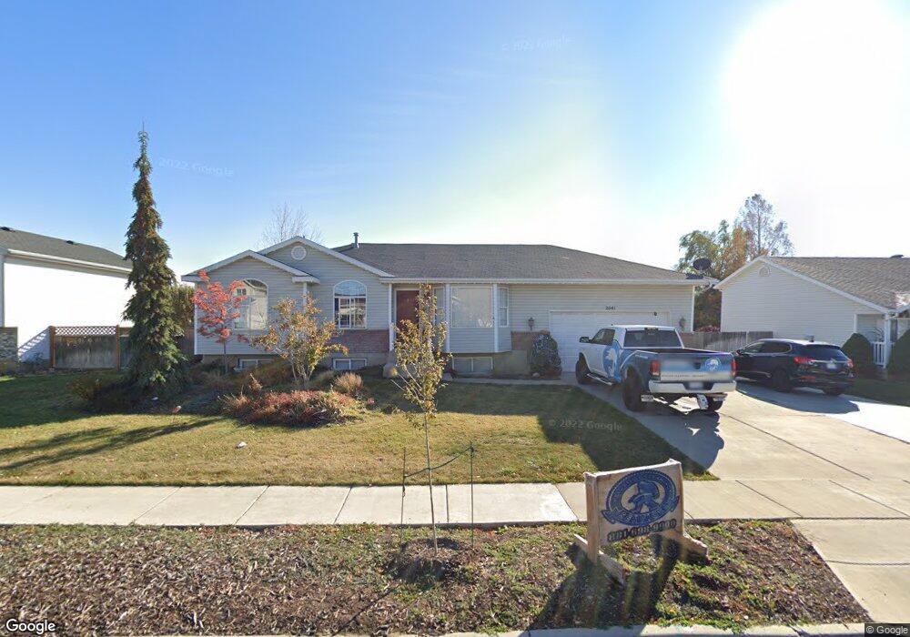
2041 W 1100 S Syracuse, UT 84075
Estimated Value: $503,656 - $546,000
5
Beds
3
Baths
2,480
Sq Ft
$208/Sq Ft
Est. Value
About This Home
This home is located at 2041 W 1100 S, Syracuse, UT 84075 and is currently estimated at $516,914, approximately $208 per square foot. 2041 W 1100 S is a home located in Davis County with nearby schools including Syracuse Elementary School, Syracuse Junior High School, and Syracuse High School.
Ownership History
Date
Name
Owned For
Owner Type
Purchase Details
Closed on
Mar 2, 2005
Sold by
Lewberg Mindy L
Bought by
Mccready Jerold J and Mccready Vickie L
Current Estimated Value
Home Financials for this Owner
Home Financials are based on the most recent Mortgage that was taken out on this home.
Original Mortgage
$116,000
Outstanding Balance
$58,417
Interest Rate
5.61%
Mortgage Type
New Conventional
Estimated Equity
$458,497
Purchase Details
Closed on
May 27, 2004
Sold by
Lewberg Paul E and Lewberg Mindy A
Bought by
Lewberg Mindy A
Home Financials for this Owner
Home Financials are based on the most recent Mortgage that was taken out on this home.
Original Mortgage
$116,000
Interest Rate
5.75%
Mortgage Type
New Conventional
Purchase Details
Closed on
Nov 7, 1997
Sold by
Seegmiller Brian G
Bought by
Lewberg Paul E and Lewberg Mindy A
Home Financials for this Owner
Home Financials are based on the most recent Mortgage that was taken out on this home.
Original Mortgage
$124,440
Interest Rate
7.26%
Mortgage Type
VA
Purchase Details
Closed on
Aug 5, 1996
Sold by
Benchmark Real Estate Company
Bought by
Seegmiller Brian G
Create a Home Valuation Report for This Property
The Home Valuation Report is an in-depth analysis detailing your home's value as well as a comparison with similar homes in the area
Home Values in the Area
Average Home Value in this Area
Purchase History
| Date | Buyer | Sale Price | Title Company |
|---|---|---|---|
| Mccready Jerold J | -- | None Available | |
| Lewberg Mindy A | -- | Executive Title Insurance Ag | |
| Lewberg Paul E | -- | Bonneville Title Company Inc | |
| Seegmiller Brian G | -- | Bonneville Title Company Inc |
Source: Public Records
Mortgage History
| Date | Status | Borrower | Loan Amount |
|---|---|---|---|
| Open | Mccready Jerold J | $116,000 | |
| Previous Owner | Lewberg Mindy A | $116,000 | |
| Previous Owner | Lewberg Paul E | $124,440 | |
| Closed | Lewberg Mindy A | $29,000 |
Source: Public Records
Tax History Compared to Growth
Tax History
| Year | Tax Paid | Tax Assessment Tax Assessment Total Assessment is a certain percentage of the fair market value that is determined by local assessors to be the total taxable value of land and additions on the property. | Land | Improvement |
|---|---|---|---|---|
| 2025 | $2,617 | $252,450 | $125,024 | $127,426 |
| 2024 | $2,537 | $246,399 | $103,457 | $142,942 |
| 2023 | $2,367 | $230,450 | $79,283 | $151,166 |
| 2022 | $2,551 | $450,000 | $150,858 | $299,142 |
| 2021 | $2,310 | $347,000 | $122,621 | $224,379 |
| 2020 | $2,029 | $295,000 | $106,789 | $188,211 |
| 2019 | $1,930 | $277,000 | $104,414 | $172,586 |
| 2018 | $1,762 | $251,000 | $100,824 | $150,176 |
| 2016 | $1,536 | $114,785 | $38,697 | $76,088 |
| 2015 | $1,474 | $104,885 | $38,697 | $66,188 |
| 2014 | $1,323 | $95,941 | $38,697 | $57,244 |
| 2013 | -- | $97,560 | $32,054 | $65,506 |
Source: Public Records
Map
Nearby Homes
- 2117 W 1275 S
- 916 S 1760 W
- 922 S 1760 W
- 2655 S 2430 W Unit 120
- 2665 S 2430 W Unit 118
- 2655 S 2430 W Unit 116
- 2633 S 2430 W Unit 113
- 2614 S 2430 W Unit 106
- 2663 S 2430 W
- 2050 Craftsman Plan at Legacy Park - Collection
- 2200 Garden Plan at Legacy Park - Collection
- Lincoln Farmhouse Plan at Legacy Park - Estates
- Hamilton Traditional Plan at Legacy Park - Estates
- Tivoli Traditional Plan at Legacy Park - Estates
- Torino Farmhouse Plan at Legacy Park - Estates
- 2400 Farmhouse Plan at Legacy Park - Collection
- 1251 S 1650 W
- 1327 S 1650 W
- 1466 Earl Cir
- 1641 S 2350 W Unit B