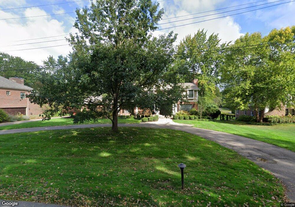
2042 Bayou Dr West Bloomfield, MI 48323
Estimated Value: $733,000 - $867,539
4
Beds
4
Baths
3,014
Sq Ft
$260/Sq Ft
Est. Value
About This Home
This home is located at 2042 Bayou Dr, West Bloomfield, MI 48323 and is currently estimated at $784,135, approximately $260 per square foot. 2042 Bayou Dr is a home located in Oakland County with nearby schools including West Hills Middle School, Bloomfield Hills High School, and Momentum Academy.
Ownership History
Date
Name
Owned For
Owner Type
Purchase Details
Closed on
Jul 14, 2011
Sold by
Johnston William J and Johnston Margery L
Bought by
Narens William and Narens Lea
Current Estimated Value
Create a Home Valuation Report for This Property
The Home Valuation Report is an in-depth analysis detailing your home's value as well as a comparison with similar homes in the area
Home Values in the Area
Average Home Value in this Area
Purchase History
| Date | Buyer | Sale Price | Title Company |
|---|---|---|---|
| Narens William | -- | None Available |
Source: Public Records
Tax History Compared to Growth
Tax History
| Year | Tax Paid | Tax Assessment Tax Assessment Total Assessment is a certain percentage of the fair market value that is determined by local assessors to be the total taxable value of land and additions on the property. | Land | Improvement |
|---|---|---|---|---|
| 2024 | $6,860 | $406,620 | $0 | $0 |
| 2022 | $6,734 | $352,170 | $125,000 | $227,170 |
| 2021 | $11,833 | $336,800 | $0 | $0 |
| 2020 | $5,869 | $338,250 | $125,000 | $213,250 |
| 2018 | $11,066 | $332,400 | $125,000 | $207,400 |
| 2015 | -- | $312,300 | $0 | $0 |
| 2014 | -- | $293,360 | $0 | $0 |
| 2011 | -- | $248,780 | $0 | $0 |
Source: Public Records
Map
Nearby Homes
- 2129 Long Lake Shore Dr
- 2276 Shore Hill Dr
- 3668 Bayou Dr
- 1887 Harvest Ln
- 2954 Long Ridge Ct
- 3468 Pine Estates Dr
- 2372 Pine Lake Rd
- 2360 Pineview
- 2045 Bordeaux St Unit 5
- 2164 Bordeaux St
- 1831 Long Pointe Dr
- 2665 Middlebelt Rd
- 1735 Heron Ridge Dr
- 1744 Heron Ridge Dr
- 1729 Heron Ridge Dr
- 1772 Heron Ridge Dr
- 1723 Heron Ridge Dr
- 2622 Pine Ridge Rd
- 2785 Turtle Lake Dr
- 4170 Prescott Park Cir
- 2030 Bayou Dr
- 2054 Bayou Dr
- 2018 Bayou Dr
- 2079 Long Lake Shore Old Orchard Trail
- 2079 Long Lake Shore Dr
- 2035 Bayou Dr
- 2119 Century Oak Ln
- 2063 Long Lake Shore Dr
- 2108 Bayou Dr
- 0 Bayou Dr
- 2294 Shore Hill Dr
- 2006 Bayou Dr
- 2137 Century Oak Ln
- 2047 Long Lake Shore Dr
- 2155 Century Oak Ln
- 2011 Bayou Dr
- 2295 Shore Hill Dr
- 1986 Bayou Dr
- 2026 W Bend Ct
- 2288 Shore Hill Dr