Estimated Value: $437,000 - $489,000
4
Beds
2
Baths
1,864
Sq Ft
$247/Sq Ft
Est. Value
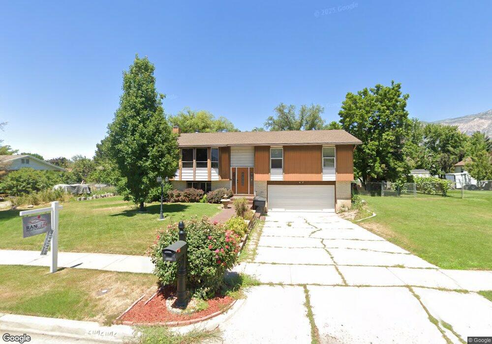
About This Home
This home is located at 2042 W 2500 N Unit 2500, Ogden, UT 84404 and is currently estimated at $461,214, approximately $247 per square foot. 2042 W 2500 N Unit 2500 is a home located in Weber County with nearby schools including Farr West Elementary School, Wahlquist Junior High School, and Fremont High School.
Ownership History
Date
Name
Owned For
Owner Type
Purchase Details
Closed on
Jul 19, 2023
Sold by
Cockrell Ronald S and Cockrell Debra A
Bought by
Benavides Gabrielle
Current Estimated Value
Home Financials for this Owner
Home Financials are based on the most recent Mortgage that was taken out on this home.
Original Mortgage
$393,772
Outstanding Balance
$384,238
Interest Rate
6.71%
Mortgage Type
FHA
Estimated Equity
$76,976
Create a Home Valuation Report for This Property
The Home Valuation Report is an in-depth analysis detailing your home's value as well as a comparison with similar homes in the area
Home Values in the Area
Average Home Value in this Area
Purchase History
| Date | Buyer | Sale Price | Title Company |
|---|---|---|---|
| Benavides Gabrielle | -- | Steed Title |
Source: Public Records
Mortgage History
| Date | Status | Borrower | Loan Amount |
|---|---|---|---|
| Open | Benavides Gabrielle | $393,772 |
Source: Public Records
Tax History Compared to Growth
Tax History
| Year | Tax Paid | Tax Assessment Tax Assessment Total Assessment is a certain percentage of the fair market value that is determined by local assessors to be the total taxable value of land and additions on the property. | Land | Improvement |
|---|---|---|---|---|
| 2025 | $2,956 | $446,712 | $130,480 | $316,232 |
| 2024 | $2,850 | $241,449 | $71,764 | $169,685 |
| 2023 | $2,582 | $216,150 | $71,712 | $144,438 |
| 2022 | $2,648 | $230,451 | $57,998 | $172,453 |
| 2021 | $2,126 | $303,000 | $70,373 | $232,627 |
| 2020 | $2,004 | $260,000 | $55,341 | $204,659 |
| 2019 | $1,965 | $240,000 | $50,173 | $189,827 |
| 2018 | $1,789 | $206,000 | $50,173 | $155,827 |
| 2017 | $1,690 | $187,000 | $40,137 | $146,863 |
| 2016 | $1,630 | $97,363 | $22,075 | $75,288 |
| 2015 | $1,597 | $93,541 | $22,075 | $71,466 |
| 2014 | $1,496 | $84,219 | $22,075 | $62,144 |
Source: Public Records
Map
Nearby Homes
- 2250 N 2000 W
- 2942 N 2000 W
- 1700 W 2700 N Unit 10
- 1700 W 2700 N Unit 112
- 1700 W 2700 N Unit 110
- 1700 W 2700 N Unit 37
- 1700 W 2700 N Unit 84
- 1700 W 2700 N Unit 36
- 1700 W 2700 N Unit 110
- 1700 W 2700 N
- 2405 W 2825 N
- 2938 N 2350 W Unit 105
- 2540 W 2575 N
- 2442 W 2850 N
- 2409 W 2950 N
- 2409 W 2950 N Unit 101
- 2440 W 2900 N
- 2427 W 2950 N Unit 100
- 2427 W 2950 N
- 2477 W 2900 N