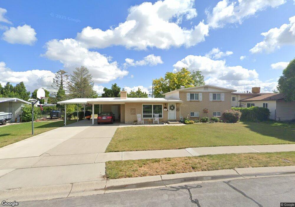
2042 W Condie Dr Taylorsville, UT 84129
Estimated Value: $434,000 - $499,000
4
Beds
3
Baths
1,700
Sq Ft
$277/Sq Ft
Est. Value
About This Home
This home is located at 2042 W Condie Dr, Taylorsville, UT 84129 and is currently estimated at $470,902, approximately $277 per square foot. 2042 W Condie Dr is a home located in Salt Lake County with nearby schools including Taylorsville Elementary School, Eisenhower Jr High School, and Taylorsville High School.
Ownership History
Date
Name
Owned For
Owner Type
Purchase Details
Closed on
Jun 29, 2016
Sold by
Sorensen Richard J and Sorensen Julie Noel
Bought by
Sanders Heidi
Current Estimated Value
Home Financials for this Owner
Home Financials are based on the most recent Mortgage that was taken out on this home.
Original Mortgage
$245,471
Outstanding Balance
$194,622
Interest Rate
3.37%
Mortgage Type
FHA
Estimated Equity
$276,280
Purchase Details
Closed on
Dec 9, 2015
Sold by
Bodily Nan S
Bought by
Bodily Nan Sorensen and The Nan Sorensen Bodily Living
Purchase Details
Closed on
May 30, 1995
Sold by
Va
Bought by
Bodily Nan S
Create a Home Valuation Report for This Property
The Home Valuation Report is an in-depth analysis detailing your home's value as well as a comparison with similar homes in the area
Home Values in the Area
Average Home Value in this Area
Purchase History
| Date | Buyer | Sale Price | Title Company |
|---|---|---|---|
| Sanders Heidi | -- | Us Title | |
| Bodily Nan Sorensen | -- | None Available | |
| Bodily Nan Sorensen | -- | None Available | |
| Bodily Nan S | -- | -- |
Source: Public Records
Mortgage History
| Date | Status | Borrower | Loan Amount |
|---|---|---|---|
| Open | Sanders Heidi | $245,471 |
Source: Public Records
Tax History Compared to Growth
Tax History
| Year | Tax Paid | Tax Assessment Tax Assessment Total Assessment is a certain percentage of the fair market value that is determined by local assessors to be the total taxable value of land and additions on the property. | Land | Improvement |
|---|---|---|---|---|
| 2025 | $2,626 | $448,600 | $103,700 | $344,900 |
| 2024 | $2,626 | $430,600 | $99,300 | $331,300 |
| 2023 | $2,532 | $407,300 | $95,500 | $311,800 |
| 2022 | $2,472 | $401,100 | $93,600 | $307,500 |
| 2021 | $2,158 | $305,000 | $72,000 | $233,000 |
| 2020 | $1,990 | $266,200 | $64,000 | $202,200 |
| 2019 | $1,953 | $255,000 | $64,000 | $191,000 |
| 2018 | $1,770 | $222,900 | $64,000 | $158,900 |
| 2017 | $1,610 | $213,100 | $60,900 | $152,200 |
| 2016 | $1,316 | $174,100 | $60,900 | $113,200 |
| 2015 | $1,315 | $162,500 | $76,800 | $85,700 |
| 2014 | $1,258 | $152,700 | $72,800 | $79,900 |
Source: Public Records
Map
Nearby Homes
- 1998 Theckston Rd
- 4257 S Morris St
- 1901 Kirkham Way
- 2267 W 4240 S
- 2218 W Mackay Ln
- 2258 W 4185 S
- 2221 W Davenshire Ln
- 2121 W 4100 S
- 2318 W 4220 S
- 1762 Mantle Ave
- 1854 W 4100 S
- 4255 S Redwood Rd W
- 2409 W Hardrock Dr
- 2451 Hard Rock Cir S
- 4497 S Edgeware Ln
- 4188 S Oak Meadows Dr Unit 21
- 4533 S Knightsbridge Rd
- 4176 S Oak Meadows Dr Unit 10
- 4148 S Oak Meadows Dr Unit 31
- 4631 S 1980 W
- 2042 Condie Dr
- 2054 Condie Dr
- 2028 Condie Dr
- 2037 Theckston Rd
- 2029 Theckston Rd
- 2049 W Theckston Rd
- 2049 Theckston Rd
- 2007 Theckston Rd
- 2007 W Theckston Rd
- 2041 Condie Dr
- 2007 W Theckston Rd
- 2068 W Condie Dr
- 2068 Condie Dr
- 2014 Condie Dr
- 2014 W Condie Dr
- 2051 Condie Dr
- 2027 Condie Dr
- 2063 W Theckston Rd
- 2063 Theckston Rd
- 1993 Theckston Rd