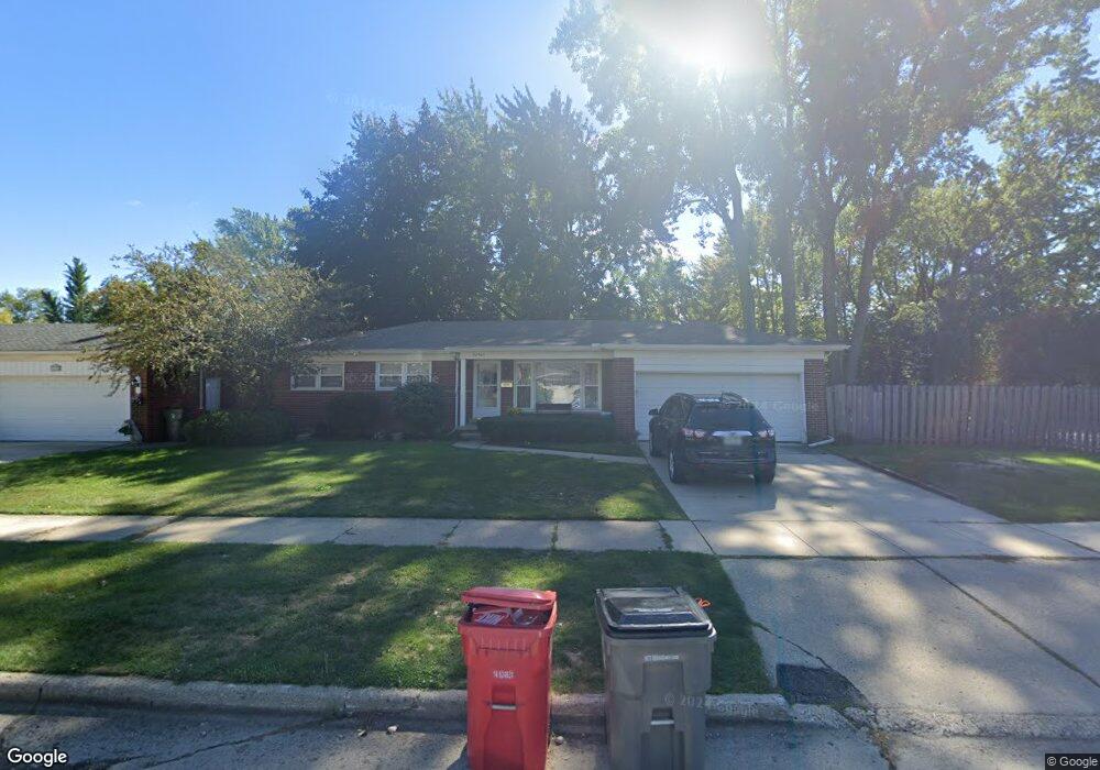
20420 Tullio St Clinton Township, MI 48035
Estimated Value: $226,339 - $271,000
--
Bed
1
Bath
1,273
Sq Ft
$196/Sq Ft
Est. Value
About This Home
This home is located at 20420 Tullio St, Clinton Township, MI 48035 and is currently estimated at $249,335, approximately $195 per square foot. 20420 Tullio St is a home located in Macomb County with nearby schools including Clintondale High School and St. Thecla Catholic School.
Ownership History
Date
Name
Owned For
Owner Type
Purchase Details
Closed on
May 25, 2011
Sold by
Thompson Victoria
Bought by
Baxa Andrea C
Current Estimated Value
Home Financials for this Owner
Home Financials are based on the most recent Mortgage that was taken out on this home.
Original Mortgage
$68,225
Outstanding Balance
$47,128
Interest Rate
4.75%
Mortgage Type
FHA
Estimated Equity
$202,207
Purchase Details
Closed on
Oct 15, 2010
Sold by
Luchtman Arthur A
Bought by
Luchtman Arthur A and Thompson Victoria
Create a Home Valuation Report for This Property
The Home Valuation Report is an in-depth analysis detailing your home's value as well as a comparison with similar homes in the area
Home Values in the Area
Average Home Value in this Area
Purchase History
| Date | Buyer | Sale Price | Title Company |
|---|---|---|---|
| Baxa Andrea C | $70,000 | Greco | |
| Luchtman Arthur A | -- | None Available |
Source: Public Records
Mortgage History
| Date | Status | Borrower | Loan Amount |
|---|---|---|---|
| Open | Baxa Andrea C | $68,225 |
Source: Public Records
Tax History Compared to Growth
Tax History
| Year | Tax Paid | Tax Assessment Tax Assessment Total Assessment is a certain percentage of the fair market value that is determined by local assessors to be the total taxable value of land and additions on the property. | Land | Improvement |
|---|---|---|---|---|
| 2025 | $2,500 | $111,500 | $0 | $0 |
| 2024 | $1,528 | $99,800 | $0 | $0 |
| 2023 | $1,450 | $90,800 | $0 | $0 |
| 2022 | $2,256 | $81,000 | $0 | $0 |
| 2021 | $2,194 | $76,900 | $0 | $0 |
| 2020 | $1,329 | $73,100 | $0 | $0 |
| 2019 | $2,056 | $64,900 | $0 | $0 |
| 2018 | $2,017 | $58,300 | $0 | $0 |
| 2017 | $2,001 | $49,100 | $8,300 | $40,800 |
| 2016 | $1,991 | $49,100 | $0 | $0 |
| 2015 | -- | $43,300 | $0 | $0 |
| 2014 | -- | $41,000 | $0 | $0 |
| 2011 | -- | $47,500 | $13,500 | $34,000 |
Source: Public Records
Map
Nearby Homes
- 35903 Little MacK Ave
- 36027 Vaughn St
- 35685 Griswald St
- 35403 Seville St
- 35501 Griswald St
- 20830 Lantz St
- 0000 Garfield
- 20176 15 Mile Rd
- 20309 Abrahm St
- 35375 Groesbeck Hwy
- 20011 Abrahm St
- 20174 Abrahm St
- 36069 Eaton Dr
- 21437 Hillside Dr
- 20550 Vermander Ave
- 20562 Vermander Ave
- 35811 Weideman St
- 20410 Woodward St
- 36047 Weideman St
- 34606 Beaconsfield St
- 20432 Tullio St
- 20346 Tullio St
- 20401 Luna St
- 20444 Tullio St
- 20423 Luna St
- 20332 Tullio St
- 20435 Luna St
- 20415 Tullio St
- 20427 Tullio St
- 20456 Tullio St
- 35661 Seville St
- 20437 Tullio St
- 20343 Tullio St
- 20453 Luna St
- 20318 Tullio St
- 20451 Tullio St
- 20331 Tullio St Unit Bldg-Unit
- 20331 Tullio St
- 20503 Luna St
- 20520 Tullio St