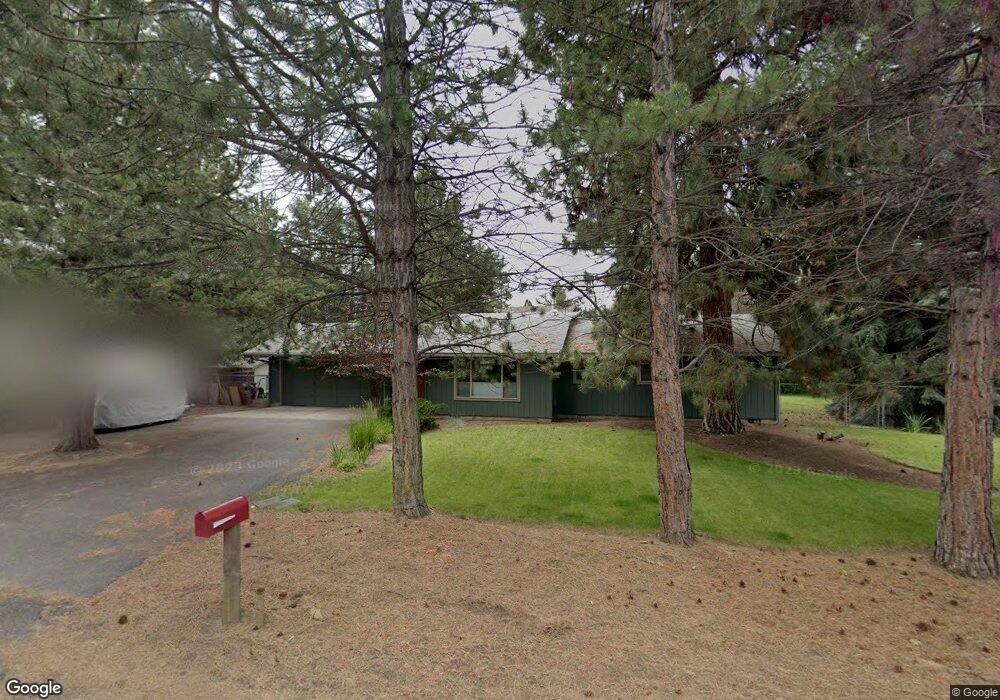
20421 Rae Rd Bend, OR 97702
Old Farm District NeighborhoodEstimated Value: $541,000 - $590,000
3
Beds
2
Baths
1,384
Sq Ft
$407/Sq Ft
Est. Value
About This Home
This home is located at 20421 Rae Rd, Bend, OR 97702 and is currently estimated at $563,661, approximately $407 per square foot. 20421 Rae Rd is a home located in Deschutes County with nearby schools including R.E. Jewell Elementary School, High Desert Middle School, and Deschutes River Montessori School.
Ownership History
Date
Name
Owned For
Owner Type
Purchase Details
Closed on
Aug 20, 2015
Sold by
Collahan Regina M
Bought by
Hardin Burt C
Current Estimated Value
Home Financials for this Owner
Home Financials are based on the most recent Mortgage that was taken out on this home.
Original Mortgage
$139,000
Interest Rate
3.86%
Mortgage Type
New Conventional
Purchase Details
Closed on
Dec 9, 2005
Sold by
Hardin Burt and Milstone Barry S
Bought by
Hardin Burt C and Callahan Regina M
Create a Home Valuation Report for This Property
The Home Valuation Report is an in-depth analysis detailing your home's value as well as a comparison with similar homes in the area
Home Values in the Area
Average Home Value in this Area
Purchase History
| Date | Buyer | Sale Price | Title Company |
|---|---|---|---|
| Hardin Burt C | -- | Accommodation | |
| Hardin Burt C | -- | Accommodation | |
| Hardin Burt C | -- | -- |
Source: Public Records
Mortgage History
| Date | Status | Borrower | Loan Amount |
|---|---|---|---|
| Previous Owner | Hardin Burt C | $139,000 |
Source: Public Records
Tax History
| Year | Tax Paid | Tax Assessment Tax Assessment Total Assessment is a certain percentage of the fair market value that is determined by local assessors to be the total taxable value of land and additions on the property. | Land | Improvement |
|---|---|---|---|---|
| 2025 | $3,869 | $228,960 | -- | -- |
| 2024 | $3,722 | $222,300 | -- | -- |
| 2023 | $3,450 | $215,830 | $0 | $0 |
| 2022 | $3,219 | $203,450 | $0 | $0 |
| 2021 | $3,224 | $197,530 | $0 | $0 |
| 2020 | $3,059 | $197,530 | $0 | $0 |
| 2019 | $2,974 | $191,780 | $0 | $0 |
| 2018 | $2,890 | $186,200 | $0 | $0 |
| 2017 | $2,805 | $180,780 | $0 | $0 |
| 2016 | $2,675 | $175,520 | $0 | $0 |
| 2015 | $2,601 | $170,410 | $0 | $0 |
| 2014 | $2,524 | $165,450 | $0 | $0 |
Source: Public Records
Map
Nearby Homes
- 61185 SE Wagyu Dr Unit Lot 126
- 61189 SE Wagyu Dr
- 20382 Penhollow Ln
- 20521 SE Dorset Place
- 61170 SE Berkshire Way Unit Lot 108
- 61166 SE Berkshire Way Unit Lot 107
- 20381 Aberdeen Dr
- 20414 Murphy Rd
- 20505 Aberdeen Dr
- 61187 Splendor Ln
- Pacific Plan at Monrovia
- Porter Plan at Monrovia
- 20596 Button Brush Ave
- 61304 SE Wizard Ln Unit 8
- 61364 SE Matthew St
- 61280 Parrell Rd Unit 10
- 61437 SE Daybreak Ct Unit Lot 9
- 61441 SE Daybreak Ct Unit Lot 10
- 20297 Knightsbridge Place
- 20580 Klahani Dr
- 20434 Silver Tip Ct
- 20419 Rae Rd
- 20432 Rae Rd
- 20443 Rae Rd
- 20420 Silver Tip Ct
- 20442 Rae Rd
- 20440 Silver Tip Ct
- 20426 Rae Rd
- 20415 Rae Rd
- 20452 Rae Rd
- 20435 Silver Tip Ct
- 20416 Rae Rd
- 20427 Silver Tip Ct
- 20439 Silver Tip Ct
- 20417 Illahee Dr
- 20435 Illahee Dr
- 20443 Illahee Dr
- 61174 Wildwood Dr
- 20430 Rocky Top Ct
- 20434 Rocky Top Ct
Your Personal Tour Guide
Ask me questions while you tour the home.