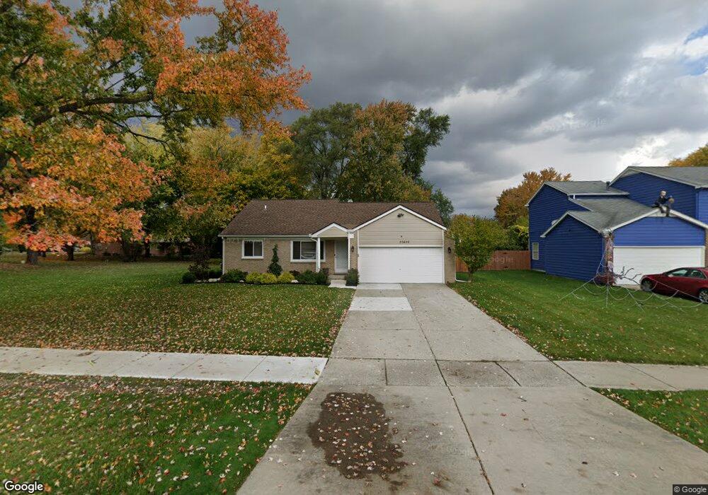
20426 Lacrosse Ave Unit Bldg-Unit Southfield, MI 48076
Estimated Value: $306,924 - $322,000
3
Beds
2
Baths
1,740
Sq Ft
$181/Sq Ft
Est. Value
About This Home
This home is located at 20426 Lacrosse Ave Unit Bldg-Unit, Southfield, MI 48076 and is currently estimated at $314,231, approximately $180 per square foot. 20426 Lacrosse Ave Unit Bldg-Unit is a home located in Oakland County with nearby schools including Alice M. Birney K-8 School, Yeshivas Darchei Torah, and Farber Hebrew Day School.
Ownership History
Date
Name
Owned For
Owner Type
Purchase Details
Closed on
Dec 23, 2017
Sold by
Southfield Neighborhood Revitalization I
Bought by
Stevenson Anthony and Stevenson Lillian
Current Estimated Value
Purchase Details
Closed on
Sep 22, 2016
Sold by
The City Of Southfield
Bought by
Southfield Neighborhood Revitalization I
Purchase Details
Closed on
Jul 7, 2016
Sold by
Oakland County
Bought by
City Of Southfield
Purchase Details
Closed on
Jun 22, 2004
Sold by
Warsaw Alan
Bought by
Leslie Ann London Revocable Trust
Create a Home Valuation Report for This Property
The Home Valuation Report is an in-depth analysis detailing your home's value as well as a comparison with similar homes in the area
Home Values in the Area
Average Home Value in this Area
Purchase History
| Date | Buyer | Sale Price | Title Company |
|---|---|---|---|
| Stevenson Anthony | $184,900 | M S Title Agency Llc | |
| Southfield Neighborhood Revitalization I | -- | None Available | |
| City Of Southfield | $17,933 | None Available | |
| Leslie Ann London Revocable Trust | $133,636 | -- |
Source: Public Records
Tax History Compared to Growth
Tax History
| Year | Tax Paid | Tax Assessment Tax Assessment Total Assessment is a certain percentage of the fair market value that is determined by local assessors to be the total taxable value of land and additions on the property. | Land | Improvement |
|---|---|---|---|---|
| 2022 | $4,192 | $107,840 | $11,250 | $96,590 |
| 2021 | $4,402 | $101,890 | $11,250 | $90,640 |
| 2020 | $3,760 | $94,750 | $11,250 | $83,500 |
| 2018 | $4,451 | $66,470 | $11,250 | $55,220 |
| 2015 | -- | $54,720 | $0 | $0 |
| 2014 | -- | $51,830 | $0 | $0 |
| 2011 | -- | $50,870 | $0 | $0 |
Source: Public Records
Map
Nearby Homes
- 20351 Lacrosse Ave
- 28430 Ranchwood Dr
- 28801 Ranchwood Dr
- 28450 Tapert Dr
- 20141 Lacrosse Ave
- 20120 Covington Pkwy
- 29230 Bermuda Ln
- 27925 Arlington Dr
- 29120 Evergreen Rd Unit 17
- 20780 Wayland St
- 19601 W 12 Mile Rd Unit 102
- 20345 Harbor Ln
- 21440 Constitution St
- 29585 Woodhaven Ln
- 27430 Evergreen Rd Unit 36
- 28330 Lahser Rd
- 21361 Andover Rd
- 21650 W 11 Mile Rd
- 29662 Westbrook Pkwy
- 18797 Wiltshire Blvd
- 20426 Lacrosse Ave
- 20422 Lacrosse Ave
- 20471 Alhambra St Unit Bldg-Unit
- 20471 Alhambra St
- 28640 Ranchwood Dr
- 20410 Lacrosse Ave
- 20445 Alhambra St
- 20390 Lacrosse Ave
- 20427 Lacrosse Ave
- 20411 Alhambra St Unit Bldg-Unit
- 20411 Alhambra St
- 20419 Lacrosse Ave
- 28680 Ranchwood Dr
- 28530 Ranchwood Dr
- 20391 Alhambra St
- 20411 Lacrosse Ave
- 20370 Lacrosse Ave
- 20391 Lacrosse Ave
- 20371 Alhambra St
- 20350 Lacrosse Ave