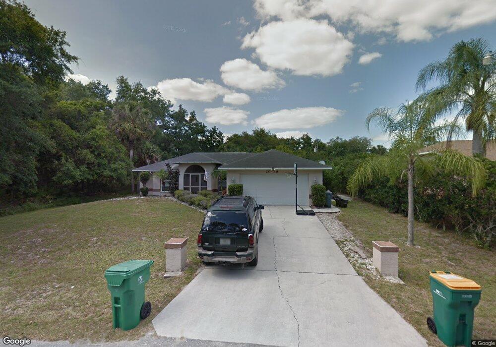
20428 Elrose Ave Port Charlotte, FL 33954
Estimated Value: $247,821 - $386,000
3
Beds
2
Baths
1,435
Sq Ft
$227/Sq Ft
Est. Value
About This Home
This home is located at 20428 Elrose Ave, Port Charlotte, FL 33954 and is currently estimated at $325,455, approximately $226 per square foot. 20428 Elrose Ave is a home located in Charlotte County with nearby schools including Liberty Elementary School, Murdock Middle School, and Port Charlotte High School.
Ownership History
Date
Name
Owned For
Owner Type
Purchase Details
Closed on
Feb 7, 2003
Sold by
Lombardi David M and Lombardi Jennifer A
Bought by
Flavin Sheryl L and Flavin Christopher R
Current Estimated Value
Home Financials for this Owner
Home Financials are based on the most recent Mortgage that was taken out on this home.
Original Mortgage
$107,900
Outstanding Balance
$46,211
Interest Rate
5.95%
Estimated Equity
$279,244
Purchase Details
Closed on
Nov 12, 1998
Sold by
Lombardi Aurelio and Lombardi Celia A
Bought by
Lombardi David M and Lombardi Jennifer A
Create a Home Valuation Report for This Property
The Home Valuation Report is an in-depth analysis detailing your home's value as well as a comparison with similar homes in the area
Home Values in the Area
Average Home Value in this Area
Purchase History
| Date | Buyer | Sale Price | Title Company |
|---|---|---|---|
| Flavin Sheryl L | $134,900 | -- | |
| Lombardi David M | -- | -- |
Source: Public Records
Mortgage History
| Date | Status | Borrower | Loan Amount |
|---|---|---|---|
| Open | Flavin Sheryl L | $107,900 |
Source: Public Records
Tax History Compared to Growth
Tax History
| Year | Tax Paid | Tax Assessment Tax Assessment Total Assessment is a certain percentage of the fair market value that is determined by local assessors to be the total taxable value of land and additions on the property. | Land | Improvement |
|---|---|---|---|---|
| 2023 | $1,300 | $76,137 | $0 | $0 |
| 2022 | $1,238 | $73,919 | $0 | $0 |
| 2021 | $1,236 | $71,766 | $0 | $0 |
| 2020 | $1,202 | $70,775 | $0 | $0 |
| 2019 | $1,137 | $69,184 | $0 | $0 |
| 2018 | $1,044 | $67,894 | $0 | $0 |
| 2017 | $1,039 | $66,498 | $0 | $0 |
| 2016 | $1,038 | $65,130 | $0 | $0 |
| 2015 | $1,022 | $64,677 | $0 | $0 |
| 2014 | $1,003 | $64,164 | $0 | $0 |
Source: Public Records
Map
Nearby Homes
- 134 Kirby
- 20372 Wingate Ave
- 20173 Spangler Terrace
- 20181 Spangler Terrace
- 48 Porter St
- 151 Kirby
- 63 Justine St
- 20380 Wingate Ave
- 20399 Hillsborough Blvd
- 95 Harvey St
- 79 Harvey St
- 10 Baldur Dr
- 62 Atwater St
- 20374 Kenilworth Blvd
- 20580 Kenilworth Blvd
- 0 E Hillsborough Blvd
- 54 Atwater St
- 113 Atwater St
- 20272 Lorette Ave
- 20318 Lorette Ave
- 20438 Elrose Ave
- 20427 Wingate Ave
- 20412 Elrose Ave
- 88 Porter St Unit 42
- 88 Porter St
- 26 or 40 Porter St Porter St
- 155 Porter St
- 160 Porter St
- 40 Porter St
- 20404 Elrose Ave
- 96 Porter St
- 20412 Wingate Ave
- 20388 Elrose Ave
- 144 Porter St
- 20437 Reston Ave
- 20397 Elrose Ave
- 20380 Elrose Ave
- 107 Baldur Dr
- 20403 Reston Ave
- 125 Baldur Dr