
Seller's Agent in 2012
Nathan Neagles
Realty ONE Group DocksideNorth
(843) 267-1414
66 Total Sales
Estimated Value: $312,000 - $516,825
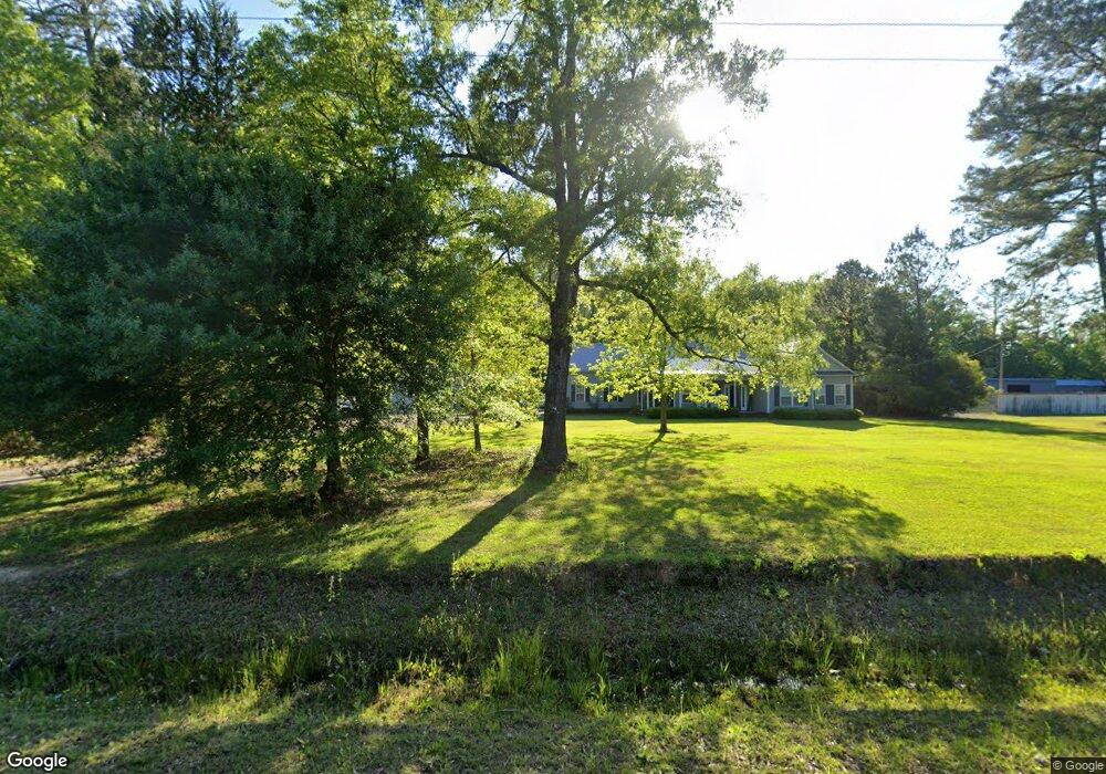
Beautiful home sits on 2.89 Acres of land with a large front yard and a back yard that back up to the woods for privacy with a small pond to enjoy. Interior features 13.5 foot cathedral ceiling in the family room and 9 Ft ceilings thru out home and a large unfinished bonus room to however you imagine..
Last Agent to Sell the Property
Realty ONE Group DocksideNorth License #71932 Listed on: 02/15/2012
Co-Listed By
Barbara Hucks
Realty ONE Group Dockside License #43798
| Date | Buyer | Sale Price | Title Company |
|---|---|---|---|
| Cook Kenneth W | $162,000 | -- | |
| Hardwick Steven W | $55,000 | -- |
| Date | Event | Price | List to Sale | Price per Sq Ft |
|---|---|---|---|---|
| 11/02/2012 11/02/12 | Sold | $164,300 | -33.5% | $86 / Sq Ft |
| 08/23/2012 08/23/12 | Pending | -- | -- | -- |
| 02/15/2012 02/15/12 | For Sale | $247,000 | -- | $130 / Sq Ft |
| Year | Tax Paid | Tax Assessment Tax Assessment Total Assessment is a certain percentage of the fair market value that is determined by local assessors to be the total taxable value of land and additions on the property. | Land | Improvement |
|---|---|---|---|---|
| 2024 | $1,229 | $17,201 | $4,269 | $12,932 |
| 2023 | $1,229 | $8,464 | $1,555 | $6,909 |
| 2021 | $890 | $10,480 | $1,620 | $8,860 |
| 2020 | $780 | $10,480 | $1,620 | $8,860 |
| 2019 | $780 | $10,480 | $1,620 | $8,860 |
| 2018 | $704 | $7,404 | $1,352 | $6,052 |
| 2017 | $689 | $7,404 | $1,352 | $6,052 |
| 2016 | -- | $7,404 | $1,352 | $6,052 |
| 2015 | $689 | $7,404 | $1,352 | $6,052 |
| 2014 | $636 | $7,404 | $1,352 | $6,052 |
Seller's Agent in 2012
Nathan Neagles
Realty ONE Group DocksideNorth
(843) 267-1414
66 Total Sales
B
Seller Co-Listing Agent in 2012
Barbara Hucks
Realty ONE Group Dockside
Buyer's Agent in 2012
Connie Arturet
RE/MAX
(843) 855-5251
62 Total Sales
Source: Coastal Carolinas Association of REALTORS®
MLS Number: 1021892
APN: 37004020001
Disclaimer: Certain information contained herein is derived from information provided by parties other than Homes.com. All information provided is deemed reliable, but is not guaranteed to be accurate and should be independently verified.
![]() Provided courtesy of the Coastal Carolinas MLS. Copyright 2025 of the Coastal Carolinas MLS. All rights reserved. Information is provided exclusively for consumers' personal, non-commercial use, and may not be used for any purpose other than to identify prospective properties consumers may be interested in purchasing, and that the data is deemed reliable but is not guaranteed accurate by the Coastal Carolinas MLS.
Provided courtesy of the Coastal Carolinas MLS. Copyright 2025 of the Coastal Carolinas MLS. All rights reserved. Information is provided exclusively for consumers' personal, non-commercial use, and may not be used for any purpose other than to identify prospective properties consumers may be interested in purchasing, and that the data is deemed reliable but is not guaranteed accurate by the Coastal Carolinas MLS.