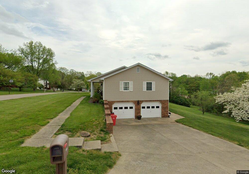
2043 Hampstead Ln Frankfort, KY 40601
Estimated Value: $321,424 - $408,000
3
Beds
3
Baths
2,174
Sq Ft
$169/Sq Ft
Est. Value
About This Home
This home is located at 2043 Hampstead Ln, Frankfort, KY 40601 and is currently estimated at $366,856, approximately $168 per square foot. 2043 Hampstead Ln is a home located in Franklin County with nearby schools including Collins Lane Elementary School, Bondurant Middle School, and Western Hills High School.
Ownership History
Date
Name
Owned For
Owner Type
Purchase Details
Closed on
Aug 25, 2017
Sold by
Dearborn Christy B and Dearborn David A
Bought by
Oconnell Victoria A
Current Estimated Value
Home Financials for this Owner
Home Financials are based on the most recent Mortgage that was taken out on this home.
Original Mortgage
$161,782
Outstanding Balance
$134,551
Interest Rate
3.75%
Mortgage Type
FHA
Estimated Equity
$232,305
Create a Home Valuation Report for This Property
The Home Valuation Report is an in-depth analysis detailing your home's value as well as a comparison with similar homes in the area
Home Values in the Area
Average Home Value in this Area
Purchase History
| Date | Buyer | Sale Price | Title Company |
|---|---|---|---|
| Oconnell Victoria A | $185,000 | Executive Title Company |
Source: Public Records
Mortgage History
| Date | Status | Borrower | Loan Amount |
|---|---|---|---|
| Open | Oconnell Victoria A | $161,782 |
Source: Public Records
Tax History Compared to Growth
Tax History
| Year | Tax Paid | Tax Assessment Tax Assessment Total Assessment is a certain percentage of the fair market value that is determined by local assessors to be the total taxable value of land and additions on the property. | Land | Improvement |
|---|---|---|---|---|
| 2024 | $2,269 | $188,000 | $0 | $0 |
| 2023 | $2,247 | $188,000 | $0 | $0 |
| 2022 | $2,226 | $188,000 | $0 | $0 |
| 2021 | $2,208 | $188,000 | $0 | $0 |
| 2020 | $2,192 | $185,000 | $28,000 | $157,000 |
| 2019 | $2,238 | $185,000 | $28,000 | $157,000 |
| 2018 | $2,233 | $185,000 | $28,000 | $157,000 |
| 2017 | -- | $155,000 | $28,000 | $127,000 |
| 2016 | $1,768 | $155,000 | $28,000 | $127,000 |
| 2015 | $1,547 | $155,000 | $28,000 | $127,000 |
| 2011 | $1,547 | $155,000 | $28,000 | $127,000 |
Source: Public Records
Map
Nearby Homes
- 2100 Crystal Creek Dr
- 412 Briar Patch Ln
- 806 Ninevah Rd
- 112 Leonardwood Dr
- 0 Physicians Park Unit 23001767
- 270 River Valley Rd
- 258 Meadowview Dr
- 256 Meadowview Dr
- 628 Chamberlin Ave
- 632 Chamberlin Ave
- 1149 Collins Ln
- 129 Portsmouth Ln
- 635 Reed Dr
- 380 Harrodswood Rd
- 100 Chapman Dr
- 371 Garden Point Dr
- 211 Knollwood Place
- 519 Timothy Dr
- 1731 Veterans Ave Unit LOT 27
- 1733 Veterans Ave Unit LOT 26
- 2039 Hampstead Ln
- 2047 Hampstead Ln
- 1009 Aderly Ln
- 2016 Hampstead Ln
- 1013 Aderly Ln
- 1010 Tyburn Ln
- 2035 Hampstead Ln
- 1018 Aderly Ln
- 1014 Tyburn Ln
- 1017 Aderly Ln
- 1002 Tyburn Ln
- 1022 Aderly Ln
- 2012 Hampstead Ln
- 2023 Hampstead Ln
- 1018 Tyburn Ln
- 1021 Aderly Ln
- 1026 Aderly Ln
- 1011 Tyburn Ln
- 1007 Tyburn Ln
- 1015 Tyburn Ln