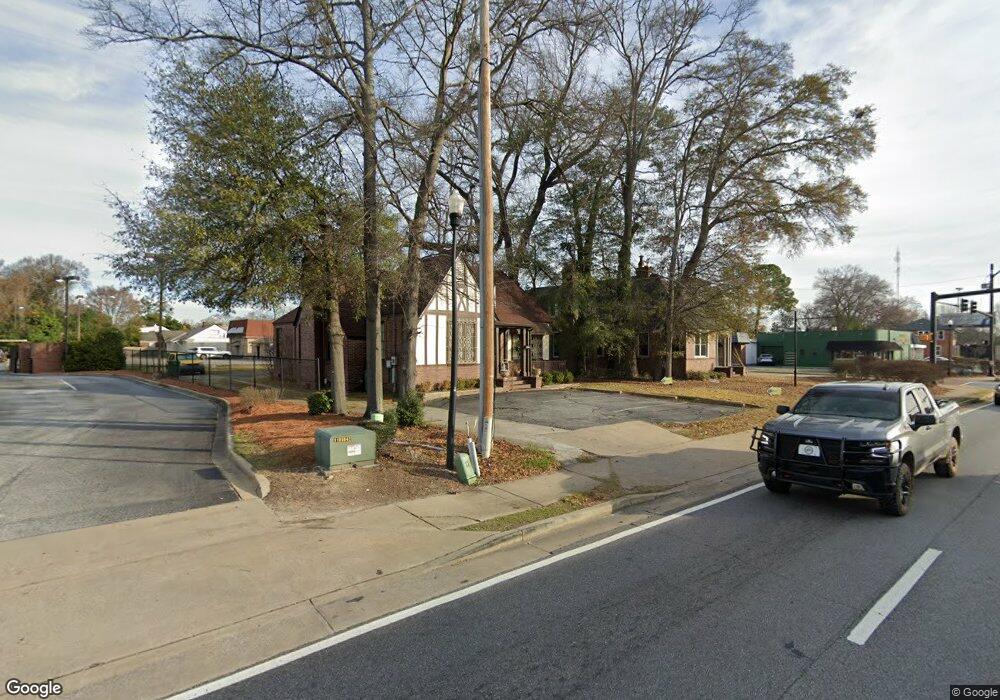
2043 Wynnton Rd Columbus, GA 31906
Wynnton Village NeighborhoodEstimated Value: $163,353
--
Bed
1
Bath
1,712
Sq Ft
$95/Sq Ft
Est. Value
About This Home
This home is located at 2043 Wynnton Rd, Columbus, GA 31906 and is currently estimated at $163,353, approximately $95 per square foot. 2043 Wynnton Rd is a home located in Muscogee County with nearby schools including Richards Middle School, Hardaway High School, and Wynnton Elementary School.
Ownership History
Date
Name
Owned For
Owner Type
Purchase Details
Closed on
Apr 12, 2023
Sold by
Jwgiii Properties Llc
Bought by
Target Language Llc
Current Estimated Value
Purchase Details
Closed on
Aug 18, 2016
Sold by
Goodwin James W
Bought by
Jwgitt Properties Llc
Create a Home Valuation Report for This Property
The Home Valuation Report is an in-depth analysis detailing your home's value as well as a comparison with similar homes in the area
Home Values in the Area
Average Home Value in this Area
Purchase History
| Date | Buyer | Sale Price | Title Company |
|---|---|---|---|
| Target Language Llc | $135,000 | None Listed On Document | |
| Jwgitt Properties Llc | $293,428 | -- |
Source: Public Records
Tax History Compared to Growth
Tax History
| Year | Tax Paid | Tax Assessment Tax Assessment Total Assessment is a certain percentage of the fair market value that is determined by local assessors to be the total taxable value of land and additions on the property. | Land | Improvement |
|---|---|---|---|---|
| 2025 | $1,637 | $41,813 | $14,896 | $26,917 |
| 2024 | $1,637 | $41,813 | $14,896 | $26,917 |
| 2023 | $1,342 | $34,062 | $14,896 | $19,166 |
| 2022 | $1,239 | $30,347 | $14,896 | $15,451 |
| 2021 | $1,160 | $28,418 | $14,896 | $13,522 |
| 2020 | $1,161 | $28,418 | $14,896 | $13,522 |
| 2019 | $1,164 | $28,418 | $14,896 | $13,522 |
| 2018 | $1,164 | $28,418 | $14,896 | $13,522 |
| 2017 | $1,168 | $28,418 | $14,896 | $13,522 |
| 2016 | $1,195 | $28,972 | $20,251 | $8,721 |
| 2015 | $1,197 | $28,972 | $20,251 | $8,721 |
| 2014 | $1,198 | $28,972 | $20,251 | $8,721 |
| 2013 | -- | $28,972 | $20,251 | $8,721 |
Source: Public Records
Map
Nearby Homes
- 1227 Forest Ave Unit 4
- 2312 Marion St
- 1033 Britt Ave
- 2133 13th St
- 2125 13th St Unit 12
- 2229 10th St
- 1226 18th Ave Unit A/B
- 1242 18th Ave
- 1917 Dimon St
- 1400 Eberhart Ave
- 2551 Wynnton Rd
- 2227 15th St
- 2016 Poplar Dr
- 2400 Bell St
- 2429 Bell St
- 2114 George St
- 1531 Wildwood Ave
- 1319 Hilton Ave
- 1164 Tate Dr
- 1054 Lawyers Ln
- 2047 Wynnton Rd
- 2033 Wynnton Rd
- 2028 Wynnton Rd
- 1231 Peacock Ave
- 1148 Lockwood Ave
- 1237 Peacock Ave
- 1235 Lockwood Ave
- 1213 Cedar Ave
- 2021 & 2009 SE Lockwood Ave
- 2021 & 2009 Lockwood Ave
- 1142 Lockwood Ave
- 1221 Cedar Ave
- 2021 Lockwood Ave Unit 1234
- 2121 Wynnton Rd
- 1147 Brown Ave
- 1225 Cedar Ave
- 1136 Lockwood Ave
- 1245 Peacock Ave
- 1229 Cedar Ave
- 1143 Brown Ave