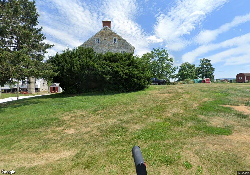
20432 Landis Rd Hagerstown, MD 21740
South End NeighborhoodEstimated Value: $562,000 - $2,031,000
--
Bed
1
Bath
2,952
Sq Ft
$522/Sq Ft
Est. Value
About This Home
This home is located at 20432 Landis Rd, Hagerstown, MD 21740 and is currently estimated at $1,540,018, approximately $521 per square foot. 20432 Landis Rd is a home located in Washington County with nearby schools including Greenbrier Elementary School, Boonsboro Middle School, and Boonsboro High School.
Ownership History
Date
Name
Owned For
Owner Type
Purchase Details
Closed on
Oct 25, 2024
Sold by
Landis Road Farm Llc
Bought by
Woodsboro Llc
Current Estimated Value
Home Financials for this Owner
Home Financials are based on the most recent Mortgage that was taken out on this home.
Original Mortgage
$1,350,000
Outstanding Balance
$1,336,485
Interest Rate
6.09%
Mortgage Type
Construction
Estimated Equity
$203,533
Purchase Details
Closed on
Oct 23, 2002
Sold by
Doub John C
Bought by
Landis Road Farm Llc
Create a Home Valuation Report for This Property
The Home Valuation Report is an in-depth analysis detailing your home's value as well as a comparison with similar homes in the area
Home Values in the Area
Average Home Value in this Area
Purchase History
| Date | Buyer | Sale Price | Title Company |
|---|---|---|---|
| Woodsboro Llc | $1,800,000 | None Listed On Document | |
| Woodsboro Llc | $1,800,000 | None Listed On Document | |
| Landis Road Farm Llc | -- | -- |
Source: Public Records
Mortgage History
| Date | Status | Borrower | Loan Amount |
|---|---|---|---|
| Open | Woodsboro Llc | $1,350,000 | |
| Closed | Woodsboro Llc | $1,350,000 |
Source: Public Records
Tax History Compared to Growth
Tax History
| Year | Tax Paid | Tax Assessment Tax Assessment Total Assessment is a certain percentage of the fair market value that is determined by local assessors to be the total taxable value of land and additions on the property. | Land | Improvement |
|---|---|---|---|---|
| 2025 | $3,321 | $364,033 | $0 | $0 |
| 2024 | $3,321 | $315,000 | $138,100 | $176,900 |
| 2023 | $3,231 | $306,267 | $0 | $0 |
| 2022 | $3,141 | $297,533 | $0 | $0 |
| 2021 | $3,121 | $288,800 | $138,100 | $150,700 |
| 2020 | $2,994 | $278,033 | $0 | $0 |
| 2019 | $2,893 | $267,267 | $0 | $0 |
| 2018 | $2,779 | $256,500 | $138,100 | $118,400 |
| 2017 | $2,779 | $256,500 | $0 | $0 |
| 2016 | -- | $256,500 | $0 | $0 |
| 2015 | $4,193 | $271,100 | $0 | $0 |
| 2014 | $4,193 | $313,800 | $0 | $0 |
Source: Public Records
Map
Nearby Homes
- 410 Londontowne Ct
- 20505 Shaheen Ln
- 342 Landis Rd
- 11013 Shalom Ln
- 20931 Mount Aetna Rd
- 20204 Plumwood Dr
- 11029 Plumwood Cir
- 11117 Shalom Ln
- 1852 Meridian Dr
- 11025 Eastwood Dr
- 1826 Meridian Dr
- 608 Trafalgar Dr
- 618 Trafalgar Dr
- 650 Trafalgar Dr
- 1814 Meridian Dr
- 20410 Trout Dr
- 626 Observatory Dr
- 9947 Crossfield Rd
- 9812 Pembroke Dr
- 20039 Rosebank Way
- 10529 White Hall Rd
- 10537 White Hall Rd
- 10541 White Hall Rd
- 10547 White Hall Rd
- 10601 White Hall Rd
- 10601 White Hall Rd
- 20312 Landis Rd
- 10613 White Hall Rd
- 10323 White Hall Rd
- 10306 White Hall Rd
- 10633 White Hall Rd
- 10405 White Hall Rd Unit 10401
- 10304 White Hall Rd
- 20135 Landis Rd
- 20137 Landis Rd
- 10214 White Hall Rd
- 10617 White Hall Rd
- 10527 White Hall Rd
- 20513 Mount Aetna Rd
- 10705 White Hall Rd