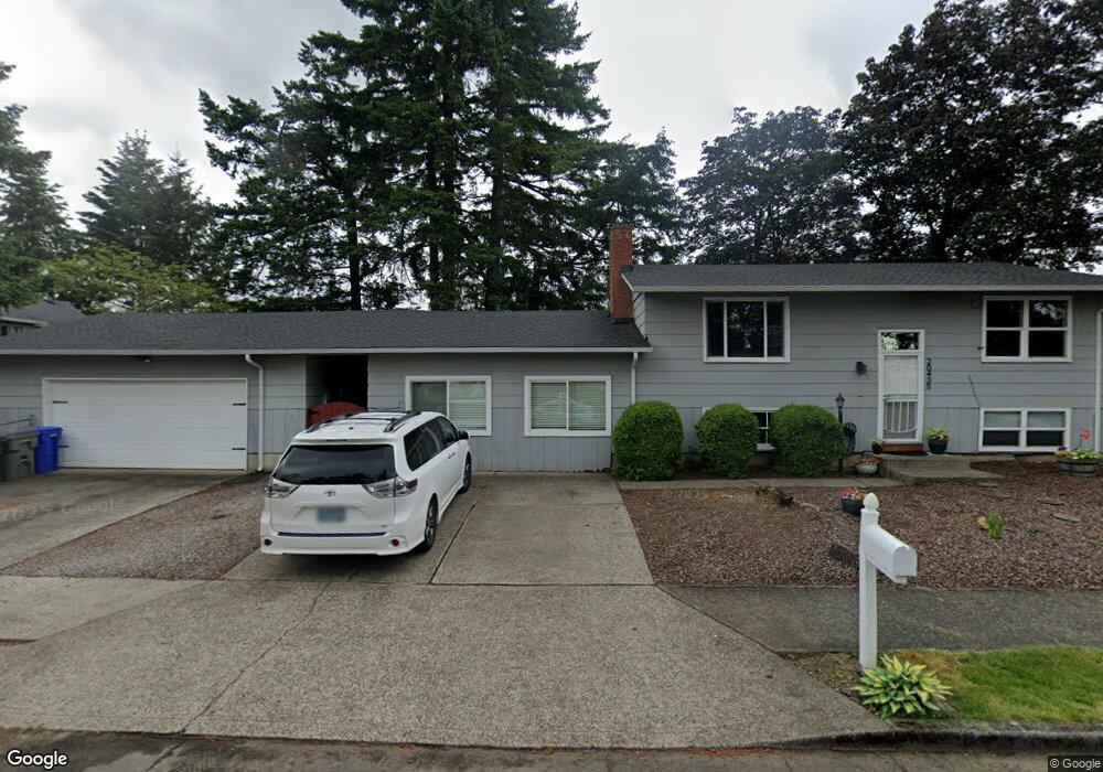
20435 SE Alder Ct Gresham, OR 97030
North Central NeighborhoodEstimated Value: $480,000 - $526,000
3
Beds
2
Baths
2,200
Sq Ft
$231/Sq Ft
Est. Value
About This Home
This home is located at 20435 SE Alder Ct, Gresham, OR 97030 and is currently estimated at $508,344, approximately $231 per square foot. 20435 SE Alder Ct is a home located in Multnomah County with nearby schools including North Gresham Elementary School, Clear Creek Middle School, and Gresham High School.
Ownership History
Date
Name
Owned For
Owner Type
Purchase Details
Closed on
Apr 4, 2003
Sold by
Bell Michael Vernon
Bought by
Mcgee Andre D and Mcgee Andrea M
Current Estimated Value
Home Financials for this Owner
Home Financials are based on the most recent Mortgage that was taken out on this home.
Original Mortgage
$192,600
Outstanding Balance
$82,618
Interest Rate
5.73%
Mortgage Type
Purchase Money Mortgage
Estimated Equity
$425,726
Purchase Details
Closed on
Jul 28, 2001
Sold by
Bell Teresa Jane
Bought by
Bell Michael Vernon
Create a Home Valuation Report for This Property
The Home Valuation Report is an in-depth analysis detailing your home's value as well as a comparison with similar homes in the area
Home Values in the Area
Average Home Value in this Area
Purchase History
| Date | Buyer | Sale Price | Title Company |
|---|---|---|---|
| Mcgee Andre D | $180,000 | Multiple | |
| Bell Michael Vernon | -- | -- |
Source: Public Records
Mortgage History
| Date | Status | Borrower | Loan Amount |
|---|---|---|---|
| Open | Mcgee Andre D | $192,600 |
Source: Public Records
Tax History
| Year | Tax Paid | Tax Assessment Tax Assessment Total Assessment is a certain percentage of the fair market value that is determined by local assessors to be the total taxable value of land and additions on the property. | Land | Improvement |
|---|---|---|---|---|
| 2025 | $5,791 | $284,580 | -- | -- |
| 2024 | $5,544 | $276,300 | -- | -- |
| 2023 | $5,544 | $268,260 | -- | -- |
| 2022 | $4,910 | $260,450 | $0 | $0 |
| 2021 | $4,786 | $252,870 | $0 | $0 |
| 2020 | $4,503 | $245,510 | $0 | $0 |
| 2019 | $4,385 | $238,360 | $0 | $0 |
| 2018 | $4,181 | $231,420 | $0 | $0 |
| 2017 | $4,012 | $224,680 | $0 | $0 |
| 2016 | $3,537 | $218,140 | $0 | $0 |
| 2015 | $3,461 | $211,790 | $0 | $0 |
| 2014 | $3,376 | $205,630 | $0 | $0 |
Source: Public Records
Map
Nearby Homes
- 21016 SE Stark St Unit 71
- 21016 SE Stark St Unit 69
- 522 SE 199th Ave
- 19776 SE Stark St Unit 147
- 2013 NW Bella Vista Dr
- 21260 SE Stark St
- 0 SE Burnside St
- 21400 SE Stark St Unit 2
- 805 SE 197th Ave
- 150 NE 202nd Ave
- 209 SE 214th Ave
- 1811 NW 19th St
- 1861 NW Wonderview Ave
- 132 SE 214th Ave
- 21532 SE Alder St
- 21525 SE Oak St
- 21033 SE Clay Ct
- 21553 SE Ankeny Terrace
- 0 NE 202nd Ave
- 19189 SE Yamhill St Unit 7
- 629 SE 205th Dr
- 622 SE 204th Place
- 20416 SE Alder Ct
- 20412 SE Alder Ct
- 605 SE 205th Dr
- 584 SE 204th Place
- 623 SE 204th Place
- 20507 SE Alder Ct
- 20420 SE Alder Ct
- 611 SE 204th Place
- 710 SE 205th Dr
- 576 SE 204th Place
- 593 SE 204th Place
- 624 SE 205th Dr
- 568 SE 204th Place
- 581 SE 204th Place
- 537 SE 205th Ave
- 725 SE 205th Dr
- 577 SE 204th Place
- 618 SE 205th Dr
Your Personal Tour Guide
Ask me questions while you tour the home.