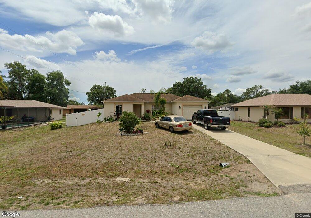
20439 Dial Ave Port Charlotte, FL 33952
Estimated Value: $221,294 - $273,000
--
Bed
2
Baths
1,168
Sq Ft
$214/Sq Ft
Est. Value
About This Home
This home is located at 20439 Dial Ave, Port Charlotte, FL 33952 and is currently estimated at $249,574, approximately $213 per square foot. 20439 Dial Ave is a home located in Charlotte County with nearby schools including Liberty Elementary School, Murdock Middle School, and Port Charlotte High School.
Ownership History
Date
Name
Owned For
Owner Type
Purchase Details
Closed on
Oct 24, 2013
Sold by
Charlotte County Habitat For Humanity In
Bought by
Tesnow Stephanie
Current Estimated Value
Home Financials for this Owner
Home Financials are based on the most recent Mortgage that was taken out on this home.
Original Mortgage
$87,950
Outstanding Balance
$66,267
Interest Rate
4.57%
Mortgage Type
Seller Take Back
Estimated Equity
$183,307
Purchase Details
Closed on
Dec 20, 2010
Sold by
The Housing Corporation Of Charlotte Cou
Bought by
County Of Charlotte
Purchase Details
Closed on
Sep 23, 2008
Sold by
Town Dannie R and Town Martha L
Bought by
The Housing Corp Of Charlotte County Inc
Create a Home Valuation Report for This Property
The Home Valuation Report is an in-depth analysis detailing your home's value as well as a comparison with similar homes in the area
Home Values in the Area
Average Home Value in this Area
Purchase History
| Date | Buyer | Sale Price | Title Company |
|---|---|---|---|
| Tesnow Stephanie | $90,000 | Attorney | |
| County Of Charlotte | -- | None Available | |
| The Housing Corp Of Charlotte County Inc | $9,500 | Attorney |
Source: Public Records
Mortgage History
| Date | Status | Borrower | Loan Amount |
|---|---|---|---|
| Open | Tesnow Stephanie | $87,950 |
Source: Public Records
Tax History Compared to Growth
Tax History
| Year | Tax Paid | Tax Assessment Tax Assessment Total Assessment is a certain percentage of the fair market value that is determined by local assessors to be the total taxable value of land and additions on the property. | Land | Improvement |
|---|---|---|---|---|
| 2023 | $1,432 | $89,496 | $0 | $0 |
| 2022 | $1,426 | $86,889 | $0 | $0 |
| 2021 | $1,404 | $84,358 | $0 | $0 |
| 2020 | $1,360 | $83,193 | $0 | $0 |
| 2019 | $1,277 | $81,323 | $0 | $0 |
| 2018 | $1,158 | $79,807 | $0 | $0 |
| 2017 | $1,147 | $78,166 | $0 | $0 |
| 2016 | $1,132 | $76,558 | $0 | $0 |
| 2015 | $1,114 | $76,026 | $0 | $0 |
| 2014 | $1,262 | $85,480 | $0 | $0 |
Source: Public Records
Map
Nearby Homes
- 20431 Stardust Ave
- 1181 Oxsalida St
- 1196 Hinton St
- 1170 Peppertree Ln
- 1160 Peppertree Ln
- 20430 Sapling Ave
- 20370 Mount Prospect Ave
- 20407 Laverne Ave
- 20347 Mount Prospect Ave
- 284 Hinton St
- 1053 Yarmouth St
- 20439 Peachland Blvd
- 20423 Peachland Blvd
- 1058 Congress St
- 1366 Preston St
- 20307 Zelda Ave
- 1302 Arrow St
- 1172 Lyle St
- 1205 Yorkshire St
- 485 Dorchester St
- 20431 Dial Ave
- 20431 Avenue
- 1157 Hinton St
- 20438 Stardust Ave
- 1173 Hinton St
- 20423 Dial Ave
- 20438 Dial Ave
- 20422 Stardust Ave
- 1141 Hinton St
- 1140 Oxsalida St
- 1156 Hinton St
- 1148 Hinton St
- 1172 Hinton St
- 20439 Stardust Ave
- 20439 Mount Prospect Ave
- 20447 Stardust Ave
- 20431 Mount Prospect Ave
- 1157 Oxsalida St
- 1165 Oxsalida St
- 1173 Oxsalida St