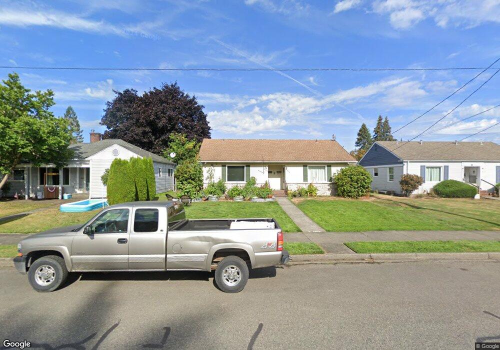
2044 Cole St Unit 1 Enumclaw, WA 98022
Estimated Value: $207,000 - $285,000
1
Bed
1
Bath
550
Sq Ft
$438/Sq Ft
Est. Value
About This Home
This home is located at 2044 Cole St Unit 1, Enumclaw, WA 98022 and is currently estimated at $240,740, approximately $437 per square foot. 2044 Cole St Unit 1 is a home located in King County with nearby schools including Byron Kibler Elementary School, Enumclaw Middle School, and Enumclaw Senior High School.
Ownership History
Date
Name
Owned For
Owner Type
Purchase Details
Closed on
Dec 26, 2007
Sold by
Northwest Home Inspection Services Llc
Bought by
Simpson Rosa
Current Estimated Value
Home Financials for this Owner
Home Financials are based on the most recent Mortgage that was taken out on this home.
Original Mortgage
$118,000
Outstanding Balance
$74,678
Interest Rate
6.21%
Estimated Equity
$166,062
Purchase Details
Closed on
Nov 27, 2007
Sold by
Simpson Richard Lewis
Bought by
Simpson Rosa M
Home Financials for this Owner
Home Financials are based on the most recent Mortgage that was taken out on this home.
Original Mortgage
$118,000
Outstanding Balance
$74,678
Interest Rate
6.21%
Estimated Equity
$166,062
Create a Home Valuation Report for This Property
The Home Valuation Report is an in-depth analysis detailing your home's value as well as a comparison with similar homes in the area
Home Values in the Area
Average Home Value in this Area
Purchase History
| Date | Buyer | Sale Price | Title Company |
|---|---|---|---|
| Simpson Rosa | $138,000 | The Talon Grou | |
| Simpson Rosa M | -- | The Talon Grou |
Source: Public Records
Mortgage History
| Date | Status | Borrower | Loan Amount |
|---|---|---|---|
| Open | Simpson Rosa | $118,000 |
Source: Public Records
Tax History Compared to Growth
Tax History
| Year | Tax Paid | Tax Assessment Tax Assessment Total Assessment is a certain percentage of the fair market value that is determined by local assessors to be the total taxable value of land and additions on the property. | Land | Improvement |
|---|---|---|---|---|
| 2024 | $1,636 | $170,000 | $55,000 | $115,000 |
| 2023 | $1,653 | $201,000 | $55,000 | $146,000 |
| 2022 | $1,477 | $176,000 | $55,000 | $121,000 |
| 2021 | $1,384 | $142,000 | $50,000 | $92,000 |
| 2020 | $1,309 | $121,000 | $50,000 | $71,000 |
| 2018 | $1,177 | $112,000 | $45,000 | $67,000 |
| 2017 | $1,033 | $93,000 | $45,000 | $48,000 |
| 2016 | $1,446 | $84,000 | $45,000 | $39,000 |
| 2015 | $1,282 | $117,000 | $40,000 | $77,000 |
| 2014 | -- | $99,000 | $40,000 | $59,000 |
| 2013 | -- | $99,000 | $40,000 | $59,000 |
Source: Public Records
Map
Nearby Homes
- 1107 Griffin Ave
- 2921 Frederickson St
- 1854 Hillcrest Ave
- 3053 Porter St
- 1486 Division St
- 349 Rainier Ave
- 1722 Harding St
- 1165 Harding St
- 1720 Garfield St Unit 4
- 2040 Roosevelt Ave
- 806 Pine Dr
- 2054 Roosevelt Ave
- 915 Mountain Villa Dr
- 1170 Cedar Dr
- 837 Myrtine St
- 930 Mountain Villa Dr
- 1207 Maple Dr
- 2632 Cascade Ave
- 1903 Clovercrest St
- 1919 Clovercrest St
- 2044 Cole St
- 2044 Cole St Unit 2
- 2046 Cole St
- 2040 Cole St
- 2038 Cole St
- 2108 Cole St
- 2043 Wells St
- 2033 Wells St
- 2118 Cole St
- 2107 Wells St
- 2032 Cole St
- 2032 Cole St Unit 3
- 2032 Cole St Unit 4
- 2032 Cole St Unit 2
- 2032 Cole St Unit 1
- 2030 Cole St Unit 4
- 2030 Cole St Unit 3
- 2030 Cole St
- 2023 Wells St
- 2117 Wells St