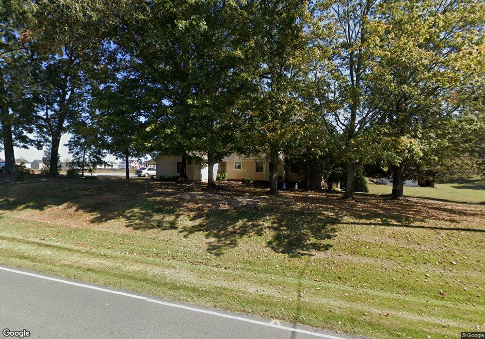
2044 Lacy Holt Rd Graham, NC 27253
Estimated Value: $324,000 - $409,000
2
Beds
2
Baths
140
Sq Ft
$2,689/Sq Ft
Est. Value
About This Home
This home is located at 2044 Lacy Holt Rd, Graham, NC 27253 and is currently estimated at $376,515, approximately $2,689 per square foot. 2044 Lacy Holt Rd is a home located in Alamance County with nearby schools including South Graham Elementary School, Southern Alamance Middle School, and Southern Alamance High School.
Ownership History
Date
Name
Owned For
Owner Type
Purchase Details
Closed on
Oct 7, 2021
Sold by
Rollins James Christopher and Rollins Andrea Elliott
Bought by
Edwards Janet Williams and Talbert Jeremy Wayne
Current Estimated Value
Home Financials for this Owner
Home Financials are based on the most recent Mortgage that was taken out on this home.
Original Mortgage
$277,500
Outstanding Balance
$253,054
Interest Rate
2.8%
Mortgage Type
New Conventional
Estimated Equity
$123,461
Purchase Details
Closed on
Oct 30, 2007
Sold by
Oakley Patricia D
Bought by
Rollins James C
Home Financials for this Owner
Home Financials are based on the most recent Mortgage that was taken out on this home.
Original Mortgage
$129,600
Interest Rate
6.27%
Mortgage Type
New Conventional
Create a Home Valuation Report for This Property
The Home Valuation Report is an in-depth analysis detailing your home's value as well as a comparison with similar homes in the area
Home Values in the Area
Average Home Value in this Area
Purchase History
| Date | Buyer | Sale Price | Title Company |
|---|---|---|---|
| Edwards Janet Williams | $297,500 | None Available | |
| Rollins James C | $162,000 | -- |
Source: Public Records
Mortgage History
| Date | Status | Borrower | Loan Amount |
|---|---|---|---|
| Open | Edwards Janet Williams | $277,500 | |
| Previous Owner | Rollins James C | $129,600 | |
| Previous Owner | Rollins James C | $16,200 |
Source: Public Records
Tax History Compared to Growth
Tax History
| Year | Tax Paid | Tax Assessment Tax Assessment Total Assessment is a certain percentage of the fair market value that is determined by local assessors to be the total taxable value of land and additions on the property. | Land | Improvement |
|---|---|---|---|---|
| 2025 | $1,742 | $352,663 | $55,011 | $297,652 |
| 2024 | $1,654 | $352,663 | $55,011 | $297,652 |
| 2023 | $1,516 | $352,663 | $55,011 | $297,652 |
| 2022 | $1,688 | $153,171 | $40,792 | $112,379 |
| 2021 | $1,703 | $153,171 | $40,792 | $112,379 |
| 2020 | $1,718 | $153,171 | $40,792 | $112,379 |
| 2019 | $1,723 | $153,171 | $40,792 | $112,379 |
| 2018 | $0 | $153,171 | $40,792 | $112,379 |
| 2017 | $884 | $153,171 | $40,792 | $112,379 |
| 2016 | $1,568 | $151,535 | $40,792 | $110,743 |
| 2015 | $875 | $151,535 | $40,792 | $110,743 |
| 2014 | -- | $151,535 | $40,792 | $110,743 |
Source: Public Records
Map
Nearby Homes
- 3109 Cullens Dr
- 1929 Darrell Dr Unit 7
- 1929 Darrell Dr
- 1923 Darrell Dr Unit 6
- 1923 Darrell Dr
- 1917 Darrell Dr Unit 5
- 1917 Darrell Dr
- 1938 Darrell Dr Unit Lot 11
- 1938 Darrell Dr
- 1911 Darrell Dr Unit 4
- 1911 Darrell Dr
- 2061 Cline Ct Unit 18
- 2061 Cline Ct
- 1932 Darrell Dr Unit Lot12
- 1932 Darrell Dr
- 1926 Darrell Dr Unit Lot 13
- 1926 Darrell Dr
- 2374 Whelen Dr
- 2363 Whelen Dr
- 2002 Guinness Dr
- 2100 Lacy Holt Rd
- 1715 Carter Daniel Dr
- 2025 Lacy Holt Rd
- 1702 Carter Daniel Dr
- 2114 Lacy Holt Rd
- 1723 Carter Daniel Dr
- 1714 Carter Daniel Dr
- 1727 Carter Daniel Dr
- 1731 Carter Daniel Dr
- 1722 Carter Daniel Dr Unit 49
- 1722 Carter Daniel Dr
- 1726 Carter Daniel Dr
- 1735 Carter Daniel Dr
- 1739 Carter Daniel Dr
- 1734 Carter Daniel Dr Unit 46
- 1734 Carter Daniel Dr
- 0 Lacy Holt Rd Unit 1038967
- 0 Lacy Holt Rd Unit 114154
- 0 Lacy Holt Rd Unit 97627
- 0 Lacy Holt Rd Unit 71927