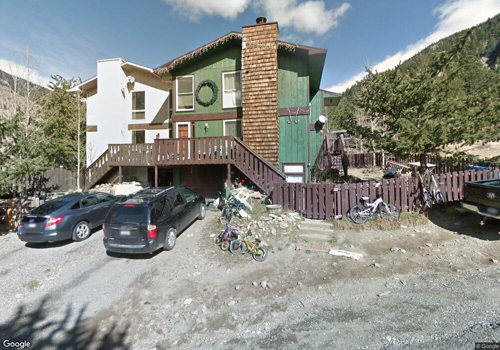
2045 Bluebird Dr Georgetown, CO 80444
Estimated Value: $599,871 - $741,000
4
Beds
3
Baths
1,928
Sq Ft
$354/Sq Ft
Est. Value
About This Home
This home is located at 2045 Bluebird Dr, Georgetown, CO 80444 and is currently estimated at $682,718, approximately $354 per square foot. 2045 Bluebird Dr is a home with nearby schools including Clear Creek High School and Georgetown Community School.
Ownership History
Date
Name
Owned For
Owner Type
Purchase Details
Closed on
Dec 23, 2015
Sold by
Janov Dawn
Bought by
Janov Dawn and Nugent Diane
Current Estimated Value
Purchase Details
Closed on
Apr 9, 2014
Sold by
Mateer Edward R and Roberts Alice E
Bought by
Janov Dawn
Purchase Details
Closed on
Jul 3, 2013
Sold by
Nugent Diane C and Janov Jeremy M
Bought by
Janov Dawn C and Roberts Alice E
Purchase Details
Closed on
Feb 12, 2013
Sold by
Nugent Diane C and Janov Jeremy M
Bought by
Nugent Diane C and Janov Jeremy M
Purchase Details
Closed on
Jun 8, 2011
Sold by
Janov Dawn C
Bought by
Nugent Diane C and Janov Jeremy M
Create a Home Valuation Report for This Property
The Home Valuation Report is an in-depth analysis detailing your home's value as well as a comparison with similar homes in the area
Home Values in the Area
Average Home Value in this Area
Purchase History
| Date | Buyer | Sale Price | Title Company |
|---|---|---|---|
| Janov Dawn | -- | None Available | |
| Janov Dawn | -- | None Available | |
| Janov Dawn C | -- | None Available | |
| Nugent Diane C | -- | None Available | |
| Nugent Diane C | -- | None Available |
Source: Public Records
Tax History Compared to Growth
Tax History
| Year | Tax Paid | Tax Assessment Tax Assessment Total Assessment is a certain percentage of the fair market value that is determined by local assessors to be the total taxable value of land and additions on the property. | Land | Improvement |
|---|---|---|---|---|
| 2024 | $1,608 | $27,410 | $1,830 | $25,580 |
| 2023 | $1,603 | $27,410 | $1,830 | $25,580 |
| 2022 | $1,469 | $25,790 | $2,150 | $23,640 |
| 2021 | $1,464 | $26,530 | $2,210 | $24,320 |
| 2020 | $1,124 | $22,740 | $2,210 | $20,530 |
| 2019 | $1,121 | $22,740 | $2,210 | $20,530 |
| 2018 | $827 | $19,180 | $2,230 | $16,950 |
| 2017 | $859 | $19,180 | $2,230 | $16,950 |
| 2016 | $856 | $19,900 | $1,850 | $18,050 |
| 2015 | -- | $19,900 | $1,850 | $18,050 |
| 2014 | -- | $16,160 | $3,180 | $12,980 |
Source: Public Records
Map
Nearby Homes
- 0 Clear Creek Dr Unit REC6029254
- 0 Clear Creek Unit REC7593075
- 2186 Clear Creek Dr
- 2110 Bighorn Trail
- 2110 Bighorn Trail Unit 2110
- 611 Bighorn Rd Unit 162
- 1901 Clear Creek Dr Unit A204
- North Lot Clear Creek Dr
- South Lot Clear Creek Dr
- 611 Blue Spruce Ln Unit 150
- 2115 Hummingbird Way Unit 105
- 2115 Hummingbird Way Unit 102
- 2115 Hummingbird Way Unit 201
- 2115 Hummingbird Way Unit 103
- 2115 Hummingbird Way Unit 105
- 2121 Hummingbird Way Unit 204
- 2121 Hummingbird Way Unit 203
- 2121 Hummingbird Way Unit 105
- 2121 Hummingbird Way Unit 104
- 2121 Hummingbird Way Unit 103
- 2035 Bluebird Dr
- 2055 Blue Bird Dr
- 2130 Flat Iron Dr
- 2055 Bluebird Dr
- 2025 Bluebird Dr
- 2030 Bluebird Dr
- 2040 Blue Bird Dr
- 2040 Bluebird Dr
- 300 Saxon Mountain Rd
- 2020 Flat Iron Dr
- 2050 Bluebird Dr
- 2005 Bluebird Dr
- 2015 Alliance Dr
- 2035 Flat Iron Dr
- 350 Saxon Mountain Rd
- 2025 Alliance Dr
- 0 Flatiron Dr Unit 1784844
- 0 Flatiron Dr Unit 6799527
- 0 Flatiron Dr Unit 9390677
- 2125 Flat Iron Dr