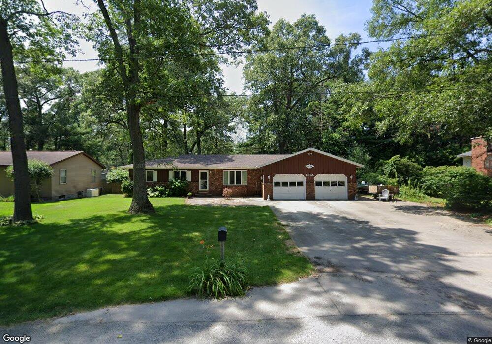
2045 Bluebird Ln Muskegon, MI 49445
Estimated Value: $281,588 - $297,000
4
Beds
2
Baths
1,482
Sq Ft
$195/Sq Ft
Est. Value
About This Home
This home is located at 2045 Bluebird Ln, Muskegon, MI 49445 and is currently estimated at $289,397, approximately $195 per square foot. 2045 Bluebird Ln is a home located in Muskegon County with nearby schools including Reeths-Puffer High School.
Ownership History
Date
Name
Owned For
Owner Type
Purchase Details
Closed on
Jun 27, 2008
Sold by
Independent Mortgage Co and Troyer David
Bought by
Foster Thomas R
Current Estimated Value
Home Financials for this Owner
Home Financials are based on the most recent Mortgage that was taken out on this home.
Original Mortgage
$50,000
Outstanding Balance
$32,306
Interest Rate
6.1%
Mortgage Type
Purchase Money Mortgage
Estimated Equity
$257,092
Purchase Details
Closed on
Feb 9, 2007
Sold by
Penny Sandra L
Bought by
Independent Mortgage Co West Michigan
Create a Home Valuation Report for This Property
The Home Valuation Report is an in-depth analysis detailing your home's value as well as a comparison with similar homes in the area
Home Values in the Area
Average Home Value in this Area
Purchase History
| Date | Buyer | Sale Price | Title Company |
|---|---|---|---|
| Foster Thomas R | $81,400 | Independent Title Svcs Inc | |
| Independent Mortgage Co West Michigan | $110,489 | None Available |
Source: Public Records
Mortgage History
| Date | Status | Borrower | Loan Amount |
|---|---|---|---|
| Open | Foster Thomas R | $50,000 |
Source: Public Records
Tax History Compared to Growth
Tax History
| Year | Tax Paid | Tax Assessment Tax Assessment Total Assessment is a certain percentage of the fair market value that is determined by local assessors to be the total taxable value of land and additions on the property. | Land | Improvement |
|---|---|---|---|---|
| 2025 | $2,437 | $128,200 | $0 | $0 |
| 2024 | $729 | $118,000 | $0 | $0 |
| 2023 | $698 | $100,100 | $0 | $0 |
| 2022 | $2,226 | $87,400 | $0 | $0 |
| 2021 | $2,173 | $80,300 | $0 | $0 |
| 2020 | $2,147 | $75,200 | $0 | $0 |
| 2019 | $2,115 | $69,700 | $0 | $0 |
| 2018 | $2,076 | $66,200 | $0 | $0 |
| 2017 | $2,067 | $65,800 | $0 | $0 |
| 2016 | $595 | $59,500 | $0 | $0 |
| 2015 | -- | $56,000 | $0 | $0 |
| 2014 | -- | $56,300 | $0 | $0 |
| 2013 | -- | $49,400 | $0 | $0 |
Source: Public Records
Map
Nearby Homes
- 2060 N Roberts Rd
- 2021 Queens Ct
- 0 N Getty St
- 1925 Shady Oak Dr
- 0 Holton Vl Rd Unit 20027438
- 2026 N Port Blvd
- 1960 Nielwood Dr
- 764 E Giles Rd
- 787 E Giles Rd
- V/L Holton Rd
- 2624 Holton Rd
- 1850 Mildred St
- V/L Reed Ave
- 1353 Holton Rd
- 2551 Hiawatha Trail
- 0 E Mcmillan Rd
- 129 Maple Ct
- 1699 Sycamore Dr
- 2337 Northwind Dr
- 2400 Russell Rd
- 2035 Bluebird Ln
- 2061 Bluebird Ln
- 1247 Cardinal Circle Dr
- 1245 Cardinal Circle Dr
- 1255 Cardinal Circle Dr
- 2034 Bluebird Ln
- 1325 Cardinal Circle Dr
- 1286 Robin Rd
- 1300 Robin Rd
- 2014 Bluebird Ln
- 1239 Cardinal Circle Dr
- 1345 Cardinal Circle Dr
- 1241 Cardinal Circle Dr
- 1291 Robin Rd
- 1340 Robin Rd
- 1330 Cardinal Circle Dr
- 1290 Cardinal Circle Dr
- 1306 Cardinal Circle Dr
- 1280 Cardinal Circle Dr
- 1336 Cardinal Circle Dr