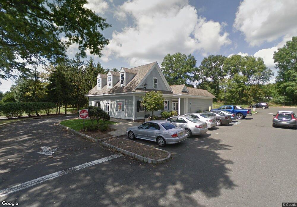
2045 Burnt Mills Rd Bedminster, NJ 07921
Estimated Value: $1,755,809 - $2,030,000
--
Bed
1
Bath
2,500
Sq Ft
$757/Sq Ft
Est. Value
About This Home
This home is located at 2045 Burnt Mills Rd, Bedminster, NJ 07921 and is currently estimated at $1,892,905, approximately $757 per square foot. 2045 Burnt Mills Rd is a home located in Somerset County with nearby schools including Bedminster Township School.
Ownership History
Date
Name
Owned For
Owner Type
Purchase Details
Closed on
Dec 29, 2020
Sold by
Amd Family Holdings Llc
Bought by
Westfield Hall Inc
Current Estimated Value
Purchase Details
Closed on
Jan 18, 2019
Sold by
Dhp Company Llc
Bought by
Amd Family Holdings Llc
Purchase Details
Closed on
Apr 11, 1995
Sold by
Stanley Veda
Bought by
D H P Company
Home Financials for this Owner
Home Financials are based on the most recent Mortgage that was taken out on this home.
Original Mortgage
$200,000
Interest Rate
8.55%
Mortgage Type
Commercial
Create a Home Valuation Report for This Property
The Home Valuation Report is an in-depth analysis detailing your home's value as well as a comparison with similar homes in the area
Home Values in the Area
Average Home Value in this Area
Purchase History
| Date | Buyer | Sale Price | Title Company |
|---|---|---|---|
| Westfield Hall Inc | $1,300,000 | Chicago Title Insurance Co | |
| Amd Family Holdings Llc | $969,200 | Old Republic Title Ins Co | |
| D H P Company | $350,000 | -- |
Source: Public Records
Mortgage History
| Date | Status | Borrower | Loan Amount |
|---|---|---|---|
| Previous Owner | D H P Company | $200,000 |
Source: Public Records
Tax History Compared to Growth
Tax History
| Year | Tax Paid | Tax Assessment Tax Assessment Total Assessment is a certain percentage of the fair market value that is determined by local assessors to be the total taxable value of land and additions on the property. | Land | Improvement |
|---|---|---|---|---|
| 2025 | $17,085 | $1,300,000 | $975,000 | $325,000 |
| 2024 | $17,085 | $1,300,000 | $975,000 | $325,000 |
| 2023 | $17,085 | $1,275,000 | $975,000 | $300,000 |
| 2022 | $17,506 | $1,275,000 | $975,000 | $300,000 |
| 2021 | $15,813 | $1,275,000 | $975,000 | $300,000 |
| 2020 | $14,176 | $1,025,000 | $700,000 | $325,000 |
| 2019 | $15,813 | $1,150,000 | $735,000 | $415,000 |
| 2018 | $15,266 | $1,125,000 | $735,000 | $390,000 |
| 2017 | $15,376 | $1,115,000 | $725,000 | $390,000 |
| 2016 | $15,031 | $1,106,000 | $718,000 | $388,000 |
| 2015 | $14,881 | $1,095,000 | $712,500 | $382,500 |
| 2014 | $14,774 | $1,080,000 | $700,000 | $380,000 |
Source: Public Records
Map
Nearby Homes
- 66 Mountain Ct Unit 4766
- 79 Sage Ct Unit 3A
- 1002 Timberbrooke Dr
- 41 Cambridge Rd
- 13 Eton Ct
- 5 Harrow Ln
- 15 Ray Ct
- 25 Spruce Ct
- 31 Spruce Ct
- 86 Wescott Rd
- 270 Washington Valley Rd
- 94 Wescott Rd Unit 7794
- 6 Wood Duck Pond Road Ondo
- 233 Long Meadow Rd
- 971 Washington Valley Rd
- 328 Enclave Ln
- 25 Stevens Ct
- 39 Academy Ct
- 22 Morgan Ct
- 10 Morgan Ct
- 2085 Burnt Mills Rd Unit 1
- 243 243 Us Highway 202 206
- 255 Us Highway 202 206
- 255 U S 202
- 261 Us Highway 202 206
- 264 Route202 206
- 255 Route202 206
- 100 Pluckemin Park Ct
- 274 U S 202 Unit 1
- 264 U S 202 Unit 264
- 206 Route 202
- 254 U S 202
- 264 Us Highway 202 206 Unit 264
- 294 Us Highway 202 206
- 235 Route202 206
- 254 Route 202 206
- 254 Us Highway 202 206
- 302 Us Highway 202 206 Unit 1
- 302 Us Highway 202 206
- 302 Route202 206