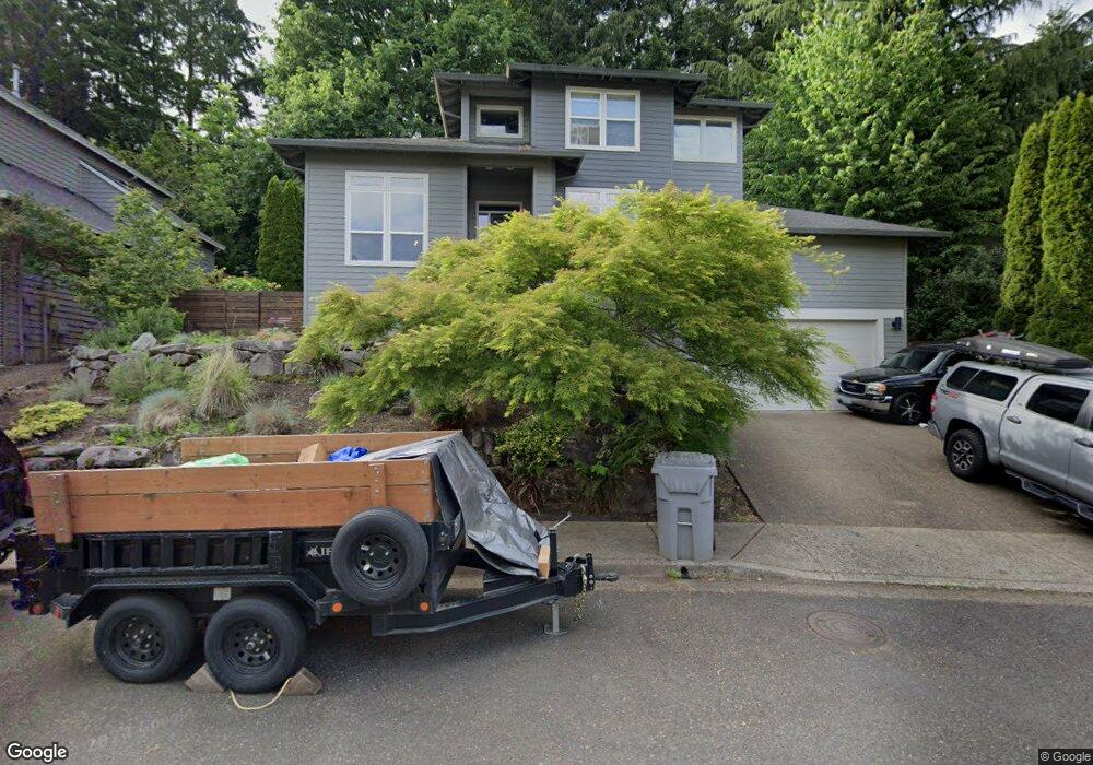
2045 Leslies Way West Linn, OR 97068
Willamette NeighborhoodEstimated Value: $741,190 - $975,000
--
Bed
3
Baths
2,207
Sq Ft
$393/Sq Ft
Est. Value
About This Home
This home is located at 2045 Leslies Way, West Linn, OR 97068 and is currently estimated at $866,298, approximately $392 per square foot. 2045 Leslies Way is a home located in Clackamas County with nearby schools including Willamette Primary School, Athey Creek Middle School, and West Linn High School.
Ownership History
Date
Name
Owned For
Owner Type
Purchase Details
Closed on
Nov 19, 2003
Sold by
Engelman David Barry and Engelman Karin M
Bought by
Darrow Amy J
Current Estimated Value
Home Financials for this Owner
Home Financials are based on the most recent Mortgage that was taken out on this home.
Original Mortgage
$264,000
Outstanding Balance
$116,057
Interest Rate
5.37%
Mortgage Type
Purchase Money Mortgage
Estimated Equity
$750,241
Purchase Details
Closed on
May 12, 1998
Sold by
Oregon Cascade Construction Inc
Bought by
Engelman David Barry and Engelman Karin M
Home Financials for this Owner
Home Financials are based on the most recent Mortgage that was taken out on this home.
Original Mortgage
$185,250
Interest Rate
6.65%
Mortgage Type
Balloon
Create a Home Valuation Report for This Property
The Home Valuation Report is an in-depth analysis detailing your home's value as well as a comparison with similar homes in the area
Home Values in the Area
Average Home Value in this Area
Purchase History
| Date | Buyer | Sale Price | Title Company |
|---|---|---|---|
| Darrow Amy J | $330,000 | Transnation | |
| Engelman David Barry | $247,000 | Fidelity National Title Co |
Source: Public Records
Mortgage History
| Date | Status | Borrower | Loan Amount |
|---|---|---|---|
| Open | Darrow Amy J | $264,000 | |
| Previous Owner | Engelman David Barry | $185,250 | |
| Closed | Darrow Amy J | $49,500 |
Source: Public Records
Tax History Compared to Growth
Tax History
| Year | Tax Paid | Tax Assessment Tax Assessment Total Assessment is a certain percentage of the fair market value that is determined by local assessors to be the total taxable value of land and additions on the property. | Land | Improvement |
|---|---|---|---|---|
| 2025 | $6,993 | $362,860 | -- | -- |
| 2024 | $6,731 | $352,292 | -- | -- |
| 2023 | $6,731 | $342,032 | $0 | $0 |
| 2022 | $6,353 | $332,070 | $0 | $0 |
| 2021 | $6,031 | $322,399 | $0 | $0 |
| 2020 | $6,072 | $313,009 | $0 | $0 |
| 2019 | $5,790 | $303,893 | $0 | $0 |
| 2018 | $5,532 | $295,042 | $0 | $0 |
| 2017 | $5,288 | $286,449 | $0 | $0 |
| 2016 | $5,132 | $278,106 | $0 | $0 |
| 2015 | $4,755 | $270,006 | $0 | $0 |
| 2014 | $4,545 | $262,142 | $0 | $0 |
Source: Public Records
Map
Nearby Homes
- 1315 11th St
- 1218 9th St Unit Lot 3
- 2077 5th Ave
- 1296 13th St
- 2315 5th Ave
- 1931 13th St
- 1721 Dollar St Unit 1721
- 1690 16th St
- 18830 Highway 99e Unit 41
- 1694 16th St
- 1733 Jamie Cir
- 1950 Hall St
- 1925 Hillhouse Dr
- 1925 Hall St
- 25540 Cheryl Dr
- 2026 Virginia Ln
- 1791 Blankenship Rd
- 1808 Hall Ct
- 2378 Falcon Dr
- 4650 Summerlinn Way