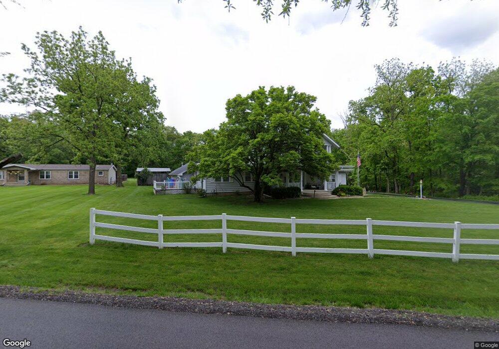
2045 Mckinley Ave Charleston, IL 61920
Estimated Value: $232,000 - $319,000
4
Beds
3
Baths
2,890
Sq Ft
$95/Sq Ft
Est. Value
About This Home
This home is located at 2045 Mckinley Ave, Charleston, IL 61920 and is currently estimated at $275,425, approximately $95 per square foot. 2045 Mckinley Ave is a home located in Coles County with nearby schools including Charleston High School, Charleston Christian Academy, and Charleston Christian Academy High School.
Ownership History
Date
Name
Owned For
Owner Type
Purchase Details
Closed on
Oct 10, 2006
Sold by
Drake Robert Douglas and Last Will And Testament Of Ani
Bought by
Keefer Kenneth F and Keefer Cindy K
Current Estimated Value
Home Financials for this Owner
Home Financials are based on the most recent Mortgage that was taken out on this home.
Original Mortgage
$54,000
Outstanding Balance
$4,858
Interest Rate
6%
Mortgage Type
Adjustable Rate Mortgage/ARM
Estimated Equity
$270,567
Purchase Details
Closed on
Oct 9, 2006
Sold by
Drake Robert Douglas and Drake Anita M
Bought by
Bosler George William and Bosler Suzanne P
Home Financials for this Owner
Home Financials are based on the most recent Mortgage that was taken out on this home.
Original Mortgage
$54,000
Outstanding Balance
$4,858
Interest Rate
6%
Mortgage Type
Adjustable Rate Mortgage/ARM
Estimated Equity
$270,567
Create a Home Valuation Report for This Property
The Home Valuation Report is an in-depth analysis detailing your home's value as well as a comparison with similar homes in the area
Home Values in the Area
Average Home Value in this Area
Purchase History
| Date | Buyer | Sale Price | Title Company |
|---|---|---|---|
| Keefer Kenneth F | -- | None Available | |
| Bosler George William | $175,000 | None Available |
Source: Public Records
Mortgage History
| Date | Status | Borrower | Loan Amount |
|---|---|---|---|
| Open | Bosler George William | $54,000 |
Source: Public Records
Tax History Compared to Growth
Tax History
| Year | Tax Paid | Tax Assessment Tax Assessment Total Assessment is a certain percentage of the fair market value that is determined by local assessors to be the total taxable value of land and additions on the property. | Land | Improvement |
|---|---|---|---|---|
| 2024 | $3,603 | $67,133 | $11,831 | $55,302 |
| 2023 | $3,403 | $61,309 | $10,805 | $50,504 |
| 2022 | $3,439 | $60,296 | $10,626 | $49,670 |
| 2021 | $3,562 | $57,866 | $10,198 | $47,668 |
| 2020 | $3,320 | $55,485 | $8,468 | $47,017 |
| 2019 | $3,255 | $53,552 | $8,173 | $45,379 |
| 2018 | $3,242 | $53,552 | $8,173 | $45,379 |
| 2017 | $3,226 | $53,552 | $8,173 | $45,379 |
| 2016 | $3,217 | $53,552 | $8,173 | $45,379 |
| 2015 | $3,467 | $53,552 | $8,173 | $45,379 |
| 2014 | $3,467 | $53,552 | $8,173 | $45,379 |
| 2013 | $3,467 | $53,552 | $8,173 | $45,379 |
Source: Public Records
Map
Nearby Homes
- 2162 Hidden Lake Ct
- 950 Edgar Dr Unit 4
- 2536 Salem Rd
- Lot 41 Hawthorne Dr
- Lot 43 Hawthorne Dr
- Lot 45 Hawthorne Dr
- Lot 47 Hawthorne Dr
- Lot 49 Hawthorne Dr
- Lot 52 Hawthorne Dr
- Lot 59 Hawthorne Dr
- Lot 60 Hawthorne Dr
- Lot 63 Hawthorne Dr
- Lot 65 Hawthorne Dr
- Lot 67 Hawthorne Dr
- Lot 3 Buxton Woods Dr
- Lot 1 Buxton Woods Dr
- Lot 2 Buxton Woods Dr
- Lot 28 Tanglewood Dr
- Lot 35 Tanglewood Dr
- 1402 14th St
- 2039 Mckinley Ave
- 2017 Stoner Dr W
- 2011 Stoner Dr W
- 2100 Stoner Dr W
- 2100 Stoner Dr E
- 2005 Stoner Dr W
- 2025 Mckinley Ave
- 2101 Stoner Dr W
- 2106 Stoner Dr E
- 2106 Stoner Dr W
- 2107 Stoner Dr W
- 2011 Mckinley Ave
- 2104 Stoner Dr W
- 2101 Stoner Dr E
- 2113 Stoner Dr W
- 2008 Stoner Dr W
- 2014 Mckinley Ave
- 2014 Stoner Dr W
- 2112 Stoner Dr E
- 2112 Stoner Dr W