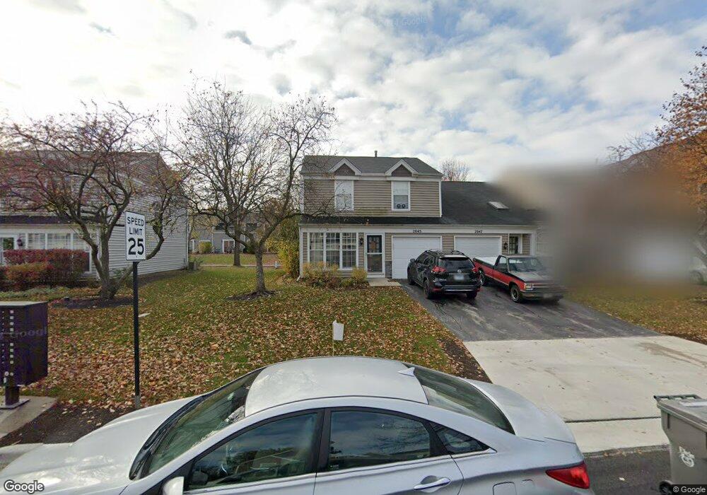
2045 Muirfield Cir Elgin, IL 60123
College Green NeighborhoodEstimated Value: $288,925 - $296,000
3
Beds
3
Baths
1,446
Sq Ft
$201/Sq Ft
Est. Value
About This Home
This home is located at 2045 Muirfield Cir, Elgin, IL 60123 and is currently estimated at $290,731, approximately $201 per square foot. 2045 Muirfield Cir is a home located in Kane County with nearby schools including Otter Creek Elementary School, Abbott Middle School, and South Elgin High School.
Ownership History
Date
Name
Owned For
Owner Type
Purchase Details
Closed on
Nov 2, 2021
Sold by
Jacqueline Bogaert
Bought by
Us Bank Trust National Associa
Current Estimated Value
Purchase Details
Closed on
Sep 16, 1997
Sold by
Smith Paul H
Bought by
Humes Alvin L
Home Financials for this Owner
Home Financials are based on the most recent Mortgage that was taken out on this home.
Original Mortgage
$76,125
Interest Rate
7.3%
Create a Home Valuation Report for This Property
The Home Valuation Report is an in-depth analysis detailing your home's value as well as a comparison with similar homes in the area
Home Values in the Area
Average Home Value in this Area
Purchase History
| Date | Buyer | Sale Price | Title Company |
|---|---|---|---|
| Us Bank Trust National Associa | -- | Codilis & Associates Pc | |
| Humes Alvin L | $67,666 | Attorneys National Title |
Source: Public Records
Mortgage History
| Date | Status | Borrower | Loan Amount |
|---|---|---|---|
| Previous Owner | Humes Alvin L | $76,125 |
Source: Public Records
Tax History Compared to Growth
Tax History
| Year | Tax Paid | Tax Assessment Tax Assessment Total Assessment is a certain percentage of the fair market value that is determined by local assessors to be the total taxable value of land and additions on the property. | Land | Improvement |
|---|---|---|---|---|
| 2024 | $5,492 | $68,624 | $15,669 | $52,955 |
| 2023 | $5,285 | $61,997 | $14,156 | $47,841 |
| 2022 | $4,902 | $56,531 | $12,908 | $43,623 |
| 2021 | $4,715 | $52,852 | $12,068 | $40,784 |
| 2020 | $4,369 | $47,909 | $11,521 | $36,388 |
| 2019 | $4,262 | $45,636 | $10,974 | $34,662 |
| 2018 | $4,250 | $42,992 | $10,338 | $32,654 |
| 2017 | $4,180 | $40,643 | $9,773 | $30,870 |
| 2016 | $4,021 | $37,706 | $9,067 | $28,639 |
| 2015 | -- | $34,561 | $8,311 | $26,250 |
| 2014 | -- | $34,134 | $8,208 | $25,926 |
| 2013 | -- | $35,035 | $8,425 | $26,610 |
Source: Public Records
Map
Nearby Homes
- 2038 College Green Dr
- 761 Verde Vista Ct Unit 611F
- 611 Woodbridge Dr
- 391 Cornell Ln
- 740 Fairview Ln
- 500 S Randall Rd
- 9N621 Flora Dr Unit 1
- 1141 Delta Ct Unit 255E
- 1044 Reserve Dr
- 671 Fieldcrest Dr
- 270 Nautical Way
- 005 South St
- 1-11 South St
- 2525 Rolling Ridge
- 2911 Kelly Dr
- 215 2nd St
- 3102 Holden St
- 512 Lowell Dr Unit 2
- 1458 Woodland Dr
- 598 Lismore Cir
- 2047 Muirfield Cir
- 2041 Muirfield Cir
- 2049 Muirfield Cir
- 2039 Muirfield Cir
- 2051 Muirfield Cir
- 2037 Muirfield Cir Unit 8
- 2053 Muirfield Cir
- 2035 Muirfield Cir
- 2016 College Green Dr Unit 8
- 2014 College Green Dr
- 2012 College Green Dr Unit 8
- 2055 Muirfield Cir
- 2020 College Green Dr Unit 1
- 2010 College Green Dr
- 2033 Muirfield Cir
- 2022 College Green Dr
- 2008 College Green Dr
- 2008 College Green Dr Unit 2008
- 2024 College Green Dr
- 2031 Muirfield Cir