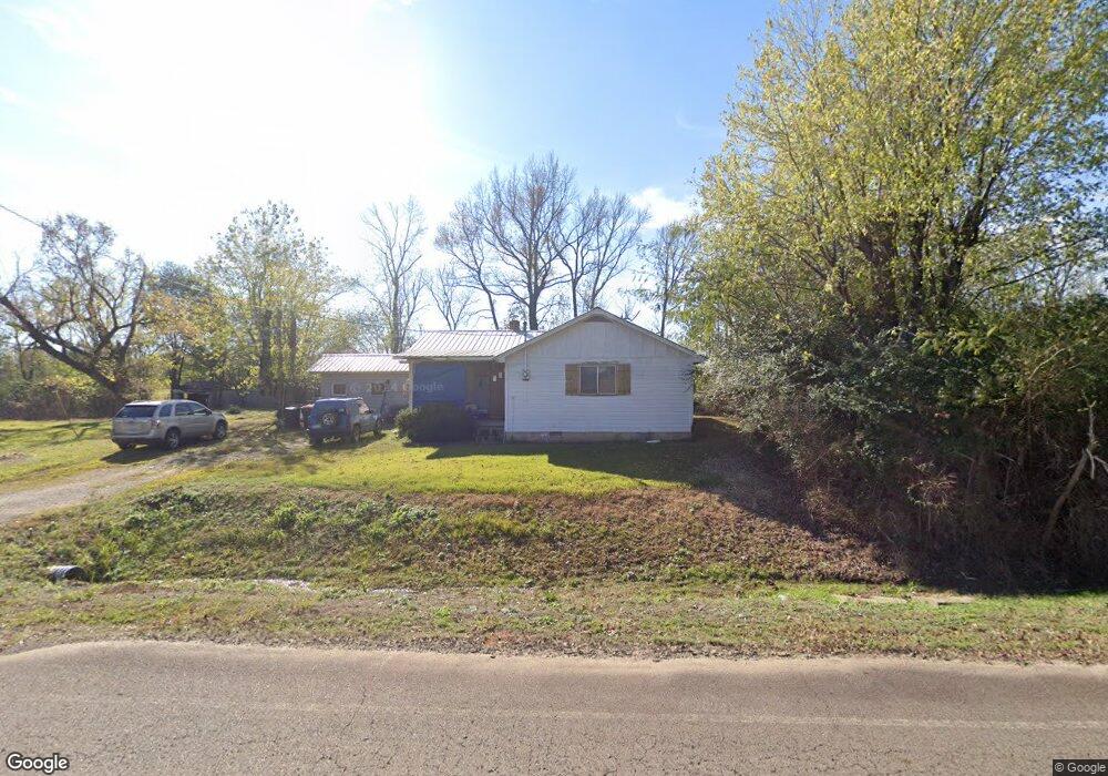
2045 Mulberry Wire Rd Mulberry, AR 72947
Estimated Value: $88,613 - $142,000
--
Bed
1
Bath
1,270
Sq Ft
$93/Sq Ft
Est. Value
About This Home
This home is located at 2045 Mulberry Wire Rd, Mulberry, AR 72947 and is currently estimated at $118,653, approximately $93 per square foot. 2045 Mulberry Wire Rd is a home located in Crawford County with nearby schools including Marvin Primary School, Pleasant View Junior High School, and Mulberry High School.
Ownership History
Date
Name
Owned For
Owner Type
Purchase Details
Closed on
Mar 23, 2007
Sold by
Mccollum Ronnie and Mccollum Angela
Bought by
Mccollum Ronnie D and Mccollum Angela S
Current Estimated Value
Home Financials for this Owner
Home Financials are based on the most recent Mortgage that was taken out on this home.
Original Mortgage
$30,600
Interest Rate
6.3%
Mortgage Type
Purchase Money Mortgage
Purchase Details
Closed on
Nov 3, 1999
Bought by
Bk Mulberry-Mccollum
Purchase Details
Closed on
Oct 14, 1999
Bought by
State-Bk Mulberry
Purchase Details
Closed on
Oct 7, 1999
Bought by
Morse-Bk Mulberry
Purchase Details
Closed on
Sep 12, 1995
Bought by
Barris-Morse
Purchase Details
Closed on
Nov 16, 1993
Bought by
Barrish-Barrish Trust
Create a Home Valuation Report for This Property
The Home Valuation Report is an in-depth analysis detailing your home's value as well as a comparison with similar homes in the area
Home Values in the Area
Average Home Value in this Area
Purchase History
| Date | Buyer | Sale Price | Title Company |
|---|---|---|---|
| Mccollum Ronnie D | -- | -- | |
| Bk Mulberry-Mccollum | $25,000 | -- | |
| State-Bk Mulberry | -- | -- | |
| Morse-Bk Mulberry | -- | -- | |
| Barris-Morse | $28,000 | -- | |
| Barrish-Barrish Trust | -- | -- |
Source: Public Records
Mortgage History
| Date | Status | Borrower | Loan Amount |
|---|---|---|---|
| Closed | Mccollum Ronnie D | $30,600 |
Source: Public Records
Tax History Compared to Growth
Tax History
| Year | Tax Paid | Tax Assessment Tax Assessment Total Assessment is a certain percentage of the fair market value that is determined by local assessors to be the total taxable value of land and additions on the property. | Land | Improvement |
|---|---|---|---|---|
| 2025 | $19 | $15,380 | $4,070 | $11,310 |
| 2024 | $19 | $15,380 | $4,070 | $11,310 |
| 2023 | $70 | $15,380 | $4,070 | $11,310 |
| 2022 | $96 | $9,030 | $2,690 | $6,340 |
| 2021 | $65 | $9,030 | $2,690 | $6,340 |
| 2020 | $65 | $9,030 | $2,690 | $6,340 |
| 2019 | $65 | $9,030 | $2,690 | $6,340 |
| 2018 | $71 | $9,030 | $2,690 | $6,340 |
| 2017 | $36 | $8,240 | $2,690 | $5,550 |
| 2016 | $36 | $8,240 | $2,690 | $5,550 |
| 2015 | $36 | $8,240 | $2,690 | $5,550 |
| 2014 | $26 | $8,240 | $2,690 | $5,550 |
Source: Public Records
Map
Nearby Homes
- 2034 Mulberry Wire Rd
- 1321 Old Graphic St
- 2150 Old Graphic St
- TBD (lot 29) Keystone Dr
- TBD (lot 30) Keystone Dr
- 3032 King Dr
- TBD Duncan Rd
- 3042 Mulberry Highway 64 W
- 3218 Mulberry Wire Rd
- 10110 Booth Rd
- TBD Exsorbet Dr
- TBD Industrial Park Dr
- 3819 Ridgemont Estate
- 8 W 10th St
- 5319 Chastain Rd
- 36 W 8th St
- 770 Church Ave
- 519 Church Ave
- 210 W 2nd St
- 101 Reynolds St
- 1916 Mulberry Wire Rd
- 0 Mulberry Wire Rd
- 1800 Old Graphic St
- 1519 Old Graphic St
- 2229 Mulberry Wire Rd
- 1736 Old Graphic St
- 1518 Old Graphic St
- 1423 Old Graphic St
- 1634 Mulberry Wire Rd
- 2343 Mulberry Wire Rd
- 1590 Mulberry Wire Rd
- 1343 Old Graphic St
- 1402 Old Graphic St
- 2416 Mulberry Wire Rd
- 2340 Mulberry Wire Rd
- 2000 Old Graphic St
- 2005 Old Graphic St
- 11307 Booth Rd
- 1232 Old Graphic St
- 1233 Old Graphic St