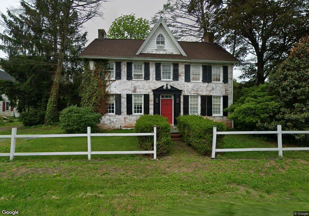
2045 Newark Rd Lincoln University, PA 19352
Estimated Value: $350,000 - $681,000
4
Beds
3
Baths
2,614
Sq Ft
$187/Sq Ft
Est. Value
About This Home
This home is located at 2045 Newark Rd, Lincoln University, PA 19352 and is currently estimated at $488,619, approximately $186 per square foot. 2045 Newark Rd is a home located in Chester County with nearby schools including Penn London Elementary School, Avon Grove Intermediate School, and Fred S Engle Middle School.
Ownership History
Date
Name
Owned For
Owner Type
Purchase Details
Closed on
Aug 21, 1998
Sold by
White James Franklin
Bought by
Foley Robert D and Foley Amy Greenwald
Current Estimated Value
Home Financials for this Owner
Home Financials are based on the most recent Mortgage that was taken out on this home.
Original Mortgage
$156,750
Outstanding Balance
$32,644
Interest Rate
6.9%
Estimated Equity
$455,975
Purchase Details
Closed on
Feb 23, 1995
Sold by
Chandler Byron M and Chandler Dianne V
Bought by
White James Franklin
Home Financials for this Owner
Home Financials are based on the most recent Mortgage that was taken out on this home.
Original Mortgage
$100,000
Interest Rate
8.96%
Create a Home Valuation Report for This Property
The Home Valuation Report is an in-depth analysis detailing your home's value as well as a comparison with similar homes in the area
Home Values in the Area
Average Home Value in this Area
Purchase History
| Date | Buyer | Sale Price | Title Company |
|---|---|---|---|
| Foley Robert D | $165,000 | -- | |
| White James Franklin | $174,900 | -- |
Source: Public Records
Mortgage History
| Date | Status | Borrower | Loan Amount |
|---|---|---|---|
| Open | Foley Robert D | $156,750 | |
| Previous Owner | White James Franklin | $100,000 |
Source: Public Records
Tax History Compared to Growth
Tax History
| Year | Tax Paid | Tax Assessment Tax Assessment Total Assessment is a certain percentage of the fair market value that is determined by local assessors to be the total taxable value of land and additions on the property. | Land | Improvement |
|---|---|---|---|---|
| 2025 | $7,075 | $174,680 | $38,070 | $136,610 |
| 2024 | $7,075 | $174,680 | $38,070 | $136,610 |
| 2023 | $6,839 | $174,680 | $38,070 | $136,610 |
| 2022 | $6,825 | $174,680 | $38,070 | $136,610 |
| 2021 | $6,683 | $174,680 | $38,070 | $136,610 |
| 2020 | $6,459 | $174,680 | $38,070 | $136,610 |
| 2019 | $6,299 | $174,680 | $38,070 | $136,610 |
| 2018 | $6,138 | $174,680 | $38,070 | $136,610 |
| 2017 | $6,011 | $174,680 | $38,070 | $136,610 |
| 2016 | $4,700 | $174,680 | $38,070 | $136,610 |
| 2015 | $4,700 | $174,680 | $38,070 | $136,610 |
| 2014 | $4,700 | $174,680 | $38,070 | $136,610 |
Source: Public Records
Map
Nearby Homes
- 1011 State Rd
- 12 Owenwood Dr
- 118 Westview Dr
- 140 Mill House Dr
- 1 Brae Ct
- 601 Saginaw Rd
- 2893 Newark Rd
- 430 Dartmouth Ln
- 2 Radence Ln
- 602 Kensington Dr
- 54 Mccormick Way
- Kipling Plan at Lexington Point
- Magnolia Plan at Lexington Point
- Ethan Plan at Lexington Point
- Parker Plan at Lexington Point
- Covington Plan at Lexington Point
- Harrison Plan at Lexington Point
- Nottingham Plan at Lexington Point
- Woodford Plan at Lexington Point
- Augusta Plan at Lexington Point
- 2039 Newark Rd
- 2049 Newark Rd
- 2053 Newark Rd
- 2035 Newark Rd
- 2037 Newark Rd
- 2041 Newark Rd
- 2061 Newark Rd
- 2057 Newark Rd
- 2050 Newark Rd
- 2050 Newark Rd Unit A
- 2050 Newark Rd Unit C
- 2050 Newark Rd Unit B
- 2046 Newark Rd
- 2044 Newark Rd
- 2042 Newark Rd
- 1007 State Rd
- 2057 Newark Rd
- 1008 State Rd
- 2047 State Rd
- 2038 Newark Rd