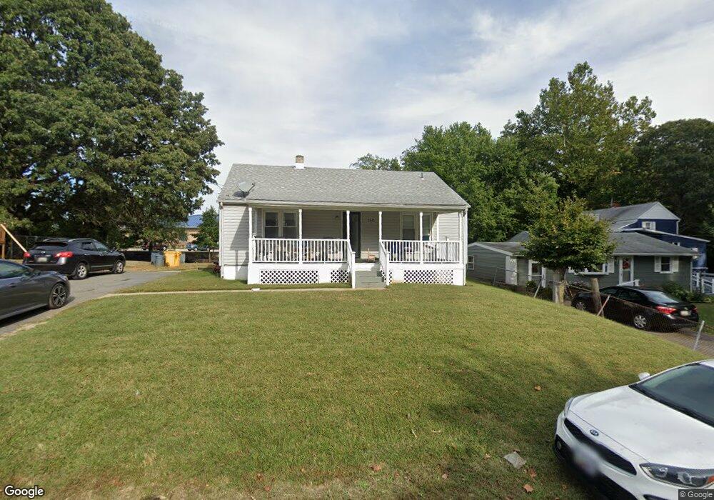
2045 Parker Dr Annapolis, MD 21401
Parole NeighborhoodEstimated Value: $360,000 - $489,000
Studio
1
Bath
1,044
Sq Ft
$402/Sq Ft
Est. Value
About This Home
This home is located at 2045 Parker Dr, Annapolis, MD 21401 and is currently estimated at $419,902, approximately $402 per square foot. 2045 Parker Dr is a home located in Anne Arundel County with nearby schools including Rolling Knolls Elementary School, Wiley H. Bates Middle School, and Annapolis High School.
Ownership History
Date
Name
Owned For
Owner Type
Purchase Details
Closed on
Apr 11, 2007
Sold by
Parker Mildred I
Bought by
Austin Melissa and Austin Clifford L
Current Estimated Value
Purchase Details
Closed on
Apr 9, 2007
Sold by
Parker Mildred I
Bought by
Austin Melissa and Austin Clifford L
Purchase Details
Closed on
Aug 16, 2000
Sold by
Parker Mildred Irene
Bought by
Parker Mildred I and Austin Melissa
Purchase Details
Closed on
May 26, 1999
Sold by
Parker Thomas
Bought by
Parker Mildred Irene
Create a Home Valuation Report for This Property
The Home Valuation Report is an in-depth analysis detailing your home's value as well as a comparison with similar homes in the area
Home Values in the Area
Average Home Value in this Area
Purchase History
| Date | Buyer | Sale Price | Title Company |
|---|---|---|---|
| Austin Melissa | -- | -- | |
| Austin Melissa | -- | -- | |
| Parker Mildred I | -- | -- | |
| Parker Mildred Irene | -- | -- |
Source: Public Records
Tax History
| Year | Tax Paid | Tax Assessment Tax Assessment Total Assessment is a certain percentage of the fair market value that is determined by local assessors to be the total taxable value of land and additions on the property. | Land | Improvement |
|---|---|---|---|---|
| 2025 | $3,587 | $412,200 | $330,100 | $82,100 |
| 2024 | $3,587 | $401,867 | $0 | $0 |
| 2023 | $3,499 | $391,533 | $0 | $0 |
| 2022 | $3,285 | $381,200 | $316,000 | $65,200 |
| 2020 | $2,817 | $316,400 | $0 | $0 |
| 2019 | $2,606 | $284,000 | $213,700 | $70,300 |
| 2018 | $2,849 | $280,967 | $0 | $0 |
| 2017 | $2,497 | $277,933 | $0 | $0 |
| 2016 | -- | $274,900 | $0 | $0 |
| 2015 | -- | $267,167 | $0 | $0 |
| 2014 | -- | $259,433 | $0 | $0 |
Source: Public Records
Map
Nearby Homes
- 1976 Scotts Crossing Way Unit 1
- 34 Harbour Heights Dr
- 12 Harbour Heights Dr
- 633 Admiral Dr Unit 308
- 629 Admiral Dr Unit U206
- 1930 Severn Grove Rd
- 2075 Old Admiral Ct
- 2013 Warners Terrace S Unit 138
- 2013 Warners Terrace S Unit 242
- 668 N Bestgate Rd
- 2058 Quaker Way Unit 12
- 1915 Towne Centre Blvd Unit 1001
- 1915 Towne Centre Blvd Unit 301
- 1915 Towne Centre Blvd Unit 606
- 1915 Towne Centre Blvd Unit 807
- 1915 Towne Centre Blvd Unit 309
- 1915 Towne Centre Blvd Unit 406
- 1915 Towne Centre Blvd Unit 707
- 1915 Towne Centre Blvd Unit 503
- 1915 Towne Centre Blvd Unit 402
- 2047 Parker Dr
- 2043 Parker Dr
- 2049 Parker Dr
- 2050 Parker Dr
- 2041 Parker Dr
- 2044 Parker Dr
- 2052 Parker Dr
- 2042 Parker Dr
- 825 Bestgate Rd
- 2040 Parker Dr
- 829 Bestgate Rd
- 827 Bestgate Rd
- 831 Bestgate Rd
- 833 Bestgate Rd
- 823 Bestgate Rd
- 835 Bestgate Rd
- 837 Bestgate Rd
- 2048 Gate Ct
- 2046 Gate Ct
- 2042 Gate Dr
Your Personal Tour Guide
Ask me questions while you tour the home.