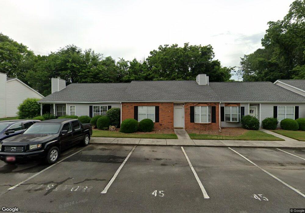
2045 Shields Rd Unit 21 Dalton, GA 30720
Estimated Value: $199,522 - $221,000
Studio
2
Baths
1,194
Sq Ft
$175/Sq Ft
Est. Value
About This Home
This home is located at 2045 Shields Rd Unit 21, Dalton, GA 30720 and is currently estimated at $208,381, approximately $174 per square foot. 2045 Shields Rd Unit 21 is a home located in Whitfield County with nearby schools including Brookwood Elementary School, Dalton High School, and Rock Hill School.
Ownership History
Date
Name
Owned For
Owner Type
Purchase Details
Closed on
Mar 12, 2021
Sold by
Bright J W Estate
Bought by
Townsend Tammy D
Current Estimated Value
Home Financials for this Owner
Home Financials are based on the most recent Mortgage that was taken out on this home.
Original Mortgage
$94,400
Outstanding Balance
$81,338
Interest Rate
2.73%
Mortgage Type
New Conventional
Estimated Equity
$127,043
Purchase Details
Closed on
Aug 2, 2010
Sold by
Woodward George William
Bought by
Bright J W
Purchase Details
Closed on
Feb 4, 2002
Sold by
Woodward George William and Woodward Violet
Bought by
Woodward George William
Purchase Details
Closed on
Aug 13, 2001
Sold by
Mary Haywood R and Mary Pat
Bought by
Woodward George William Jr Etal
Purchase Details
Closed on
Oct 1, 1999
Bought by
Mary Haywood R and Mary Pat
Create a Home Valuation Report for This Property
The Home Valuation Report is an in-depth analysis detailing your home's value as well as a comparison with similar homes in the area
Purchase History
| Date | Buyer | Sale Price | Title Company |
|---|---|---|---|
| Townsend Tammy D | $118,000 | -- | |
| Bright J W | $84,000 | -- | |
| Woodward George William | -- | -- | |
| Woodward George William Jr Etal | $85,000 | -- | |
| Mary Haywood R | $76,000 | -- |
Source: Public Records
Mortgage History
| Date | Status | Borrower | Loan Amount |
|---|---|---|---|
| Open | Townsend Tammy D | $94,400 |
Source: Public Records
Tax History
| Year | Tax Paid | Tax Assessment Tax Assessment Total Assessment is a certain percentage of the fair market value that is determined by local assessors to be the total taxable value of land and additions on the property. | Land | Improvement |
|---|---|---|---|---|
| 2025 | $2,048 | $76,243 | $0 | $76,243 |
| 2024 | $2,048 | $76,243 | $0 | $76,243 |
| 2023 | $1,583 | $51,354 | $0 | $51,354 |
| 2022 | $1,148 | $40,728 | $0 | $40,728 |
| 2021 | $1,405 | $40,728 | $0 | $40,728 |
| 2020 | $1,338 | $37,334 | $0 | $37,334 |
| 2019 | $1,379 | $37,334 | $0 | $37,334 |
| 2018 | $1,341 | $35,764 | $5,040 | $30,724 |
| 2017 | $1,291 | $35,764 | $5,040 | $30,724 |
| 2016 | $1,244 | $34,254 | $5,040 | $29,214 |
| 2014 | $1,131 | $34,254 | $5,040 | $29,214 |
| 2013 | -- | $34,254 | $5,040 | $29,214 |
Source: Public Records
Map
Nearby Homes
- 1482 Mineral Springs Rd
- 1506 Summer Gate Way
- 1506 Summer Gate Way Unit 8
- 1908 Fairfield Dr
- 1910 Fairfield Dr
- 1922 Fairfield Dr
- 1498 Mineral Springs Rd
- 1803 Waterford Place
- 111 Broadview Terrace
- 1704 Southmont Dr
- 2002 Kingsridge Dr
- 00 Rio Vista Dr
- 1123 Ridgeleigh Cir
- 1913 Tara Place
- 1117 Lakemont Dr
- 1300 Belmont Dr
- Lot 12 Bald Eagle Ln
- Lot 11 Bald Eagle Ln
- 2305 Ravine Way
- 0 Lakemont Dr Unit 10664970
- 2047 Shields Rd
- 2043 Shields Rd
- 2049 Shields Rd Unit 23
- 2041 Shields Rd Unit 19
- 2039 Shields Rd Unit 18
- 2030 Shields Rd Unit 24
- 2037 Shields Rd
- 2028 Shields Rd Unit 25
- 2035 Shields Rd
- 2026 Shields Rd Unit 26
- 2033 Shields Rd Unit 15
- 2031 Shields Rd Unit 14
- 2024 Shields Rd Unit 27
- 1403 Rosewood Cir Unit 20
- 1403 Rosewood Cir Unit 19
- 1403 Rosewood Cir Unit 18
- 1403 Rosewood Cir Unit 17
- 1403 Rosewood Cir Unit 16
- 1403 Rosewood Cir
- 2029 Shields Rd Unit 13
Your Personal Tour Guide
Ask me questions while you tour the home.