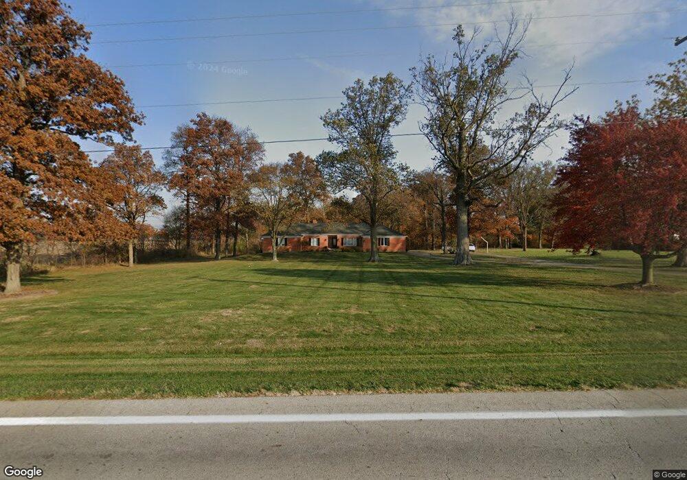
2045 State Route 705 W Fort Loramie, OH 45845
Estimated Value: $246,000 - $444,000
4
Beds
2
Baths
2,488
Sq Ft
$148/Sq Ft
Est. Value
About This Home
This home is located at 2045 State Route 705 W, Fort Loramie, OH 45845 and is currently estimated at $368,741, approximately $148 per square foot. 2045 State Route 705 W is a home located in Shelby County with nearby schools including Fort Loramie Elementary School and Fort Loramie Junior/Senior High School.
Ownership History
Date
Name
Owned For
Owner Type
Purchase Details
Closed on
May 9, 1997
Sold by
Middendorf Max
Bought by
Middendorf Mark A and Middendorf Michelle J
Current Estimated Value
Home Financials for this Owner
Home Financials are based on the most recent Mortgage that was taken out on this home.
Original Mortgage
$85,000
Outstanding Balance
$11,692
Interest Rate
8.05%
Mortgage Type
New Conventional
Estimated Equity
$357,049
Create a Home Valuation Report for This Property
The Home Valuation Report is an in-depth analysis detailing your home's value as well as a comparison with similar homes in the area
Home Values in the Area
Average Home Value in this Area
Purchase History
| Date | Buyer | Sale Price | Title Company |
|---|---|---|---|
| Middendorf Mark A | $125,000 | -- |
Source: Public Records
Mortgage History
| Date | Status | Borrower | Loan Amount |
|---|---|---|---|
| Open | Middendorf Mark A | $85,000 |
Source: Public Records
Tax History Compared to Growth
Tax History
| Year | Tax Paid | Tax Assessment Tax Assessment Total Assessment is a certain percentage of the fair market value that is determined by local assessors to be the total taxable value of land and additions on the property. | Land | Improvement |
|---|---|---|---|---|
| 2024 | $3,172 | $91,980 | $13,820 | $78,160 |
| 2023 | $3,172 | $91,980 | $13,820 | $78,160 |
| 2022 | $2,694 | $72,110 | $11,190 | $60,920 |
| 2021 | $2,722 | $72,110 | $11,190 | $60,920 |
| 2020 | $2,722 | $72,110 | $11,190 | $60,920 |
| 2019 | $2,299 | $61,390 | $9,170 | $52,220 |
| 2018 | $2,243 | $61,390 | $9,170 | $52,220 |
| 2017 | $2,254 | $61,390 | $9,170 | $52,220 |
| 2016 | $2,263 | $60,380 | $7,510 | $52,870 |
| 2015 | $2,207 | $59,400 | $7,510 | $51,890 |
| 2014 | $2,207 | $59,400 | $7,510 | $51,890 |
| 2013 | $2,308 | $57,500 | $7,510 | $49,990 |
Source: Public Records
Map
Nearby Homes
- 8381 Ohio 66
- 7 E 2nd St
- 47 N Frankfort St
- 11519 Eilerman Rd
- 12244 Short Dr Unit Condo Unit 10
- 193 N Paris St
- 17 Stonegate Dr
- 0 Stonegate Dr Unit 21 10544857
- 0 Stonegate Dr Unit 14 10544847
- 36 Shania Place Unit 23
- 27 Shania Place Unit 26
- 19 Shania Place Unit 33
- 28 Shania Place Unit 33
- 11 Shania Place Unit 28
- 561 S Walnut St Unit Lot3
- 5025 Walzer Rd
- 150 Brewer Dr
- 149 Brewer Dr
- 148 Brewer Dr
- 154 Liberty Dr
- 2045 Ohio 705
- 2091 State Route 705 W
- 1884 State Route 705 W
- 10755 Friemering Rd
- 10380 Friemering Rd
- 10320 Friemering Rd
- 2195 Fortman Rd
- 2041 Fortman Rd
- 10265 Friemering Rd
- 2081 Fortman Rd
- 2131 Fortman Rd
- 10276 Friemering Rd
- 2546 Ohio 705
- 2201 Fortman Rd
- 10674 Friemering Rd
- 1748 Fortman Rd
- 2225 Fortman Rd
- 1700 Fortman Rd
- 2265 Fortman Rd
- 1666 Fortman Rd