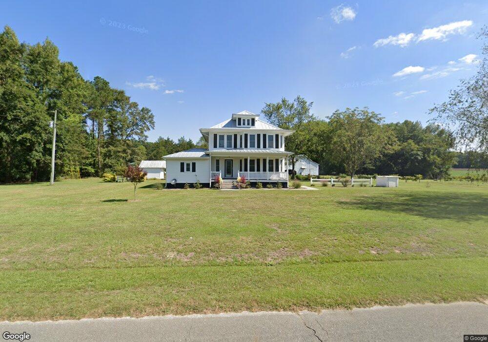
2045 Strouds Corner Rd Kinston, NC 28504
Estimated Value: $180,000 - $434,766
4
Beds
1
Bath
1,908
Sq Ft
$141/Sq Ft
Est. Value
About This Home
This home is located at 2045 Strouds Corner Rd, Kinston, NC 28504 and is currently estimated at $269,442, approximately $141 per square foot. 2045 Strouds Corner Rd is a home located in Lenoir County with nearby schools including Southwood Elementary School, Woodington Middle School, and South Lenoir High School.
Ownership History
Date
Name
Owned For
Owner Type
Purchase Details
Closed on
Dec 12, 2023
Sold by
Cox Mary Lynn Waller and Cox Raymond Dalton
Bought by
Coastal Carolina Land & Timber Llc
Current Estimated Value
Purchase Details
Closed on
Dec 11, 2023
Sold by
Cox Mary Lynn Waller and Cox Raymond Dalton
Bought by
Coastal Carolina Land & Timber Llc
Create a Home Valuation Report for This Property
The Home Valuation Report is an in-depth analysis detailing your home's value as well as a comparison with similar homes in the area
Home Values in the Area
Average Home Value in this Area
Purchase History
| Date | Buyer | Sale Price | Title Company |
|---|---|---|---|
| Coastal Carolina Land & Timber Llc | -- | None Listed On Document | |
| Coastal Carolina Land & Timber Llc | -- | None Listed On Document | |
| Coastal Carolina Land & Timber Llc | $147,000 | None Listed On Document | |
| Coastal Carolina Land & Timber Llc | $147,000 | None Listed On Document |
Source: Public Records
Tax History Compared to Growth
Tax History
| Year | Tax Paid | Tax Assessment Tax Assessment Total Assessment is a certain percentage of the fair market value that is determined by local assessors to be the total taxable value of land and additions on the property. | Land | Improvement |
|---|---|---|---|---|
| 2025 | $2,639 | $351,828 | $66,020 | $285,808 |
| 2024 | $1,827 | $193,284 | $55,165 | $138,119 |
| 2023 | $1,978 | $193,284 | $55,165 | $138,119 |
| 2022 | $1,978 | $193,284 | $55,165 | $138,119 |
| 2021 | $1,978 | $193,284 | $55,165 | $138,119 |
| 2020 | $1,978 | $193,284 | $55,165 | $138,119 |
| 2019 | $1,978 | $193,284 | $55,165 | $138,119 |
| 2018 | $1,823 | $179,525 | $55,165 | $124,360 |
| 2017 | $1,693 | $179,525 | $55,165 | $124,360 |
Source: Public Records
Map
Nearby Homes
- 323 Alexander Rouse Rd
- 162 Waller Farm Rd
- 804 Alexander Rouse Rd
- 5199 Hwy 258 S
- 1562 Patterson Rd
- 46 Hwy 258 S
- 00 Patterson Rd Lot Unit WP001
- 928 Joshua Creek Rd
- 0 U S 258 Unit 100507192
- 919 Albrittons Rd
- 1020 Albrittons Rd
- 431 Joe Nunn Rd
- 1006 White Oak Dr
- 0 Hwy 58 S Unit 23625918
- 0 Sargett Brown Rd
- 414 Wheat St
- 204 Tyree Rd
- Lot A Tyree
- Lot B Tyree
- 840 E Bright Leaf Rd
- 1917 Strouds Corner Rd
- 2167 Strouds Corner Rd
- 327 Alexander Rouse Rd
- 333 Alexander Rouse Rd
- 315 Alexander Rouse Rd
- 313 Alexander Rouse Rd
- 297 Alexander Rouse Rd
- 283 Alexander Rouse Rd
- 255 Alexander Rouse Rd
- 2236 Strouds Corner Rd
- 2253 Strouds Corner Rd
- 362 Alexander Rouse Rd
- 237 Alexander Rouse Rd
- 380 Alexander Rouse Rd
- 305 Woodington Rd
- 4505 Hwy 258 S
- 306 Woodington Rd
- 2299 Strouds Corner Rd
- 244 Woodington Rd
- 511 Alexander Rouse Rd