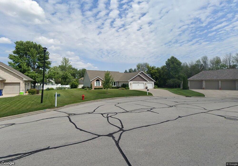
2045 Swanstone Cir de Pere, WI 54115
Estimated Value: $447,154 - $551,000
--
Bed
--
Bath
--
Sq Ft
0.51
Acres
About This Home
This home is located at 2045 Swanstone Cir, de Pere, WI 54115 and is currently estimated at $495,039. 2045 Swanstone Cir is a home located in Brown County with nearby schools including Heritage Elementary School, De Pere Middle School, and Foxview Intermediate School.
Ownership History
Date
Name
Owned For
Owner Type
Purchase Details
Closed on
Mar 27, 2015
Sold by
Morford Craig F and Morford Joni M
Bought by
Jesse David J and Jesse Cheryl A
Current Estimated Value
Home Financials for this Owner
Home Financials are based on the most recent Mortgage that was taken out on this home.
Original Mortgage
$50,000
Interest Rate
3.77%
Mortgage Type
New Conventional
Create a Home Valuation Report for This Property
The Home Valuation Report is an in-depth analysis detailing your home's value as well as a comparison with similar homes in the area
Home Values in the Area
Average Home Value in this Area
Purchase History
| Date | Buyer | Sale Price | Title Company |
|---|---|---|---|
| Jesse David J | $215,000 | Knight Barry Title |
Source: Public Records
Mortgage History
| Date | Status | Borrower | Loan Amount |
|---|---|---|---|
| Closed | Jesse David J | $50,000 |
Source: Public Records
Tax History Compared to Growth
Tax History
| Year | Tax Paid | Tax Assessment Tax Assessment Total Assessment is a certain percentage of the fair market value that is determined by local assessors to be the total taxable value of land and additions on the property. | Land | Improvement |
|---|---|---|---|---|
| 2024 | $5,031 | $342,400 | $61,900 | $280,500 |
| 2023 | $4,481 | $342,400 | $61,900 | $280,500 |
| 2022 | $4,095 | $342,400 | $61,900 | $280,500 |
| 2021 | $3,791 | $246,800 | $51,600 | $195,200 |
| 2020 | $3,757 | $246,800 | $51,600 | $195,200 |
| 2019 | $4,039 | $246,800 | $51,600 | $195,200 |
| 2018 | $4,135 | $246,800 | $51,600 | $195,200 |
| 2017 | $4,100 | $246,800 | $51,600 | $195,200 |
| 2016 | $4,086 | $208,400 | $43,700 | $164,700 |
| 2015 | $4,244 | $208,400 | $43,700 | $164,700 |
| 2014 | $4,163 | $208,400 | $43,700 | $164,700 |
| 2013 | $4,163 | $208,400 | $43,700 | $164,700 |
Source: Public Records
Map
Nearby Homes
- 1653 Remington Ridge Way Unit 1653
- 1655 Remington Ridge Way Unit 1655
- 1658 Remington Ridge Way Unit 1658
- 1871 Ledgeview Rd
- 1144 Jordan Rd
- 3910 Monroe Rd
- 1724 Remington Ridge Way Unit 1724
- 1853 Swan Rd
- 3980 N Parker Way
- 2206 Blue Stem Ln
- 2200 Dickinson Rd
- 2188 Trellis Dr
- 906 Silver St
- 1764 Other
- 0 S Broadway St
- 124 Shelley Ln
- 1960 Charles St
- 737 Desplaine Rd
- 1403 Quinnette Ln
- 1861 Chicago St
- 2051 Swanstone Cir
- 2039 Swanstone Cir
- 1994 Paint Horse Trail
- 1990 Paint Horse Trail
- 2033 Swanstone Cir
- 2057 Swanstone Cir
- 1982 Paint Horse Trail
- 2060 Swanstone Cir
- 1998 Paint Horse Trail
- 2027 Swanstone Cir
- 2063 Swanstone Cir
- 1974 Paint Horse Trail
- 2032 Swanstone Cir
- 2066 Swanstone Cir
- 1995 Paint Horse Trail
- 2026 Swanstone Cir
- 2021 Swanstone Cir
- 1991 Paint Horse Trail
- 1966 Paint Horse Trail
- 2069 Swanstone Cir