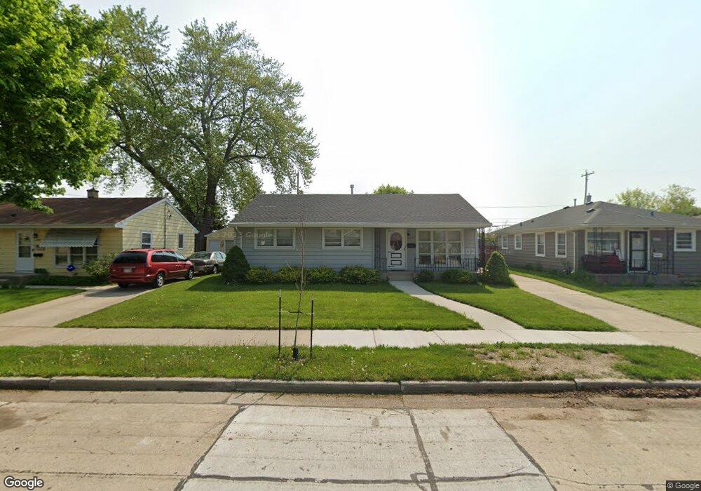
2045 Wustum Ave Racine, WI 53404
Wustum Park NeighborhoodEstimated Value: $200,000 - $260,000
--
Bed
--
Bath
1,117
Sq Ft
$198/Sq Ft
Est. Value
About This Home
This home is located at 2045 Wustum Ave, Racine, WI 53404 and is currently estimated at $221,226, approximately $198 per square foot. 2045 Wustum Ave is a home located in Racine County with nearby schools including Wadewitz Elementary School, Jerstad-Agerholm Middle School, and Horlick High School.
Ownership History
Date
Name
Owned For
Owner Type
Purchase Details
Closed on
Mar 11, 2019
Sold by
Peterson Merlyn K and Peterson Helen L
Bought by
Wamboldt Holdings Llc
Current Estimated Value
Home Financials for this Owner
Home Financials are based on the most recent Mortgage that was taken out on this home.
Original Mortgage
$82,500
Outstanding Balance
$72,532
Interest Rate
4.4%
Mortgage Type
Commercial
Estimated Equity
$148,694
Create a Home Valuation Report for This Property
The Home Valuation Report is an in-depth analysis detailing your home's value as well as a comparison with similar homes in the area
Home Values in the Area
Average Home Value in this Area
Purchase History
| Date | Buyer | Sale Price | Title Company |
|---|---|---|---|
| Wamboldt Holdings Llc | $110,000 | Landmark Title Of Racine |
Source: Public Records
Mortgage History
| Date | Status | Borrower | Loan Amount |
|---|---|---|---|
| Open | Wamboldt Holdings Llc | $82,500 |
Source: Public Records
Tax History Compared to Growth
Tax History
| Year | Tax Paid | Tax Assessment Tax Assessment Total Assessment is a certain percentage of the fair market value that is determined by local assessors to be the total taxable value of land and additions on the property. | Land | Improvement |
|---|---|---|---|---|
| 2024 | $4,260 | $185,200 | $20,400 | $164,800 |
| 2023 | $3,923 | $165,000 | $20,400 | $144,600 |
| 2022 | $3,613 | $150,000 | $20,400 | $129,600 |
| 2021 | $3,664 | $136,000 | $20,400 | $115,600 |
| 2020 | $3,659 | $136,000 | $20,400 | $115,600 |
| 2019 | $3,363 | $127,000 | $20,400 | $106,600 |
| 2018 | $3,207 | $107,000 | $20,400 | $86,600 |
| 2017 | $3,177 | $107,000 | $20,400 | $86,600 |
| 2016 | $2,999 | $99,000 | $20,400 | $78,600 |
| 2015 | $2,912 | $94,000 | $20,400 | $73,600 |
| 2014 | $2,912 | $94,000 | $20,400 | $73,600 |
| 2013 | $2,912 | $100,000 | $25,200 | $74,800 |
Source: Public Records
Map
Nearby Homes
- 2701 Rapids Dr
- 1818 Neptune Ave
- 2402 Eaton Ln
- 2300 Rapids Dr
- 2915 Romayne Ave
- 2210 Rapids Dr
- 2400 Romayne Ave
- 2009 Rapids Dr
- 2525 Donna Ave
- 1708 Shoop St
- 2525 Diane Ave
- 2100 Carlisle Ave
- 2812 Jean Ave
- 2123 Carlisle Ave
- 1626 Rapids Dr
- 2600 W High St
- 1322 Summit Ave
- 2742 Old Mill Dr
- 1406 Blake Ave
- 1429 Crabapple Dr
- 2039 Wustum Ave
- 2051 Wustum Ave
- 2035 Wustum Ave
- 2057 Wustum Ave
- 2031 Wustum Ave
- 2063 Wustum Ave
- 2027 Wustum Ave
- 2042 Wustum Ave
- 2046 Wustum Ave
- 2050 Wustum Ave
- 2036 Wustum Ave
- 2056 Wustum Ave
- 2030 Wustum Ave
- 2021 Wustum Ave
- 2062 Wustum Ave
- 2015 Wustum Ave
- 2020 Wustum Ave
- 2047 Georgia Ave
- 2051 Georgia Ave
- 2035 Georgia Ave