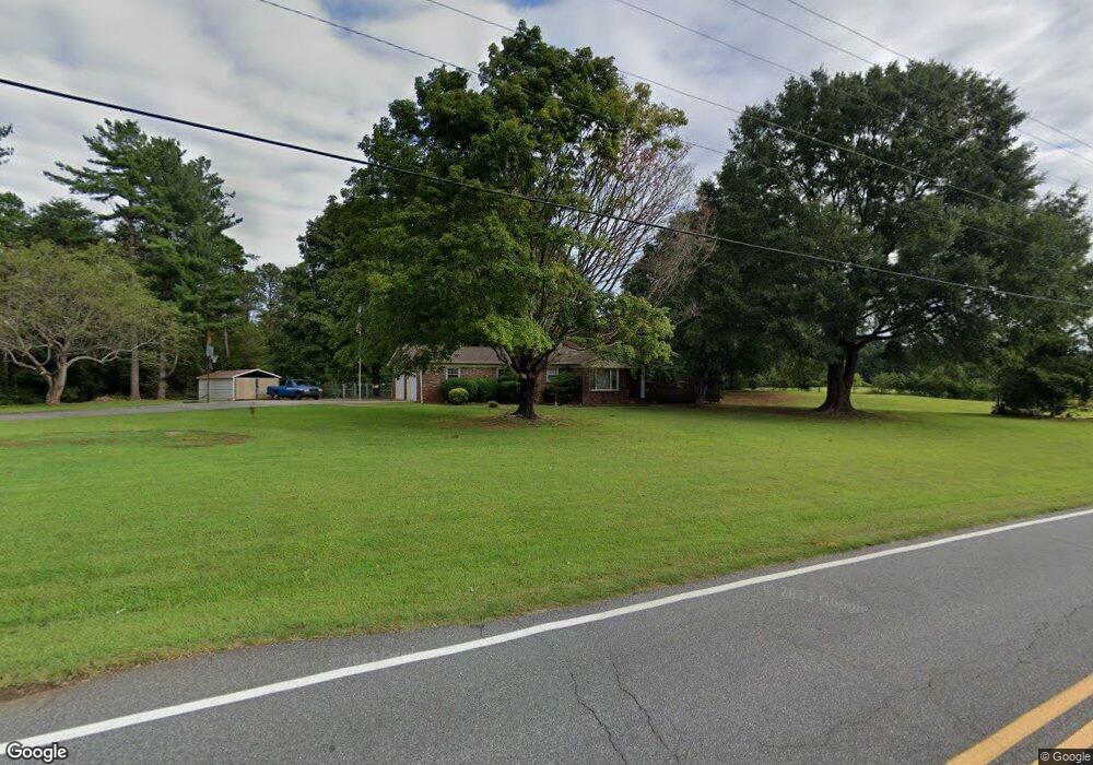
2046 Burris Rd Conover, NC 28613
Estimated Value: $302,000 - $322,450
3
Beds
2
Baths
2,206
Sq Ft
$143/Sq Ft
Est. Value
About This Home
This home is located at 2046 Burris Rd, Conover, NC 28613 and is currently estimated at $314,613, approximately $142 per square foot. 2046 Burris Rd is a home located in Catawba County with nearby schools including Claremont Elementary School, River Bend Middle School, and Bunker Hill High School.
Ownership History
Date
Name
Owned For
Owner Type
Purchase Details
Closed on
Jan 30, 2012
Sold by
Settlemyre Richard Allen and Settlemyre Sharon Lynn
Bought by
Linkous Brian K and Linkous Amy M
Current Estimated Value
Home Financials for this Owner
Home Financials are based on the most recent Mortgage that was taken out on this home.
Original Mortgage
$105,000
Outstanding Balance
$12,227
Interest Rate
3.23%
Mortgage Type
New Conventional
Estimated Equity
$302,386
Create a Home Valuation Report for This Property
The Home Valuation Report is an in-depth analysis detailing your home's value as well as a comparison with similar homes in the area
Home Values in the Area
Average Home Value in this Area
Purchase History
| Date | Buyer | Sale Price | Title Company |
|---|---|---|---|
| Linkous Brian K | $140,000 | None Available |
Source: Public Records
Mortgage History
| Date | Status | Borrower | Loan Amount |
|---|---|---|---|
| Open | Linkous Brian K | $105,000 |
Source: Public Records
Tax History Compared to Growth
Tax History
| Year | Tax Paid | Tax Assessment Tax Assessment Total Assessment is a certain percentage of the fair market value that is determined by local assessors to be the total taxable value of land and additions on the property. | Land | Improvement |
|---|---|---|---|---|
| 2025 | $1,380 | $276,200 | $22,500 | $253,700 |
| 2024 | $1,380 | $276,200 | $22,500 | $253,700 |
| 2023 | $1,380 | $276,200 | $22,500 | $253,700 |
| 2022 | $1,174 | $161,900 | $19,100 | $142,800 |
| 2021 | $1,141 | $161,900 | $19,100 | $142,800 |
| 2020 | $1,141 | $161,900 | $19,100 | $142,800 |
| 2019 | $1,125 | $161,900 | $0 | $0 |
| 2018 | $1,054 | $151,700 | $19,900 | $131,800 |
| 2017 | $1,009 | $0 | $0 | $0 |
| 2016 | $1,009 | $0 | $0 | $0 |
| 2015 | $602 | $151,700 | $19,900 | $131,800 |
| 2014 | $923 | $153,800 | $20,900 | $132,900 |
Source: Public Records
Map
Nearby Homes
- 1486 Farmington Hills Dr
- 1502 Farmington Hills Dr
- 2244 Burris Rd
- 0000 Burris Rd
- 712 Mount Olive Church Rd
- 710 Mount Olive Church Rd
- 1687 Golden Cedar Ln
- 805 Mount Olive Church Rd
- 1611 Emmaus Walk
- The Piedmont Plan at Rowe Crossing
- The Braselton II Plan at Rowe Crossing
- The Caldwell Plan at Rowe Crossing
- The Benson II Plan at Rowe Crossing
- The Coleman Plan at Rowe Crossing
- The Reynolds Plan at Rowe Crossing
- The Harrington Plan at Rowe Crossing
- 932 Eastern Ridge Dr
- 2075 N Whisnant Ave
- 7.03 acres 5 W Hwy 10 Hwy
- 1128 McRee Heights Cir
- 2055 Burris Rd
- 1735 Farmington Hills Dr Unit 50
- 2027 Burris Rd
- 2027 Burris Rd
- 1713 Farmington Hills Dr
- 1742 Farmington Hills Dr Unit 1
- 1388 Farmington Hills Dr
- 1396 Farmington Hills Dr
- 1404 Farmington Hills Dr
- 1716 Farmington Hills Dr Unit 3
- 2030 Burris Rd
- 1708 Farmington Hills Dr
- 1412 Farmington Hills Dr
- 1385 Farmington Hills Dr
- 1700 Farmington Hills Dr
- 1405 Farmington Hills Dr
- 1990 Burris Rd
- 1692 Farmington Hills Dr
- 1675 Farmington Hills Dr
- 1420 Farmington Hills Dr