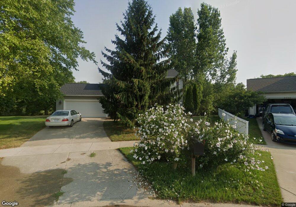
2046 Shiloh Point Dr SE Grand Rapids, MI 49546
East Paris NeighborhoodEstimated Value: $421,598 - $483,000
3
Beds
3
Baths
1,662
Sq Ft
$278/Sq Ft
Est. Value
About This Home
This home is located at 2046 Shiloh Point Dr SE, Grand Rapids, MI 49546 and is currently estimated at $462,150, approximately $278 per square foot. 2046 Shiloh Point Dr SE is a home located in Kent County with nearby schools including Meadow Brook Elementary School, Northern Trails 5/6 School, and Northern Hills Middle School.
Ownership History
Date
Name
Owned For
Owner Type
Purchase Details
Closed on
Feb 22, 2008
Sold by
Holwerda Rentals Llc
Bought by
Ubm Rentals Llc
Current Estimated Value
Purchase Details
Closed on
Dec 20, 2006
Sold by
Holwerda Builders Llc
Bought by
Holwerda Rentals Llc
Purchase Details
Closed on
Aug 11, 2003
Sold by
Holwerda Builders Llc
Bought by
Halstead James M and Kline Becky Lynn
Purchase Details
Closed on
Mar 8, 2001
Sold by
Shiloh Development Llc
Bought by
G & C Land Company Llc
Create a Home Valuation Report for This Property
The Home Valuation Report is an in-depth analysis detailing your home's value as well as a comparison with similar homes in the area
Home Values in the Area
Average Home Value in this Area
Purchase History
| Date | Buyer | Sale Price | Title Company |
|---|---|---|---|
| Ubm Rentals Llc | -- | None Available | |
| Holwerda Rentals Llc | -- | None Available | |
| Halstead James M | -- | Beltline Title Agency Inc | |
| Holwerda Builders Llc | -- | Beltline Title Agency Inc | |
| G & C Land Company Llc | $1,312,000 | Metropolitan Title Company |
Source: Public Records
Tax History Compared to Growth
Tax History
| Year | Tax Paid | Tax Assessment Tax Assessment Total Assessment is a certain percentage of the fair market value that is determined by local assessors to be the total taxable value of land and additions on the property. | Land | Improvement |
|---|---|---|---|---|
| 2025 | $3,772 | $187,200 | $0 | $0 |
| 2024 | $3,772 | $181,400 | $0 | $0 |
| 2023 | $4,122 | $142,700 | $0 | $0 |
| 2022 | $3,865 | $140,200 | $0 | $0 |
| 2021 | $3,765 | $144,100 | $0 | $0 |
| 2020 | $3,109 | $131,400 | $0 | $0 |
| 2019 | $3,728 | $119,100 | $0 | $0 |
| 2018 | $3,673 | $109,400 | $0 | $0 |
| 2017 | $3,642 | $104,400 | $0 | $0 |
| 2016 | $3,534 | $97,200 | $0 | $0 |
| 2015 | $3,492 | $97,200 | $0 | $0 |
| 2013 | -- | $87,200 | $0 | $0 |
Source: Public Records
Map
Nearby Homes
- 4496 Shiloh Way Dr SE
- 2045 Forest Hill Ave SE
- 4478 Burton Forest Ct SE
- 4223 Burton St SE
- 1950 Hidden Oak Ct SE
- 4365 Cloverleaf Dr SE Unit Lot 8
- 1618 Blue Grass Ct SE
- 4327 Woodside Oaks Dr SE
- 4323 Woodside Oaks Dr SE
- 1909 Deerfield Ct SE
- 2441 Kingbridge Terrace SE Unit 86
- 4694 E Meadows Dr SE
- 2376 Bob White Ct SE
- 4519 Thornberry Dr SE Unit 26
- 2462 Highridge Ln SE
- 2242 Christine Ct SE
- 1840 Keyhill Ave SE
- 6114 Stahl Dr Unit 16
- 1145 Eastmont Dr SE
- 1940 Observatory Ave SE
- 2056 Shiloh Point Dr SE
- 2056 Shiloh Point Dr SE
- 2044 Shiloh Point Dr SE
- 2070 Shiloh Point Dr SE
- 2055 Shiloh Point Dr SE
- 2055 Shiloh Point SE
- 2063 Shiloh Point Dr SE
- 2067 Shiloh Point Dr SE
- 2076 Shiloh Point Dr SE
- 4511 Shiloh Way Dr SE
- 2082 Shiloh Point Dr SE
- 4499 Shiloh Way Dr SE
- 2112 Shiloh Hills Dr SE
- 2108 Shiloh Hills Dr SE
- 4487 Shiloh Way Dr SE
- 2096 Shiloh Point Dr SE
- 2106 Shiloh Hills Dr SE
- 1990 Forest Hill Ave SE
- 4520 Shiloh Way Dr SE
- 2104 Shiloh Point Dr SE