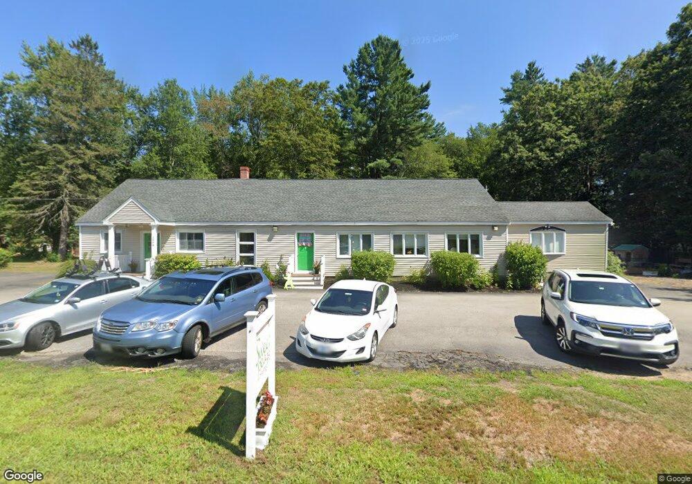
2046 State Rd Eliot, ME 03903
East Eliot NeighborhoodEstimated Value: $610,940
Studio
--
Bath
3,410
Sq Ft
$179/Sq Ft
Est. Value
About This Home
This home is located at 2046 State Rd, Eliot, ME 03903 and is currently estimated at $610,940, approximately $179 per square foot. 2046 State Rd is a home located in York County with nearby schools including Marshwood High School and Seacoast Waldorf School.
Ownership History
Date
Name
Owned For
Owner Type
Purchase Details
Closed on
Apr 21, 2021
Sold by
Houde Edward and Houde Norma O
Bought by
Hickory Hl Prop Mgmt Llc
Current Estimated Value
Home Financials for this Owner
Home Financials are based on the most recent Mortgage that was taken out on this home.
Original Mortgage
$336,000
Outstanding Balance
$299,661
Interest Rate
3.05%
Mortgage Type
Purchase Money Mortgage
Estimated Equity
$311,279
Create a Home Valuation Report for This Property
The Home Valuation Report is an in-depth analysis detailing your home's value as well as a comparison with similar homes in the area
Home Values in the Area
Average Home Value in this Area
Purchase History
| Date | Buyer | Sale Price | Title Company |
|---|---|---|---|
| Hickory Hl Prop Mgmt Llc | -- | None Available |
Source: Public Records
Mortgage History
| Date | Status | Borrower | Loan Amount |
|---|---|---|---|
| Open | Hickory Hl Prop Mgmt Llc | $336,000 |
Source: Public Records
Tax History
| Year | Tax Paid | Tax Assessment Tax Assessment Total Assessment is a certain percentage of the fair market value that is determined by local assessors to be the total taxable value of land and additions on the property. | Land | Improvement |
|---|---|---|---|---|
| 2025 | $4,557 | $405,100 | $157,000 | $248,100 |
| 2024 | $4,800 | $405,100 | $157,000 | $248,100 |
| 2023 | $4,876 | $398,000 | $149,900 | $248,100 |
| 2022 | $4,816 | $398,000 | $149,900 | $248,100 |
| 2021 | $4,784 | $354,400 | $106,300 | $248,100 |
| 2020 | $5,210 | $354,400 | $106,300 | $248,100 |
| 2019 | $5,210 | $354,400 | $106,300 | $248,100 |
| 2018 | $5,210 | $354,400 | $106,300 | $248,100 |
| 2017 | $5,068 | $354,400 | $106,300 | $248,100 |
| 2016 | $4,979 | $354,400 | $106,300 | $248,100 |
| 2015 | $4,962 | $354,400 | $106,300 | $248,100 |
| 2014 | $4,891 | $354,400 | $106,300 | $248,100 |
| 2013 | $4,667 | $354,400 | $106,300 | $248,100 |
Source: Public Records
Map
Nearby Homes
- 25 Heritage Dr
- 116 Heron Cove Rd
- 65 Wildbrook Ln
- 39 Isaac Lucas Cir
- 6 Isaac Lucas Cir
- 25 Fosters Dr
- 25 Schooner Dr
- 209 Dover Point Rd
- 11 Ayers Ln
- 220 Dover Point Rd
- 15 Ayers Ln
- 69 Polly Ann Trailer Park
- 16 Polly Ann Park
- 296 Dow Hwy
- 1 Independence Dr
- 14 Independence Dr
- 51 Constitution Way
- 390 Goodwin Rd
- 17 Constitution Way
- 55 Pointe Place Unit 108
- 440 State Rd
- 2054 State Rd
- 2039 State Rd
- 426 State Rd
- 2035 State Rd
- 59 Imperial Dr
- 51 Imperial Dr
- 47 Imperial Dr
- 55 Marshwood Estates Mhp
- 9 Worster Rd
- 61 Imperial Dr
- 99 Marshwood Estates Dr
- 43 Imperial Dr
- 2028 State Rd
- 72 Imperial Dr
- 72 Imperial Dr
- 83 Imperial Dr
- 95 Marshwood Estates Dr
- 27 Heritage Dr
- 56 Marshwood Dr
Your Personal Tour Guide
Ask me questions while you tour the home.