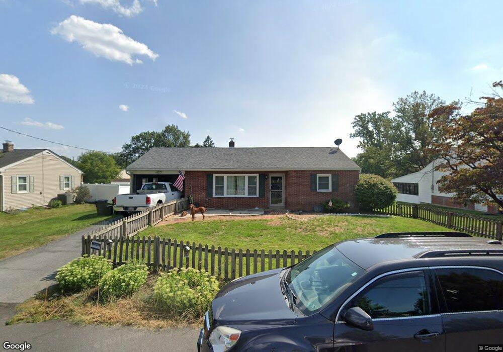
2046 Ursinus Ave Lancaster, PA 17603
Wheatland NeighborhoodEstimated Value: $269,709 - $304,000
2
Beds
1
Bath
1,014
Sq Ft
$287/Sq Ft
Est. Value
About This Home
This home is located at 2046 Ursinus Ave, Lancaster, PA 17603 and is currently estimated at $290,927, approximately $286 per square foot. 2046 Ursinus Ave is a home located in Lancaster County with nearby schools including Hambright Elementary School, Manor Middle School, and Penn Manor High School.
Ownership History
Date
Name
Owned For
Owner Type
Purchase Details
Closed on
Sep 9, 2005
Sold by
Groff Jeffrey P
Bought by
Sylvester Franklin S and Griest Kimberly A
Current Estimated Value
Home Financials for this Owner
Home Financials are based on the most recent Mortgage that was taken out on this home.
Original Mortgage
$109,500
Outstanding Balance
$58,362
Interest Rate
5.79%
Mortgage Type
Fannie Mae Freddie Mac
Estimated Equity
$232,565
Create a Home Valuation Report for This Property
The Home Valuation Report is an in-depth analysis detailing your home's value as well as a comparison with similar homes in the area
Home Values in the Area
Average Home Value in this Area
Purchase History
| Date | Buyer | Sale Price | Title Company |
|---|---|---|---|
| Sylvester Franklin S | $136,900 | First American Title Ins Co |
Source: Public Records
Mortgage History
| Date | Status | Borrower | Loan Amount |
|---|---|---|---|
| Open | Sylvester Franklin S | $109,500 |
Source: Public Records
Tax History
| Year | Tax Paid | Tax Assessment Tax Assessment Total Assessment is a certain percentage of the fair market value that is determined by local assessors to be the total taxable value of land and additions on the property. | Land | Improvement |
|---|---|---|---|---|
| 2025 | $2,782 | $127,400 | $45,200 | $82,200 |
| 2024 | $2,782 | $127,400 | $45,200 | $82,200 |
| 2023 | $2,782 | $127,400 | $45,200 | $82,200 |
| 2022 | $2,729 | $127,400 | $45,200 | $82,200 |
| 2021 | $2,660 | $127,400 | $45,200 | $82,200 |
| 2020 | $2,660 | $127,400 | $45,200 | $82,200 |
| 2019 | $2,586 | $127,400 | $45,200 | $82,200 |
| 2018 | $1,969 | $127,400 | $45,200 | $82,200 |
| 2017 | $2,133 | $87,900 | $33,700 | $54,200 |
| 2016 | $2,133 | $87,900 | $33,700 | $54,200 |
| 2015 | $439 | $87,900 | $33,700 | $54,200 |
| 2014 | $1,429 | $87,900 | $33,700 | $54,200 |
Source: Public Records
Map
Nearby Homes
- 266 Redwood Dr
- 323 Millersville Rd
- 408 Fairway Dr
- 619 621 Millersville Rd
- 105 Silverwind Ct S
- 203 Thrush Ct N
- 215 Fawn Meadow Crossing
- 121 Pheasant Ridge Cir
- 421 Rohrerstown Rd
- 114 Pheasant Ridge Cir
- 205 Greyfield Dr
- 104 Fox Run Ct
- 203 Oakfield Ct W
- 129 Townhouse Ln
- 2707 Kimberly Rd
- 2336 Wood St
- 62 Oak Ln
- 2318 Marietta Ave
- 1529 Springside Dr
- 2458 Spring Water Cir
- 2040 Ursinus Ave
- 2048 Ursinus Ave
- 2045 Temple Ave
- 2041 Temple Ave
- 2034 Ursinus Ave
- 2049 Temple Ave
- 2068 Ursinus Ave
- 2039 Temple Ave
- 2069 Temple Ave
- 2028 Ursinus Ave
- 2029 Temple Ave
- 2050 Columbia Ave
- 2050 Columbia Ave
- 2022 Ursinus Ave
- 2023 Temple Ave
- 2054 Temple Ave
- 2048 Temple Ave
- 2060 Temple Ave
- 2040 Temple Ave
- 2016 Ursinus Ave
Your Personal Tour Guide
Ask me questions while you tour the home.