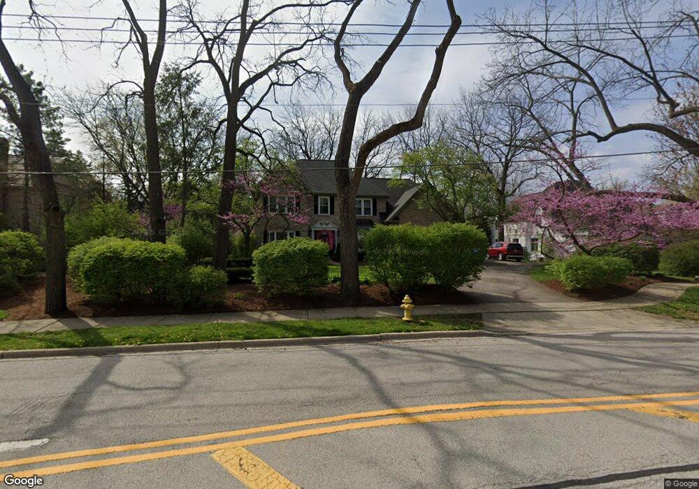
2046 W Wiesbrook Rd Wheaton, IL 60189
West Wheaton NeighborhoodEstimated Value: $963,592 - $1,033,000
4
Beds
4
Baths
3,261
Sq Ft
$308/Sq Ft
Est. Value
About This Home
This home is located at 2046 W Wiesbrook Rd, Wheaton, IL 60189 and is currently estimated at $1,004,398, approximately $308 per square foot. 2046 W Wiesbrook Rd is a home located in DuPage County with nearby schools including Wiesbrook Elementary School, Hubble Middle School, and Wheaton Warrenville South High School.
Ownership History
Date
Name
Owned For
Owner Type
Purchase Details
Closed on
Jun 6, 2025
Sold by
Timothy M Palmer M and Timothy Juliska M
Bought by
Juliska M Aponte Revocable Trust and Aponte
Current Estimated Value
Purchase Details
Closed on
Sep 30, 2012
Sold by
Aponte Juliska M and Palmer Timothy W
Bought by
Palmer Timothy M and Join Juliska
Purchase Details
Closed on
Jun 21, 2008
Sold by
Arena Vincent and Arena Susan
Bought by
Aponte Juliska M and Palmer Timothy M
Home Financials for this Owner
Home Financials are based on the most recent Mortgage that was taken out on this home.
Original Mortgage
$417,000
Interest Rate
6.15%
Mortgage Type
Purchase Money Mortgage
Purchase Details
Closed on
Jul 7, 2006
Sold by
Weinstein Saul and Weinstein Caron
Bought by
Arena Vincent and Arena Susan
Home Financials for this Owner
Home Financials are based on the most recent Mortgage that was taken out on this home.
Original Mortgage
$711,000
Interest Rate
9.62%
Mortgage Type
Balloon
Purchase Details
Closed on
Mar 4, 2005
Sold by
Weinstein Saul and Weinstein Caron
Bought by
Weistein Saul and Weistein Caron
Home Financials for this Owner
Home Financials are based on the most recent Mortgage that was taken out on this home.
Original Mortgage
$417,000
Interest Rate
5.37%
Mortgage Type
Stand Alone Refi Refinance Of Original Loan
Purchase Details
Closed on
Apr 11, 2000
Sold by
Weinstein Saul and Weinstein Caron
Bought by
Weinstein Saul and Weinstein Caron
Create a Home Valuation Report for This Property
The Home Valuation Report is an in-depth analysis detailing your home's value as well as a comparison with similar homes in the area
Home Values in the Area
Average Home Value in this Area
Purchase History
| Date | Buyer | Sale Price | Title Company |
|---|---|---|---|
| Juliska M Aponte Revocable Trust | -- | None Listed On Document | |
| Palmer Timothy M | -- | None Available | |
| Aponte Juliska M | $695,000 | Pntn | |
| Arena Vincent | $790,000 | Atg | |
| Weistein Saul | -- | Stewart Title Company | |
| Weinstein Saul | -- | -- |
Source: Public Records
Mortgage History
| Date | Status | Borrower | Loan Amount |
|---|---|---|---|
| Previous Owner | Aponte Juliska M | $417,000 | |
| Previous Owner | Arena Vincent | $711,000 | |
| Previous Owner | Weistein Saul | $417,000 |
Source: Public Records
Tax History Compared to Growth
Tax History
| Year | Tax Paid | Tax Assessment Tax Assessment Total Assessment is a certain percentage of the fair market value that is determined by local assessors to be the total taxable value of land and additions on the property. | Land | Improvement |
|---|---|---|---|---|
| 2024 | $17,110 | $273,468 | $41,522 | $231,946 |
| 2023 | $16,471 | $251,720 | $38,220 | $213,500 |
| 2022 | $16,059 | $237,890 | $36,120 | $201,770 |
| 2021 | $16,012 | $232,240 | $35,260 | $196,980 |
| 2020 | $15,965 | $230,080 | $34,930 | $195,150 |
| 2019 | $15,608 | $224,010 | $34,010 | $190,000 |
| 2018 | $15,615 | $221,590 | $32,050 | $189,540 |
| 2017 | $16,561 | $229,140 | $48,340 | $180,800 |
| 2016 | $16,623 | $223,480 | $63,730 | $159,750 |
| 2015 | $16,514 | $213,200 | $60,800 | $152,400 |
| 2014 | $16,389 | $208,130 | $60,380 | $147,750 |
| 2013 | $15,966 | $208,750 | $60,560 | $148,190 |
Source: Public Records
Map
Nearby Homes
- 1477 S County Farm Rd Unit 23F
- 1521 S County Farm Rd Unit 1-1
- 1420 Stonebridge Trail Unit 1-3
- 1601 W Wiesbrook Rd
- 1460 Stonebridge Cir Unit G9
- 2S386 Seneca Dr
- 1S728 Shaffner Rd
- 1S710 Shaffner Rd
- 1519 Foothill Dr
- 2S501 Seneca Dr
- 27W041 Walz Way
- 27W020 Walz Way
- 1961 Wexford Cir Unit 116
- Lot 1 Foothill Dr
- 1110 S Gables Blvd
- 1907 Gresham Cir Unit D
- 1785 Grosvenor Cir Unit A
- 1s050 Shaffner Rd
- 1028 Lodalia Ct
- 2059 W Roosevelt Rd
- 2064 W Wiesbrook Rd
- 1700 Stonebridge Ct
- 2049 Stonebridge Ct
- 2019 Stonebridge Ct
- 2 W Wiesbrook Rd
- 2070 W Wiesbrook Rd
- 2065 Stonebridge Ct
- 2071 Stonebridge Ct
- 1691 Stonebridge Ct
- 2100 W Wiesbrook Rd
- 1703 Stonebridge Ct
- 1709 Stonebridge Ct
- 2048 Stonebridge Ct
- 2101 Stonebridge Ct
- 2040 Stonebridge Ct
- 2052 Stonebridge Ct
- 1671 Stonebridge Trail
- 1673 Stonebridge Trail
- 2112 W Wiesbrook Rd
- 2010 Stonebridge Ct