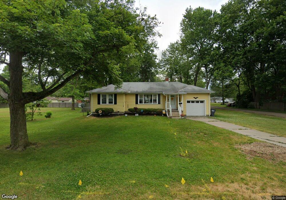
2047 Brancaster Rd Toledo, OH 43615
Reynolds Corners NeighborhoodEstimated Value: $94,000 - $158,000
2
Beds
1
Bath
914
Sq Ft
$143/Sq Ft
Est. Value
About This Home
This home is located at 2047 Brancaster Rd, Toledo, OH 43615 and is currently estimated at $130,667, approximately $142 per square foot. 2047 Brancaster Rd is a home located in Lucas County with nearby schools including Hawkins Elementary School, Rogers High School, and St. Benedict Catholic School.
Ownership History
Date
Name
Owned For
Owner Type
Purchase Details
Closed on
Apr 26, 2010
Sold by
Holmes John J and Holmes Lynn A
Bought by
J & L Holdings Brancaster Llc
Current Estimated Value
Purchase Details
Closed on
Sep 5, 2008
Sold by
Fink Debra L
Bought by
Holmes John J and Holmes Lynn A
Purchase Details
Closed on
Aug 24, 1990
Sold by
Gott W S and L S
Create a Home Valuation Report for This Property
The Home Valuation Report is an in-depth analysis detailing your home's value as well as a comparison with similar homes in the area
Home Values in the Area
Average Home Value in this Area
Purchase History
| Date | Buyer | Sale Price | Title Company |
|---|---|---|---|
| J & L Holdings Brancaster Llc | -- | Attorney | |
| Holmes John J | $44,000 | Area Title Agency Inc | |
| -- | -- | -- |
Source: Public Records
Tax History
| Year | Tax Paid | Tax Assessment Tax Assessment Total Assessment is a certain percentage of the fair market value that is determined by local assessors to be the total taxable value of land and additions on the property. | Land | Improvement |
|---|---|---|---|---|
| 2025 | -- | $34,615 | $8,155 | $26,460 |
| 2024 | $1,239 | $34,615 | $8,155 | $26,460 |
| 2023 | $1,974 | $25,060 | $7,280 | $17,780 |
| 2022 | $1,938 | $25,060 | $7,280 | $17,780 |
| 2021 | $2,011 | $25,060 | $7,280 | $17,780 |
| 2020 | $2,084 | $22,295 | $6,755 | $15,540 |
| 2019 | $1,991 | $22,295 | $6,755 | $15,540 |
| 2018 | $2,008 | $22,295 | $6,755 | $15,540 |
| 2017 | $1,945 | $21,805 | $6,615 | $15,190 |
| 2016 | $1,993 | $62,300 | $18,900 | $43,400 |
| 2015 | $2,045 | $62,300 | $18,900 | $43,400 |
| 2014 | $1,372 | $21,810 | $6,620 | $15,190 |
| 2013 | $1,372 | $21,810 | $6,620 | $15,190 |
Source: Public Records
Map
Nearby Homes
- 5815 W Bancroft St
- 1950 Devinci Dr Unit A203
- 5665 Camberley Dr
- 1911 N Holland Sylvania Rd
- 5925 Haefner Rd
- 2015 Oakside Rd
- 2010 Oakside Rd
- 405 N Holland Sylvania Rd
- 2004 Oakside Rd
- 5722 Candlestick Ct E
- 5809 Dorr St
- 1207 Vanderbilt Rd
- 1944 Silverpine Ct
- 1809 Birdie Dr
- 1137 Bedford Woods Dr
- 5887 Globe Ave
- 2208 Valley Brook Dr
- 5409 Westcastle Dr Unit 4
- 914 Sawyer Rd
- 2720 Westcastle Dr
- 2039 Brancaster Rd
- 2048 Sandown Rd
- 2105 Brancaster Rd
- 2036 Sandown Rd
- 2104 Sandown Rd
- 2044 Brancaster Rd
- 2027 Brancaster Rd
- 2032 Sandown Rd
- 2111 Brancaster Rd
- 2104 Brancaster Rd
- 2023 Brancaster Rd
- 2032 Brancaster Rd
- 2028 Sandown Rd
- 2112 Sandown Rd
- 2112 Brancaster Rd
- 2019 Brancaster Rd
- 2028 Brancaster Rd
- 2024 Sandown Rd
- 2119 Brancaster Rd
- 2043 Birkdale Rd
Your Personal Tour Guide
Ask me questions while you tour the home.