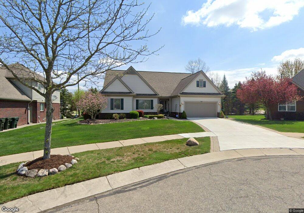
2047 Cattail Cir Unit 30 Rochester Hills, MI 48309
Estimated Value: $499,004 - $581,000
3
Beds
3
Baths
2,105
Sq Ft
$252/Sq Ft
Est. Value
About This Home
This home is located at 2047 Cattail Cir Unit 30, Rochester Hills, MI 48309 and is currently estimated at $530,501, approximately $252 per square foot. 2047 Cattail Cir Unit 30 is a home located in Oakland County with nearby schools including Deerfield Elementary School, Avondale Middle School, and Avondale High School.
Ownership History
Date
Name
Owned For
Owner Type
Purchase Details
Closed on
May 27, 2016
Sold by
May Kevin and May Trudy
Bought by
May Richard G and May Judith A
Current Estimated Value
Home Financials for this Owner
Home Financials are based on the most recent Mortgage that was taken out on this home.
Original Mortgage
$260,000
Outstanding Balance
$207,536
Interest Rate
3.66%
Mortgage Type
New Conventional
Estimated Equity
$322,965
Purchase Details
Closed on
Jun 30, 2003
Sold by
Meadow Creek Llc
Bought by
May Kevin and May Trudy
Create a Home Valuation Report for This Property
The Home Valuation Report is an in-depth analysis detailing your home's value as well as a comparison with similar homes in the area
Home Values in the Area
Average Home Value in this Area
Purchase History
| Date | Buyer | Sale Price | Title Company |
|---|---|---|---|
| May Richard G | $325,000 | Visionary Title Agency Llc | |
| May Kevin | $334,855 | Lawyers Title Ins Corp |
Source: Public Records
Mortgage History
| Date | Status | Borrower | Loan Amount |
|---|---|---|---|
| Open | May Richard G | $260,000 |
Source: Public Records
Tax History Compared to Growth
Tax History
| Year | Tax Paid | Tax Assessment Tax Assessment Total Assessment is a certain percentage of the fair market value that is determined by local assessors to be the total taxable value of land and additions on the property. | Land | Improvement |
|---|---|---|---|---|
| 2022 | $2,267 | $164,930 | $0 | $0 |
| 2018 | $3,449 | $139,670 | $0 | $0 |
| 2017 | $3,382 | $140,910 | $0 | $0 |
| 2015 | -- | $113,570 | $0 | $0 |
| 2014 | -- | $106,000 | $0 | $0 |
| 2011 | -- | $101,360 | $0 | $0 |
Source: Public Records
Map
Nearby Homes
- 2106 Cattail Cir Unit 41
- 2119 Cattail Cir Unit 24
- 2179 Lagoon Dr Unit 19
- 3315 Donley Ave
- 1838 Alsdorf Ave
- 2222 Sanctuary Ct Unit 2
- 3706 Winding Brook Cir Unit U42
- 3286 Devondale Rd
- 3226 Fantail Dr Unit 12
- 3931 Mildred Ave
- 3970 Cone Ave
- 6952 Granger Dr
- 3755 Walnut Brook Dr
- 6817 Woodcrest Dr
- 2530 South Blvd W
- 538 Scone Dr
- 4444 Angara Dr
- 1010 Angara Dr
- 2222 Angara Dr
- 1111 Angara Dr Unit 5
- 2035 Cattail Cir Unit 31
- 2059 Cattail Cir Unit 29
- 2071 Cattail Cir Unit 28
- 2023 Cattail Cir Unit 32
- 2083 Cattail Cir Unit 27
- 2045 Lagoon Dr Unit 33
- 3469 Crooks Rd
- 3599 Crooks Rd
- 3599 Crooks Rd
- 2092 Cattail Cir Unit 42
- 3567 Crooks Rd
- 3515 Crooks Rd
- 2095 Cattail Cir Unit 26
- 3644 Crooks Rd
- 3644 Crooks Rd
- 2061 Lagoon Dr Unit 34
- 2010 Lagoon Dr Unit 1
- 2107 Cattail Cir Unit 25
- 2024 Lagoon Dr
- 2077 Lagoon Dr Unit Bldg-Unit