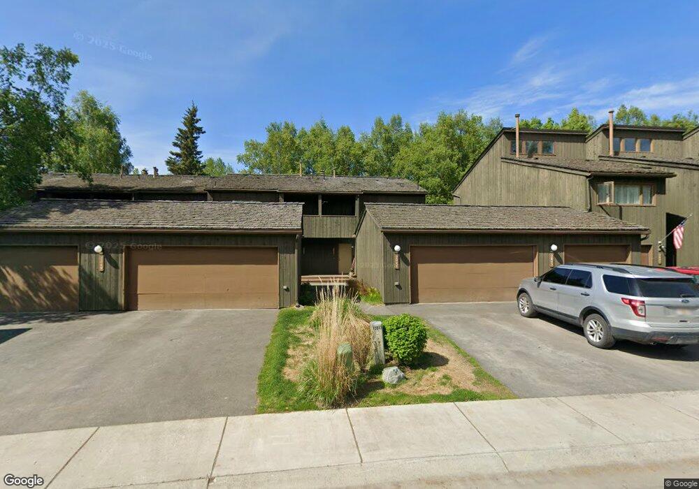
2047 Cliffside Dr Unit 10 Anchorage, AK 99501
Airport Heights NeighborhoodEstimated Value: $244,000 - $375,000
3
Beds
3
Baths
1,567
Sq Ft
$204/Sq Ft
Est. Value
About This Home
This home is located at 2047 Cliffside Dr Unit 10, Anchorage, AK 99501 and is currently estimated at $319,428, approximately $203 per square foot. 2047 Cliffside Dr Unit 10 is a home located in Anchorage Municipality with nearby schools including Airport Heights Elementary School, Wendler Middle School, and Bettye Davis East Anchorage High School.
Ownership History
Date
Name
Owned For
Owner Type
Purchase Details
Closed on
Jul 10, 2017
Sold by
Brozovsky Diane
Bought by
Alleva Jesse M
Current Estimated Value
Home Financials for this Owner
Home Financials are based on the most recent Mortgage that was taken out on this home.
Original Mortgage
$220,000
Outstanding Balance
$181,310
Interest Rate
3.95%
Mortgage Type
New Conventional
Estimated Equity
$138,119
Purchase Details
Closed on
Jul 12, 2012
Sold by
Archey Cindy G and Archey Patrick J
Bought by
Brozovsky Diane
Purchase Details
Closed on
Aug 23, 2010
Sold by
Archey Cindy G and Gay Cindy
Bought by
Cindy G Archey Living Trust
Purchase Details
Closed on
Sep 26, 1996
Sold by
Check Eileen
Bought by
Mancaruso Anthony and Mancaruso Janet A
Home Financials for this Owner
Home Financials are based on the most recent Mortgage that was taken out on this home.
Original Mortgage
$128,235
Interest Rate
7.87%
Mortgage Type
VA
Create a Home Valuation Report for This Property
The Home Valuation Report is an in-depth analysis detailing your home's value as well as a comparison with similar homes in the area
Home Values in the Area
Average Home Value in this Area
Purchase History
| Date | Buyer | Sale Price | Title Company |
|---|---|---|---|
| Alleva Jesse M | -- | None Available | |
| Brozovsky Diane | -- | Auta | |
| Cindy G Archey Living Trust | -- | None Available | |
| Mancaruso Anthony | -- | -- |
Source: Public Records
Mortgage History
| Date | Status | Borrower | Loan Amount |
|---|---|---|---|
| Open | Alleva Jesse M | $220,000 | |
| Previous Owner | Mancaruso Anthony | $128,235 |
Source: Public Records
Tax History
| Year | Tax Paid | Tax Assessment Tax Assessment Total Assessment is a certain percentage of the fair market value that is determined by local assessors to be the total taxable value of land and additions on the property. | Land | Improvement |
|---|---|---|---|---|
| 2025 | $5,216 | $311,100 | -- | $311,100 |
| 2024 | $5,216 | $323,100 | $0 | $323,100 |
| 2023 | $2,927 | $268,700 | $0 | $268,700 |
| 2022 | $3,313 | $245,900 | $0 | $245,900 |
| 2021 | $4,388 | $243,500 | $0 | $243,500 |
| 2020 | $3,308 | $243,600 | $0 | $243,600 |
| 2019 | $3,013 | $230,200 | $0 | $230,200 |
| 2018 | $3,249 | $198,100 | $0 | $198,100 |
| 2017 | $3,174 | $222,700 | $0 | $222,700 |
| 2016 | $3,567 | $232,100 | $0 | $232,100 |
| 2015 | $3,567 | $228,600 | $0 | $228,600 |
| 2014 | $3,567 | $219,100 | $0 | $219,100 |
Source: Public Records
Map
Nearby Homes
- 2089 Cliffside Dr Unit 29B-6
- 2007 Parkview Cir
- 1913 Parkview Cir
- 1620 Eastridge Dr Unit 203
- 1625 Sitka St Unit 103
- 2518 Crestwood St
- 1701 Aleutian St
- 2601 Darby Cir
- 1703 Alder Dr
- 1403 Nelchina St
- 000 Tr A Thurston
- 3215 E 18th Cir
- 3276 Vassar Dr
- 1327 Ingra St
- 890 Orca St
- 1524 Rosemary St
- 1310 Ingra St
- 943 E 12th Ave Unit 3
- 3514 E 19th Ave
- 3401 E 15th Ave
- 2047 Cliffside Dr Unit 10B3
- 2049 Cliffside Dr Unit 11
- 2049 Cliffside Dr Unit 11B-3
- 2045 Cliffside Dr Unit 9
- 2029 Cliffside Dr Unit 1
- 2065 Cliffside Dr Unit 19
- 2063 Cliffside Dr Unit 18
- 2061 Cliffside Dr Unit 17
- 2059 Cliffside Dr Unit 16
- 2057 Cliffside Dr Unit 15
- 2055 Cliffside Dr Unit 14
- 2051 Cliffside Dr Unit 12
- 2041 Cliffside Dr Unit 7
- 2037 Cliffside Dr Unit 5
- 2035 Cliffside Dr Unit 4
- 2033 Cliffside Dr Unit 3
- 2031 Cliffside Dr Unit 2
- 2033 Cliffside Dr Unit 1
- 2063 Cliffside Dr Unit B4
- 2041 Cliffside Dr Unit 7B2
Your Personal Tour Guide
Ask me questions while you tour the home.