
Seller's Agent in 2025
Carrie Faison
My Home Group
(602) 578-5611
27 in this area
30 Total Sales
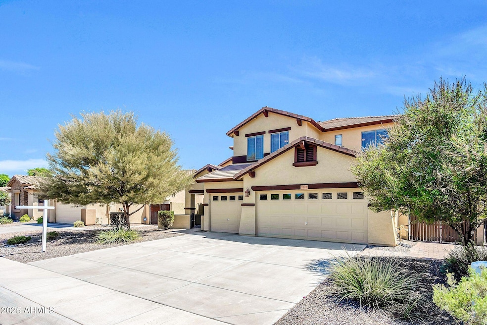
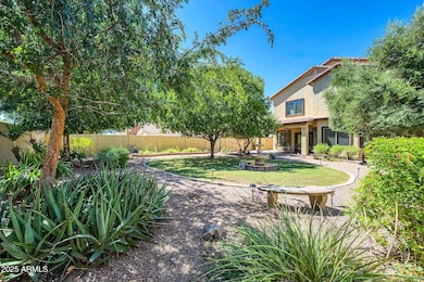
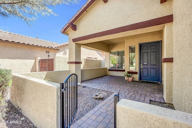
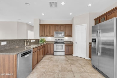
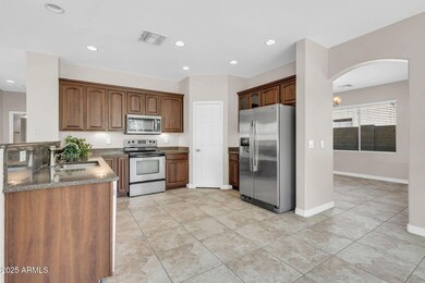
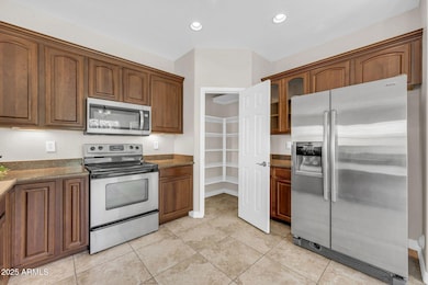
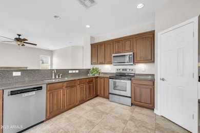
REDUCED!This serene neighborhood offers a tranquil, pleasant atmosphere with spacious parks/play areas not far from home! Nestled on a private quiet cul-de-sac. This property offers comfort, convenience. Step through the gated entrance into a courtyard welcoming you into this beautiful 5 bed/3 bath, plus a Loft! It features a formal living and dining room. Kitchen, blending each area of the home together. The kitchen, complete with an abundance of cabinets newer kitchen appliances, eat in kitchen for informal breakfasts. The Large Great Room off the kitchen offer's a cozy gas fire place! Huge Pool Size Backyard with NO Neighbor's behind, boasts covered patio, lush green grass, bushes & trees. HVAC, Garage Components, 50 amp surge protector for the entire. New Exterior & interior paint home. Large swimming pool size backyard! Top-rated schools, major employers, premier shopping, and dining, it's perfectly positioned to enjoy everything Chandler has to offer.
Last Agent to Sell the Property
My Home Group Real Estate License #SA526890000 Listed on: 08/22/2025
| Date | Type | Sale Price | Title Company |
|---|---|---|---|
| Warranty Deed | $625,000 | Lawyers Title Of Arizona | |
| Interfamily Deed Transfer | -- | None Available | |
| Special Warranty Deed | $380,479 | First American Title Ins Co |
| Date | Status | Loan Amount | Loan Type |
|---|---|---|---|
| Open | $562,500 | New Conventional | |
| Previous Owner | $304,350 | New Conventional |
| Date | Event | Price | List to Sale | Price per Sq Ft |
|---|---|---|---|---|
| 01/02/2026 01/02/26 | Off Market | $625,000 | -- | -- |
| 12/19/2025 12/19/25 | Sold | $625,000 | -0.6% | $241 / Sq Ft |
| 11/26/2025 11/26/25 | Price Changed | $629,000 | -6.8% | $243 / Sq Ft |
| 11/11/2025 11/11/25 | Price Changed | $675,000 | -2.0% | $261 / Sq Ft |
| 10/27/2025 10/27/25 | For Sale | $689,000 | 0.0% | $266 / Sq Ft |
| 10/10/2025 10/10/25 | Off Market | $689,000 | -- | -- |
| 09/27/2025 09/27/25 | Price Changed | $689,000 | -0.9% | $266 / Sq Ft |
| 08/22/2025 08/22/25 | For Sale | $695,000 | -- | $268 / Sq Ft |
| Year | Tax Paid | Tax Assessment Tax Assessment Total Assessment is a certain percentage of the fair market value that is determined by local assessors to be the total taxable value of land and additions on the property. | Land | Improvement |
|---|---|---|---|---|
| 2025 | $2,725 | $34,448 | -- | -- |
| 2024 | $2,634 | $32,808 | -- | -- |
| 2023 | $2,634 | $49,060 | $9,810 | $39,250 |
| 2022 | $2,543 | $37,320 | $7,460 | $29,860 |
| 2021 | $2,656 | $35,160 | $7,030 | $28,130 |
| 2020 | $2,643 | $32,620 | $6,520 | $26,100 |
| 2019 | $2,543 | $30,200 | $6,040 | $24,160 |
| 2018 | $2,461 | $28,250 | $5,650 | $22,600 |
| 2017 | $2,296 | $26,950 | $5,390 | $21,560 |
| 2016 | $2,200 | $26,600 | $5,320 | $21,280 |
| 2015 | $2,140 | $24,870 | $4,970 | $19,900 |
Seller's Agent in 2025
Carrie Faison
My Home Group
(602) 578-5611
27 in this area
30 Total Sales
Buyer's Agent in 2025
Jared Hernandez
Barrett Real Estate
(480) 862-6091
1 in this area
51 Total Sales
Source: Arizona Regional Multiple Listing Service (ARMLS)
MLS Number: 6909432
APN: 303-92-292
Disclaimer: Certain information contained herein is derived from information provided by parties other than Homes.com. All information provided is deemed reliable, but is not guaranteed to be accurate and should be independently verified.
![]() All information should be verified by the recipient and none is guaranteed as accurate by ARMLS
All information should be verified by the recipient and none is guaranteed as accurate by ARMLS
Listing Information presented by local MLS brokerage: Ten-X, local REALTOR®- Arlene Richardson - (888)-952-6393
Ask me questions while you tour the home.