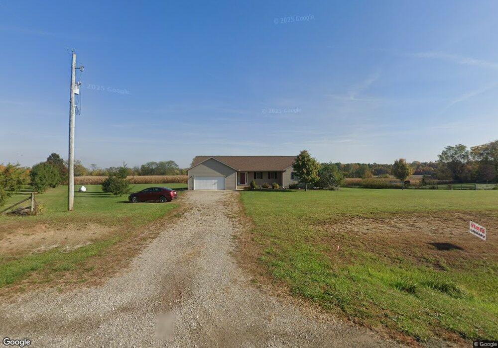
2047 State Route 529 Cardington, OH 43315
Estimated Value: $247,000 - $378,000
3
Beds
2
Baths
1,812
Sq Ft
$187/Sq Ft
Est. Value
About This Home
This home is located at 2047 State Route 529, Cardington, OH 43315 and is currently estimated at $338,730, approximately $186 per square foot. 2047 State Route 529 is a home located in Morrow County with nearby schools including Cardington-Lincoln Elementary School, Cardington Intermediate School, and Cardington-Lincoln High School.
Ownership History
Date
Name
Owned For
Owner Type
Purchase Details
Closed on
Nov 14, 2011
Sold by
Sheets Beatrice and Sheets Beatrice L
Bought by
Quinn John T and Quinn Betty B
Current Estimated Value
Home Financials for this Owner
Home Financials are based on the most recent Mortgage that was taken out on this home.
Original Mortgage
$50,000
Interest Rate
4.08%
Mortgage Type
New Conventional
Purchase Details
Closed on
Aug 15, 2011
Sold by
Sheets David L
Bought by
Sheets Beatrice
Purchase Details
Closed on
Dec 17, 2009
Bought by
Kellybrook Homes
Purchase Details
Closed on
Oct 27, 2009
Sold by
Gombert Robert D
Bought by
Secretary Of Veterans Affairs
Purchase Details
Closed on
Sep 1, 2004
Sold by
Higgins James A and Higgins Judy L
Bought by
Gombert Robert D
Purchase Details
Closed on
Apr 8, 2004
Bought by
Created **Parcel
Create a Home Valuation Report for This Property
The Home Valuation Report is an in-depth analysis detailing your home's value as well as a comparison with similar homes in the area
Home Values in the Area
Average Home Value in this Area
Purchase History
| Date | Buyer | Sale Price | Title Company |
|---|---|---|---|
| Quinn John T | $154,000 | -- | |
| Sheets Beatrice | -- | -- | |
| Kellybrook Homes | $104,300 | -- | |
| Secretary Of Veterans Affairs | -- | -- | |
| Gombert Robert D | $168,000 | -- | |
| Created **Parcel | $22,000 | -- |
Source: Public Records
Mortgage History
| Date | Status | Borrower | Loan Amount |
|---|---|---|---|
| Closed | Quinn John T | $50,000 |
Source: Public Records
Tax History Compared to Growth
Tax History
| Year | Tax Paid | Tax Assessment Tax Assessment Total Assessment is a certain percentage of the fair market value that is determined by local assessors to be the total taxable value of land and additions on the property. | Land | Improvement |
|---|---|---|---|---|
| 2024 | $3,214 | $93,980 | $13,370 | $80,610 |
| 2023 | $3,214 | $93,980 | $13,370 | $80,610 |
| 2022 | $2,506 | $68,920 | $9,030 | $59,890 |
| 2021 | $2,480 | $68,920 | $9,030 | $59,890 |
| 2020 | $2,451 | $68,920 | $9,030 | $59,890 |
| 2019 | $2,046 | $58,420 | $7,670 | $50,750 |
| 2018 | $2,044 | $58,420 | $7,670 | $50,750 |
| 2017 | $2,015 | $58,420 | $7,670 | $50,750 |
| 2016 | $1,923 | $56,740 | $8,020 | $48,720 |
| 2015 | $1,797 | $56,740 | $8,020 | $48,720 |
| 2014 | $1,827 | $56,740 | $8,020 | $48,720 |
| 2013 | $1,872 | $56,740 | $8,020 | $48,720 |
Source: Public Records
Map
Nearby Homes
- 001 Reichelderfer St
- 0002 Reichelderfer St
- 0001 Reichelderfer St
- 1675 State Route 529
- 2132 County Road 11
- 4080 Township Road 138
- 423 Douglas St
- 332 W Main St
- 329 N Marion St
- 343 E Williams St
- 134 E Main St
- 327 S Marion St
- 113 E Walnut St
- 128 Gilead St
- 221 Nichols St
- Lot 0 Chesterville Ave
- 2837 State Route 529
- 4511 U S 42
- 2843 S Caledonia-Ashley Rd
- 2843 S Caledonia-Ashley Rd Unit 8.4
- 2057 State Route 529
- 4161 County Road 28
- 4143 Township Road 28
- 2061 State Route 529
- 4141 Township Road 28
- 4121 Township Road 28
- CO28 Twp 28 Rd
- 4196 County Road 28
- 529 Rt 529 St
- 2126 State Route 529
- 2126 State Route 529
- 1890 State Route 529
- 1895 State Route 529
- 4031 Township Road 28
- 4838 Us Highway 42
- 4828 Us Highway 42
- 1889 State Route 529
- 4226 County Road 28
- 3990 Township Road 28
- 3985 Township Road 28