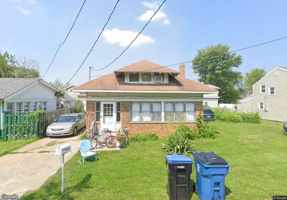
2047 Verdun St Oregon, OH 43616
Estimated Value: $111,000 - $153,000
3
Beds
1
Bath
1,151
Sq Ft
$120/Sq Ft
Est. Value
About This Home
This home is located at 2047 Verdun St, Oregon, OH 43616 and is currently estimated at $138,051, approximately $119 per square foot. 2047 Verdun St is a home located in Lucas County.
Ownership History
Date
Name
Owned For
Owner Type
Purchase Details
Closed on
Aug 13, 2007
Sold by
Us Bank Na
Bought by
Veler Karl
Current Estimated Value
Purchase Details
Closed on
Nov 20, 2006
Sold by
Ryan Michael A
Bought by
Us Bank Na and Csfb Abs Trust Series 2001-He25
Purchase Details
Closed on
Jun 29, 2001
Sold by
Ryan Michael and Ryan Suzan
Bought by
Ryan Michael A and Fletcher Susan M
Home Financials for this Owner
Home Financials are based on the most recent Mortgage that was taken out on this home.
Original Mortgage
$52,000
Interest Rate
11.99%
Create a Home Valuation Report for This Property
The Home Valuation Report is an in-depth analysis detailing your home's value as well as a comparison with similar homes in the area
Home Values in the Area
Average Home Value in this Area
Purchase History
| Date | Buyer | Sale Price | Title Company |
|---|---|---|---|
| Veler Karl | $20,000 | Us Land Title Llc | |
| Us Bank Na | $50,000 | First Capital Title Svcs Inc | |
| Ryan Michael A | $65,000 | Mta |
Source: Public Records
Mortgage History
| Date | Status | Borrower | Loan Amount |
|---|---|---|---|
| Previous Owner | Ryan Michael A | $52,000 |
Source: Public Records
Tax History Compared to Growth
Tax History
| Year | Tax Paid | Tax Assessment Tax Assessment Total Assessment is a certain percentage of the fair market value that is determined by local assessors to be the total taxable value of land and additions on the property. | Land | Improvement |
|---|---|---|---|---|
| 2024 | $812 | $33,530 | $4,900 | $28,630 |
| 2023 | $1,648 | $28,945 | $4,165 | $24,780 |
| 2022 | $1,660 | $28,945 | $4,165 | $24,780 |
| 2021 | $1,673 | $28,945 | $4,165 | $24,780 |
| 2020 | $1,669 | $25,655 | $3,815 | $21,840 |
| 2019 | $1,622 | $25,655 | $3,815 | $21,840 |
| 2018 | $1,510 | $25,655 | $3,815 | $21,840 |
| 2017 | $1,434 | $21,245 | $3,430 | $17,815 |
| 2016 | $1,452 | $60,700 | $9,800 | $50,900 |
| 2015 | $1,406 | $60,700 | $9,800 | $50,900 |
| 2014 | $1,304 | $20,830 | $3,360 | $17,470 |
| 2013 | $1,304 | $20,830 | $3,360 | $17,470 |
Source: Public Records
Map
Nearby Homes
- 2057 Blanche Dr
- 5911 Plympton Cir
- 1830 Lilias Dr
- 5243 Eagles Landing Dr
- 1633 Grand Bay Dr
- 5305 Cedar Point Rd
- 8800 Cedar Point Rd
- 2079 Arkansas St
- 6530 Corduroy Rd
- 140 N Wynn Rd
- 4263 Corduroy Rd
- 234 Avilyn Ln
- 5054 Magnolia Dr
- 5065 Magnolia Dr
- 5047 Noah Ln
- 5037 Easton Dr
- 5033 Easton Dr
- 5029 Easton Dr
- 5025 Easton Dr
- 5021 Easton Dr
- 2051 Verdun St
- 2043 Verdun St
- 2035 Verdun St
- 2046 Lakeview Ave
- 2042 Lakeview Ave
- 2055 Verdun St
- 2052 Lakeview Ave
- 2038 Lakeview Ave
- 2046 Verdun St
- 2050 Verdun St
- 2034 Lakeview Ave
- 2042 Verdun
- 2063 Verdun St
- 2058 Verdun St
- 2062 Lakeview Ave
- 2027 Verdun St
- 2051 Lakeview Ave
- 2043 Lakeview Ave
- 2026 Lakeview Ave
- 2066 Lakeview Ave