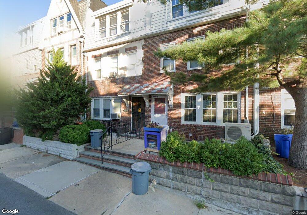
2048 32nd St Astoria, NY 11105
Ditmars Steinway NeighborhoodEstimated Value: $1,301,324 - $1,414,000
--
Bed
--
Bath
1,728
Sq Ft
$789/Sq Ft
Est. Value
About This Home
This home is located at 2048 32nd St, Astoria, NY 11105 and is currently estimated at $1,363,831, approximately $789 per square foot. 2048 32nd St is a home located in Queens County with nearby schools including P.S. 85 Judge Charles Vallone, Is 141 The Steinway, and Long Island City High School.
Ownership History
Date
Name
Owned For
Owner Type
Purchase Details
Closed on
Jun 2, 2022
Sold by
Estate Of Francis Mccartin
Bought by
Nainani Avinash and Naryani Tushti
Current Estimated Value
Home Financials for this Owner
Home Financials are based on the most recent Mortgage that was taken out on this home.
Original Mortgage
$988,000
Outstanding Balance
$939,922
Interest Rate
5.25%
Mortgage Type
Purchase Money Mortgage
Estimated Equity
$423,909
Create a Home Valuation Report for This Property
The Home Valuation Report is an in-depth analysis detailing your home's value as well as a comparison with similar homes in the area
Home Values in the Area
Average Home Value in this Area
Purchase History
| Date | Buyer | Sale Price | Title Company |
|---|---|---|---|
| Nainani Avinash | $1,235,000 | -- |
Source: Public Records
Mortgage History
| Date | Status | Borrower | Loan Amount |
|---|---|---|---|
| Open | Nainani Avinash | $988,000 |
Source: Public Records
Tax History Compared to Growth
Tax History
| Year | Tax Paid | Tax Assessment Tax Assessment Total Assessment is a certain percentage of the fair market value that is determined by local assessors to be the total taxable value of land and additions on the property. | Land | Improvement |
|---|---|---|---|---|
| 2025 | $9,315 | $49,162 | $9,029 | $40,133 |
| 2024 | $9,315 | $46,380 | $8,082 | $38,298 |
| 2023 | $9,196 | $45,785 | $7,615 | $38,170 |
| 2022 | $7,850 | $84,420 | $14,700 | $69,720 |
| 2021 | $8,237 | $82,320 | $14,700 | $67,620 |
| 2020 | $7,766 | $79,560 | $14,700 | $64,860 |
| 2019 | $7,190 | $76,320 | $14,700 | $61,620 |
| 2018 | $6,893 | $38,154 | $8,065 | $30,089 |
| 2017 | $7,125 | $38,154 | $9,647 | $28,507 |
| 2016 | $6,574 | $38,154 | $9,647 | $28,507 |
| 2015 | $3,916 | $34,140 | $11,148 | $22,992 |
| 2014 | $3,916 | $32,209 | $11,512 | $20,697 |
Source: Public Records
Map
Nearby Homes
- 20-68 33rd St
- 21-05 33 St Unit 5F
- 21-06 35th St Unit 3E
- 21-06 35th St Unit 5D
- 21-06 35th St Unit 4-E
- 21-15 33rd St Unit 4E
- 21-15 33 St Unit 4G
- 35-19 21st Ave
- 21-16 35th St Unit 5-B
- 21-16 35th St Unit 4E
- 21-16 35 Unit 1B
- 21-05 33rd St Unit 1G
- 21-05 33rd St Unit 4E
- 21-05 33rd St Unit 5-D
- 21-27 33rd St Unit 5B
- 21-21 31st St Unit 4 E
- 21-28 35th St Unit 2-A
- 21-37 33rd St Unit 5-B
- 2137 33rd St Unit 3D
- 21-38 35th St Unit 1-B
- 2050 32nd St
- 20-52 32nd St
- 20-52 32nd St Unit 2-FLR
- 20-52 32nd St Unit Sub fl
- 20-52 32 Nd St Unit 2-FLR
- 2052 32nd St Unit 1
- 2052 32nd St
- 20-48 32nd St
- 2054 32 Nd St Unit 2
- 2054 32nd St
- 2046 32nd St
- 2056 32nd St
- 2044 32nd St
- 2042 32nd St
- 2058 32nd St
- 2049 31st St
- 2051 31st St
- 2047 31st St
- 2053 31st St
- 2045 31st St