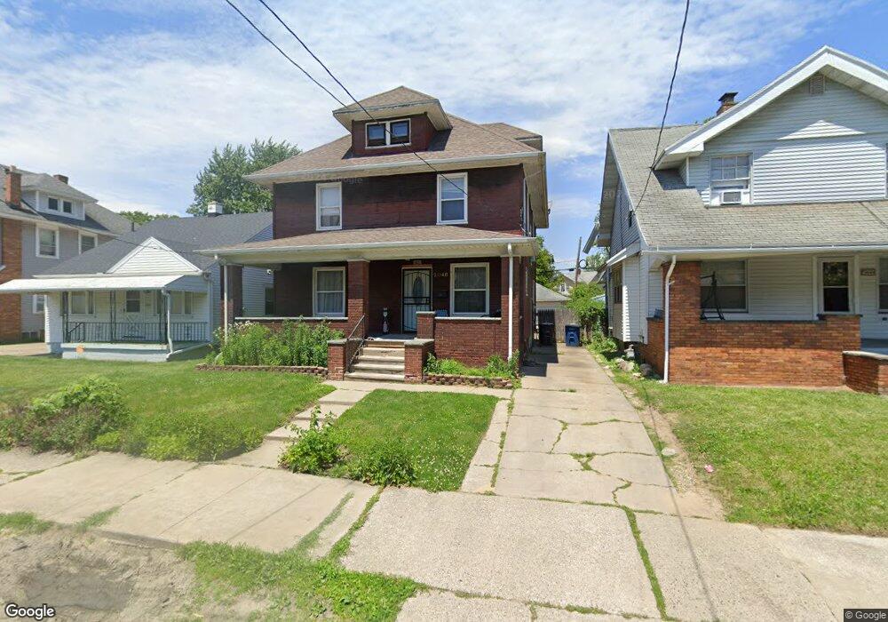
2048 Airport Hwy Toledo, OH 43609
Southside NeighborhoodEstimated Value: $89,000 - $106,000
4
Beds
2
Baths
1,912
Sq Ft
$52/Sq Ft
Est. Value
About This Home
This home is located at 2048 Airport Hwy, Toledo, OH 43609 and is currently estimated at $98,590, approximately $51 per square foot. 2048 Airport Hwy is a home located in Lucas County with nearby schools including Burroughs Elementary School, Bowsher High School, and Explorers Academy of Science and Technology.
Ownership History
Date
Name
Owned For
Owner Type
Purchase Details
Closed on
Nov 17, 2009
Sold by
Lorenc Kim and Lorenc Kimmy
Bought by
Creque K and Greater Metropolitan Real Estate Holding
Current Estimated Value
Purchase Details
Closed on
Feb 16, 2009
Sold by
Us Bank National Association
Bought by
Lorenc Kimmy L
Purchase Details
Closed on
Aug 18, 2008
Sold by
Gribben Martha J
Bought by
Us Bank Na and Mastr Asset Backed Securities Trust 2006
Purchase Details
Closed on
Oct 10, 2005
Sold by
The Westhaven Group Llc
Bought by
Gribben Martha J
Home Financials for this Owner
Home Financials are based on the most recent Mortgage that was taken out on this home.
Original Mortgage
$80,000
Interest Rate
8.15%
Mortgage Type
Fannie Mae Freddie Mac
Purchase Details
Closed on
May 7, 2003
Sold by
Ulmer John F
Bought by
Gribben Martha J
Home Financials for this Owner
Home Financials are based on the most recent Mortgage that was taken out on this home.
Original Mortgage
$72,400
Interest Rate
10%
Mortgage Type
Seller Take Back
Purchase Details
Closed on
Mar 10, 2003
Sold by
Parker Amy M
Bought by
Manufacturers & Traders Trust Co
Home Financials for this Owner
Home Financials are based on the most recent Mortgage that was taken out on this home.
Original Mortgage
$72,400
Interest Rate
10%
Mortgage Type
Seller Take Back
Purchase Details
Closed on
Feb 24, 2003
Sold by
Manufacturers & Traders Trust Co
Bought by
Westhaven Group Llc
Purchase Details
Closed on
Oct 16, 2002
Sold by
Parker Amy M
Bought by
Manufacturers & Traders Trust Co and Securitization Series 1998-2
Purchase Details
Closed on
Apr 26, 1998
Sold by
Dawson Susan I
Bought by
Parker Amy M and Okorowski Amy
Home Financials for this Owner
Home Financials are based on the most recent Mortgage that was taken out on this home.
Original Mortgage
$55,125
Interest Rate
7.18%
Mortgage Type
Balloon
Purchase Details
Closed on
Apr 18, 1998
Sold by
Dawson Thomas W
Bought by
Parker Amy M and Okorowski Amy
Home Financials for this Owner
Home Financials are based on the most recent Mortgage that was taken out on this home.
Original Mortgage
$55,125
Interest Rate
7.18%
Mortgage Type
Balloon
Create a Home Valuation Report for This Property
The Home Valuation Report is an in-depth analysis detailing your home's value as well as a comparison with similar homes in the area
Home Values in the Area
Average Home Value in this Area
Purchase History
| Date | Buyer | Sale Price | Title Company |
|---|---|---|---|
| Creque K | -- | None Available | |
| Lorenc Kimmy L | $26,200 | Rels Title | |
| Us Bank Na | $46,000 | None Available | |
| Gribben Martha J | $82,900 | Liberty Title & Escrow Inc | |
| Gribben Martha J | $82,900 | -- | |
| Manufacturers & Traders Trust Co | $34,000 | -- | |
| Westhaven Group Llc | $42,500 | Accutitle Agency Inc | |
| Manufacturers & Traders Trust Co | $34,000 | -- | |
| Parker Amy M | -- | -- | |
| Parker Amy M | $53,000 | -- |
Source: Public Records
Mortgage History
| Date | Status | Borrower | Loan Amount |
|---|---|---|---|
| Previous Owner | Gribben Martha J | $80,000 | |
| Previous Owner | Gribben Martha J | $72,400 | |
| Previous Owner | Parker Amy M | $55,125 |
Source: Public Records
Tax History Compared to Growth
Tax History
| Year | Tax Paid | Tax Assessment Tax Assessment Total Assessment is a certain percentage of the fair market value that is determined by local assessors to be the total taxable value of land and additions on the property. | Land | Improvement |
|---|---|---|---|---|
| 2024 | $798 | $23,940 | $4,375 | $19,565 |
| 2023 | $1,192 | $16,380 | $3,360 | $13,020 |
| 2022 | $1,189 | $16,380 | $3,360 | $13,020 |
| 2021 | $1,184 | $16,380 | $3,360 | $13,020 |
| 2020 | $1,229 | $14,770 | $3,115 | $11,655 |
| 2019 | $1,188 | $14,770 | $3,115 | $11,655 |
| 2018 | $1,160 | $14,770 | $3,115 | $11,655 |
| 2017 | $1,203 | $13,930 | $3,360 | $10,570 |
| 2016 | $1,175 | $39,800 | $9,600 | $30,200 |
| 2015 | $1,133 | $39,800 | $9,600 | $30,200 |
| 2014 | $900 | $13,930 | $3,360 | $10,570 |
| 2013 | $900 | $13,930 | $3,360 | $10,570 |
Source: Public Records
Map
Nearby Homes
- 440 Somerset St
- 2126 Airport Hwy
- 321 Mayberry St
- 304 Mayberry St
- 226 Somerset St
- 221 Somerset St
- 531 Shasta Dr
- 224 S Fearing Blvd
- 142 S Detroit Ave
- 512 Woodsdale Ave
- 1777 South Ave
- 1754 Finch St
- 140 Whiting Ave
- 556 Apple Ave
- 649 Wright Ave
- 705 Wright Ave
- 713 Geneva Ave
- 576 Bronx Dr
- 731 Geneva Ave
- 323 Champion St
- 2052 Airport Hwy
- 2044 Airport Hwy
- 2058 Airport Hwy
- 2040 Airport Hwy
- 2037 Dana St
- 2060 Airport Hwy
- 2041 Dana St
- 2045 Dana St
- 2064 Airport Hwy
- 2049 Dana St
- 2047 Airport Hwy
- 2030 Airport Hwy
- 2043 Airport Hwy
- 2051 Airport Hwy
- 2039 Airport Hwy
- 2057 Airport Hwy
- 2053 Dana St
- 2059 Airport Hwy
- 2028 Airport Hwy
- 2032 Dana St