2048 Dorset Dr Unit 7 Wheaton, IL 60189
Stonehedge NeighborhoodEstimated Value: $605,837 - $704,000
About This Home
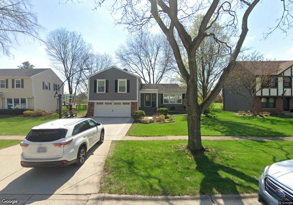
This home is located at 2048 Dorset Dr Unit 7, Wheaton, IL 60189 and is currently estimated at $637,709, approximately $386 per square foot. 2048 Dorset Dr Unit 7 is a home located in DuPage County with nearby schools including Whittier Elementary School, Edison Middle School, and Wheaton Warrenville South High School.
Ownership History
We collect this data history from publicly available records. To have your information removed, we recommend requesting removal directly through your county’s website.
Purchase Details
Purchase Details
Home Financials for this Owner
Home Financials are based on the most recent Mortgage that was taken out on this home.Purchase Details
Home Financials for this Owner
Home Financials are based on the most recent Mortgage that was taken out on this home.Home Values in the Area
Average Home Value in this Area
Purchase History
We collect this data history from publicly available records. To have your information removed, we recommend requesting removal directly through your county’s website.
| Date | Buyer | Sale Price | Title Company |
|---|---|---|---|
| -- | Attorneys Title Guaranty Fun | ||
| $320,000 | Atg | ||
| $232,000 | First American Title |
Mortgage History
We collect this data history from publicly available records. To have your information removed, we recommend requesting removal directly through your county’s website.
| Date | Status | Borrower | Loan Amount |
|---|---|---|---|
| Previous Owner | $311,888 | ||
| Previous Owner | $185,600 |
Tax History
We collect this data history from publicly available records. To have your information removed, we recommend requesting removal directly through your county’s website.
| Year | Tax Paid | Tax Assessment Tax Assessment Total Assessment is a certain percentage of the fair market value that is determined by local assessors to be the total taxable value of land and additions on the property. | Land | Improvement |
|---|---|---|---|---|
| 2024 | $9,653 | $166,741 | $51,778 | $114,963 |
| 2023 | $9,274 | $153,480 | $47,660 | $105,820 |
| 2022 | $9,090 | $137,260 | $45,040 | $92,220 |
| 2021 | $9,059 | $134,000 | $43,970 | $90,030 |
| 2020 | $9,031 | $132,750 | $43,560 | $89,190 |
| 2019 | $8,824 | $129,250 | $42,410 | $86,840 |
| 2018 | $7,944 | $115,680 | $39,960 | $75,720 |
| 2017 | $7,824 | $111,420 | $38,490 | $72,930 |
| 2016 | $7,717 | $106,970 | $36,950 | $70,020 |
| 2015 | $7,655 | $102,050 | $35,250 | $66,800 |
| 2014 | $7,452 | $97,910 | $34,740 | $63,170 |
| 2013 | $7,260 | $98,200 | $34,840 | $63,360 |
Map
- 2012 Cromwell Dr
- 2017 Somerset Ln
- 141 Loretto Ct
- 2S560 Seneca Dr
- 2552 Weatherbee Ln
- 1205 Josiah Rd
- 1221 Josiah Rd Unit 1221
- 1862 W Wiesbrook Rd
- 26W421 Wiesbrook Rd
- 1570 Orchard Rd
- 1755 S Wiesbrook Rd
- 1601 W Wiesbrook Rd
- 1262 Midwest Ln
- 2101 Timber Ln
- 2060 Iron Ridge Ln
- 2068 Iron Ridge Ln
- 2072 Iron Ridge Ln
- 1760 Shaffner Rd
- 2054 Iron Ridge Ln
- 2048 Iron Ridge Ln
- 2054 Dorset Dr
- 2042 Dorset Dr
- 2060 Dorset Dr
- 2036 Dorset Dr
- 2053 Dorset Dr
- 2047 Dorset Dr
- 2057 Dorset Dr
- 2039 Dorset Dr
- 2066 Dorset Dr
- 2030 Dorset Dr
- 2054 Sherwood Place
- 2033 Dorset Dr
- 2018 Berkshire Place
- 2024 Dorset Dr
- 2046 Sherwood Place
- 2024 Berkshire Place
- 1186 Dorset Dr
- 2014 Berkshire Place
- 2025 Dorset Dr
- 2038 Sherwood Place
Ask me questions while you tour the home.