Estimated Value: $143,000 - $329,000
3
Beds
2
Baths
1,708
Sq Ft
$137/Sq Ft
Est. Value
About This Home
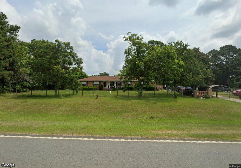
This home is located at 2048 Ga Highway 90 W, Mauk, GA 31058 and is currently estimated at $233,506, approximately $136 per square foot. 2048 Ga Highway 90 W is a home located in Taylor County with nearby schools including Taylor County Primary School, Taylor County Upper Elementary School, and Taylor County Middle School.
Ownership History
Date
Name
Owned For
Owner Type
Purchase Details
Closed on
Dec 23, 2014
Sold by
Albritton Ronnie David
Bought by
Sterling Wayde A
Current Estimated Value
Home Financials for this Owner
Home Financials are based on the most recent Mortgage that was taken out on this home.
Original Mortgage
$120,000
Outstanding Balance
$93,845
Interest Rate
4.5%
Mortgage Type
New Conventional
Estimated Equity
$139,661
Purchase Details
Closed on
Aug 20, 1993
Bought by
Albritton Ronnie Dav
Create a Home Valuation Report for This Property
The Home Valuation Report is an in-depth analysis detailing your home's value as well as a comparison with similar homes in the area
Home Values in the Area
Average Home Value in this Area
Purchase History
| Date | Buyer | Sale Price | Title Company |
|---|---|---|---|
| Sterling Wayde A | $120,000 | -- | |
| Albritton Ronnie Dav | $56,000 | -- |
Source: Public Records
Mortgage History
| Date | Status | Borrower | Loan Amount |
|---|---|---|---|
| Open | Sterling Wayde A | $120,000 |
Source: Public Records
Tax History Compared to Growth
Tax History
| Year | Tax Paid | Tax Assessment Tax Assessment Total Assessment is a certain percentage of the fair market value that is determined by local assessors to be the total taxable value of land and additions on the property. | Land | Improvement |
|---|---|---|---|---|
| 2024 | -- | $69,144 | $4,160 | $64,984 |
| 2023 | $0 | $55,464 | $3,600 | $51,864 |
| 2022 | $1,214 | $52,864 | $3,600 | $49,264 |
| 2021 | $1,162 | $49,384 | $3,000 | $46,384 |
| 2020 | $1,191 | $49,384 | $3,000 | $46,384 |
| 2019 | $1,160 | $49,384 | $3,000 | $46,384 |
| 2018 | $1,183 | $49,120 | $3,000 | $46,120 |
| 2017 | $1,075 | $44,642 | $3,676 | $40,966 |
| 2016 | -- | $44,642 | $3,676 | $40,966 |
| 2015 | -- | $44,642 | $3,676 | $40,966 |
| 2014 | -- | $37,498 | $4,084 | $33,414 |
| 2013 | -- | $38,826 | $4,084 | $34,742 |
Source: Public Records
Map
Nearby Homes
- 15 Georgia 127
- 375 Village Ln
- 0 Brannon Montgomery Rd Unit 10453495
- 0 Brannon Montgomery Rd Unit 25510431
- 0 Poll Mill Rd
- 62 Brannon Montgomery Rd
- 221 Flamingo Dr
- 65 Saddle Trail
- 2450 Fort Perry Rd
- 0 Miller Rd Unit 10319190
- 0 Miller Rd Unit 25510377
- 0 Miller Rd Unit 25510378
- Moores Chapel Rd
- 0 Moores Chapel Rd Unit 10650485
- 0 Moores Chapel Rd Unit 25800784
- 0 Moores Chapel Rd Unit 25510371
- 0 Moores Chapel Rd Unit 2 10582259
- 0 Moores Chapel Rd Unit 10544008
- 0 Moores Chapel Rd Unit 1 10582252
- 0 Liberty Rd
- 2048 Georgia 90
- 2062 Ga Highway 90 W
- 2058 Ga Highway 90 W
- 54 Mount Zion Church Rd
- 54 Mount Zion Church Rd
- 2103 Ga Highway 90 W
- 1971 Ga Highway 90 W
- 412 Averett Rd
- 782 Evergreen Church Rd
- 120 Sidney Rustin Rd
- 160 Sidney Rustin Rd
- 2158 Ga Highway 90 W
- 32 Mount Zion Church Rd
- 32 Mt Zion Church Rd
- 56 Mount Zion Church Rd
- 2163 Ga Highway 90 W
- 1930 Ga Highway 90 W
- 865 Evergreen Church Rd
- 0 Sidney Rustin Rd Unit 20067746
- 512 Junction Rd