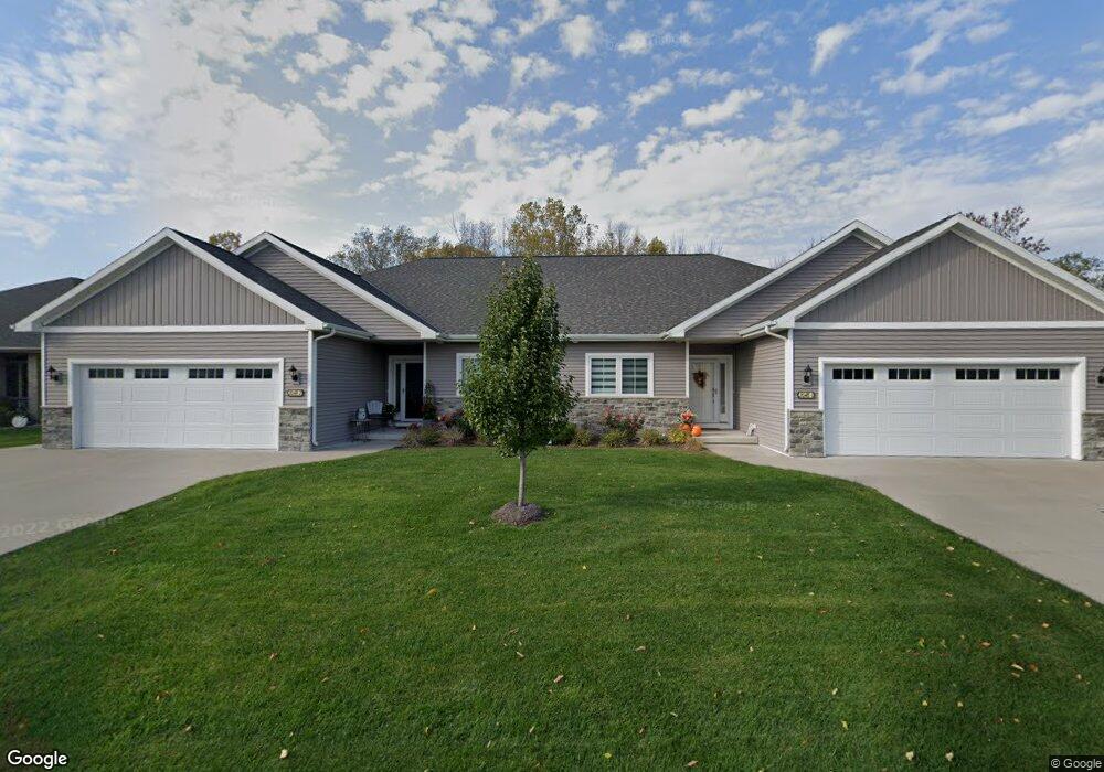
2048 Wisteria Cir Unit 2 Suamico, WI 54313
Estimated Value: $389,000 - $472,000
--
Bed
--
Bath
--
Sq Ft
9,801
Sq Ft Lot
About This Home
This home is located at 2048 Wisteria Cir Unit 2, Suamico, WI 54313 and is currently estimated at $432,887. 2048 Wisteria Cir Unit 2 is a home located in Brown County with nearby schools including Forest Glen Elementary School, Lineville Intermediate School, and Bay View Middle School.
Ownership History
Date
Name
Owned For
Owner Type
Purchase Details
Closed on
Jun 29, 2016
Sold by
Ryba Enterprises Llc
Bought by
Noles Patrick M and Noles Nancy K
Current Estimated Value
Home Financials for this Owner
Home Financials are based on the most recent Mortgage that was taken out on this home.
Original Mortgage
$199,900
Outstanding Balance
$159,581
Interest Rate
3.58%
Mortgage Type
New Conventional
Estimated Equity
$273,306
Purchase Details
Closed on
Dec 14, 2015
Sold by
Anchor Bank Fsb
Bought by
Ryba Enterprises Llc
Purchase Details
Closed on
Jul 29, 2013
Sold by
W M Development Llc
Bought by
Anchorbank Fsb
Create a Home Valuation Report for This Property
The Home Valuation Report is an in-depth analysis detailing your home's value as well as a comparison with similar homes in the area
Home Values in the Area
Average Home Value in this Area
Purchase History
| Date | Buyer | Sale Price | Title Company |
|---|---|---|---|
| Noles Patrick M | $249,900 | Liberty Title & Abstract Inc | |
| Ryba Enterprises Llc | $25,000 | Liberty Title | |
| Anchorbank Fsb | -- | None Available |
Source: Public Records
Mortgage History
| Date | Status | Borrower | Loan Amount |
|---|---|---|---|
| Open | Noles Patrick M | $199,900 |
Source: Public Records
Tax History Compared to Growth
Tax History
| Year | Tax Paid | Tax Assessment Tax Assessment Total Assessment is a certain percentage of the fair market value that is determined by local assessors to be the total taxable value of land and additions on the property. | Land | Improvement |
|---|---|---|---|---|
| 2024 | $5,239 | $298,100 | $32,600 | $265,500 |
| 2023 | $5,156 | $298,100 | $32,600 | $265,500 |
| 2022 | $5,316 | $298,100 | $32,600 | $265,500 |
| 2021 | $5,030 | $298,100 | $32,600 | $265,500 |
| 2020 | $5,013 | $298,100 | $32,600 | $265,500 |
| 2019 | $4,241 | $205,000 | $23,300 | $181,700 |
| 2018 | $4,070 | $205,000 | $23,300 | $181,700 |
| 2017 | $3,946 | $205,000 | $23,300 | $181,700 |
| 2016 | $713 | $23,300 | $23,300 | $0 |
| 2015 | $409 | $23,300 | $23,300 | $0 |
| 2014 | $433 | $23,300 | $23,300 | $0 |
| 2013 | $433 | $23,300 | $23,300 | $0 |
Source: Public Records
Map
Nearby Homes
- 2937 Yellow Jasmine Way
- 2636 Moose Creek Trail
- 2126 Summer Breeze Ct
- 2819 Prairie Garden Trail
- 2770 Prairie Garden Trail
- 2454 Forest Meadows Ct
- 3081 Big Timber Cir
- 2378 Autumn Ridge Trail
- 3467 Jewel Way
- 3053 Mercedes Dr
- 2579 Telluride Trail Unit E
- 1341 Sunray Ln Unit 1343
- 2543 Telluride Trail Unit P
- 12056 Velp Ave
- 1726 Red Oak St
- 3262 Evergreen Ave
- 1725 Red Oak St
- 2326 Pristine Ln
- 3683 Austrian Ln
- 2121 Durum Ct
- 2036 Wisteria Cir Unit 1
- 2036 Wisteria Cir Unit 2
- 2042 Wisteria Cir Unit 1
- 2042 Wisteria Cir Unit 2
- 2048 Wisteria Cir Unit 1
- 2048 Wisteria Cir
- 2036 Wisteria Cir
- 2028 Wisteria Cir
- 2047 Wisteria Cir
- 2018 Wisteria Cir
- 2028 2028 Wisteria
- 2036 2036 Wisteria
- 2048 2048 Wisteria
- 2014 Golden Bell Dr Unit 1
- 2078 Golden Bell Dr
- 2028 Golden Bell Dr
- 2018 2018 Wisteria
- 2049 2049 Wisteria
- 2057 Wisteria Cir
- 2057 Wisteria Cir Unit 2